Newfoundland: Rugged, majestic, beauty

The fiord, Western Brook Pond, is between those cliffs in the background

Majesty.

It was everywhere I looked in Newfoundland: the Long Range Mountains, the Tablelands, the sea cliffs, and the waves that crashed even in calm seas. The whole island, from Gros Morne National Park, to the Northern Peninsula, to Bonavista and then St. John’s radiated majesty.

Majesty. One lovely word that managed to crowd out the tangle of tasks, commitments, worries and inadequacies that usually fill my mind.

It was wonderful.
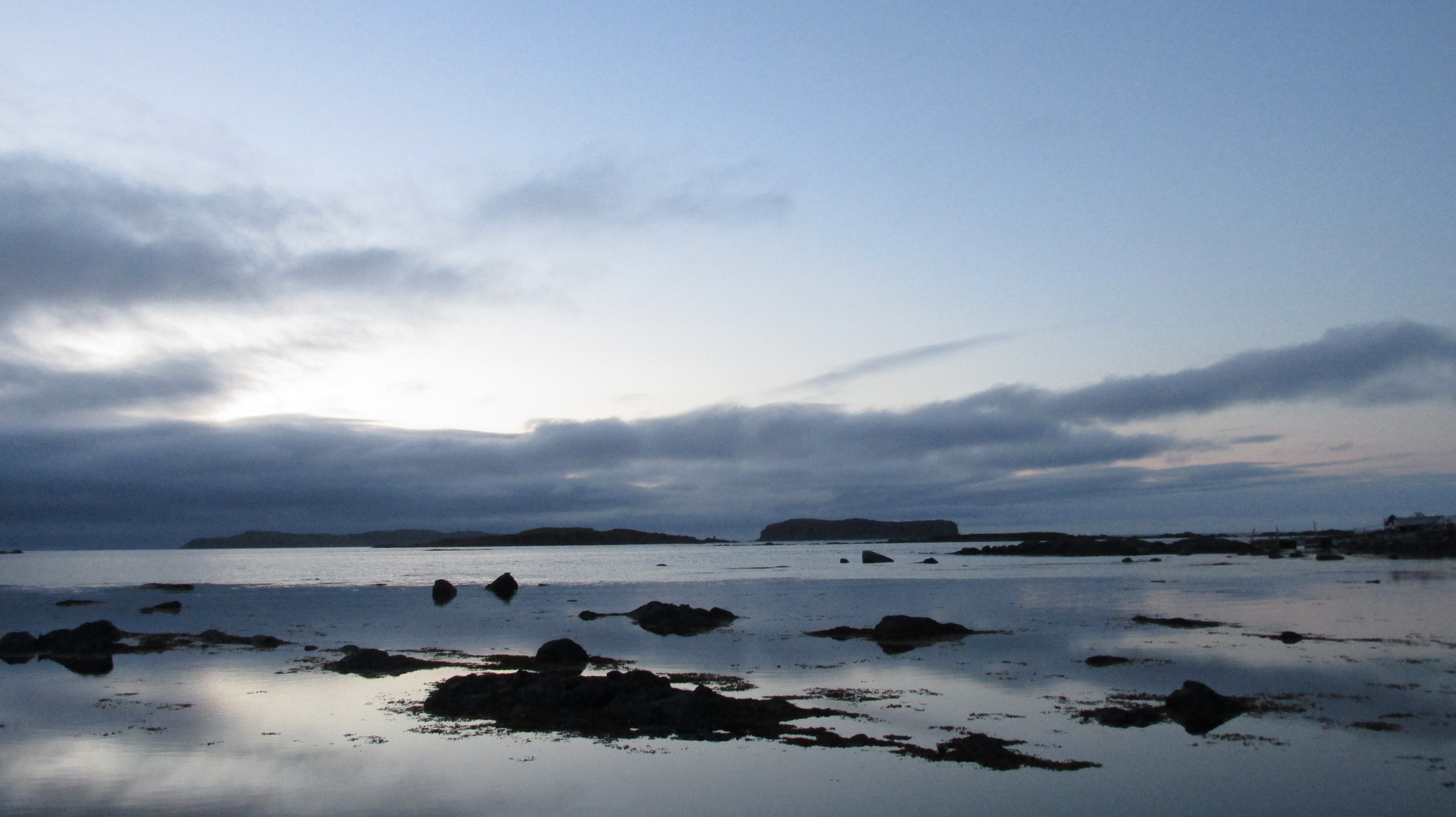
02_20170826_66ViewNorsteadRdAtDusk
Looking north from the tip of the Northern Peninsula at dusk

And to think, that our Newfoundland road trip stemmed from Parks Canada’s decision to make Parks and Heritage sites free for 2017. Of course we could have used the Parks Pass anywhere in Canada. It was probably the red chairs that did it. Canada Parks “Red Chair Experience Program” was started in Gros Morne National Park and it was vistas from those Gros Morne chairs that got me hooked. By spring 2017 I knew that the proper use of the Parks Pass would require a trip to Newfoundland. Now we have our own “red chair” photos.
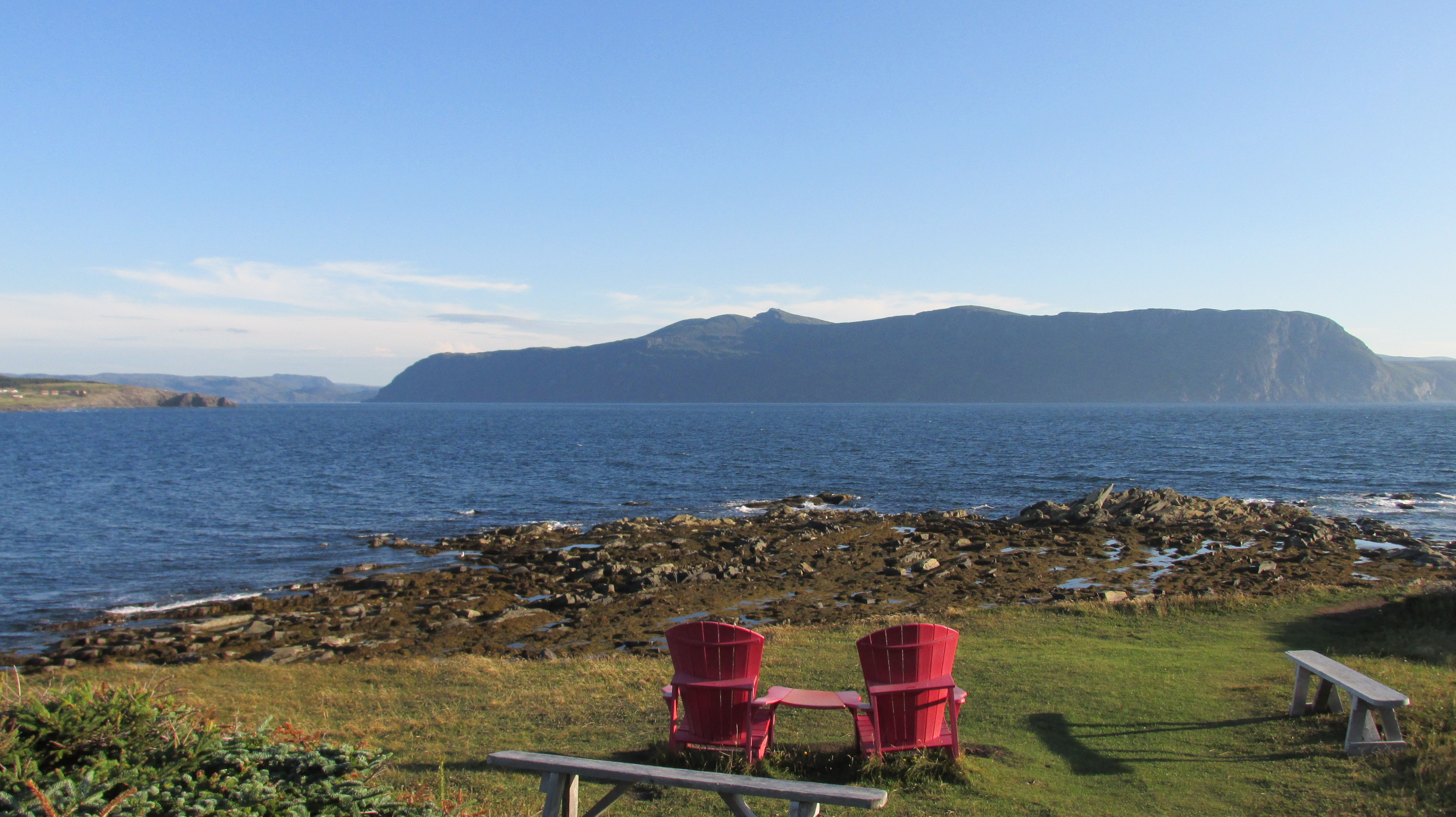
03_20170824_45MuskokaChairsAndBonnieBay
Bonnie Bay and the Lookout mountains

We drove nearly the entire island of Newfoundland in one gas efficient rental car, staying in cabins where we could cook our own meals and changing locations every two days. It was our family’s first real road trip and I couldn’t have planned it on my own. I had help from the experts at Linkum Tours a Newfoundland based company that helped us create a custom self-guided tour that fit our family to a tee. I highly recommend this company to anyone looking to travel in Newfoundland & Labrador.

The landscape in Newfoundland is incredible and we experienced it immediately on the drive from the airport in Deer Lake to Rocky Harbour (a town made famous in 2014 when one of two blue whales washed up on its shores). The road wound through the scenery of northern Gros Morne National Park – craggy mountains that seemed to rise out of the waters of Bonnie Bay. One such mountain is the one for which the park is named: Mount Gros Morne at 806m. In French its name means “large mountain standing alone,” or more literally “great sombre.”
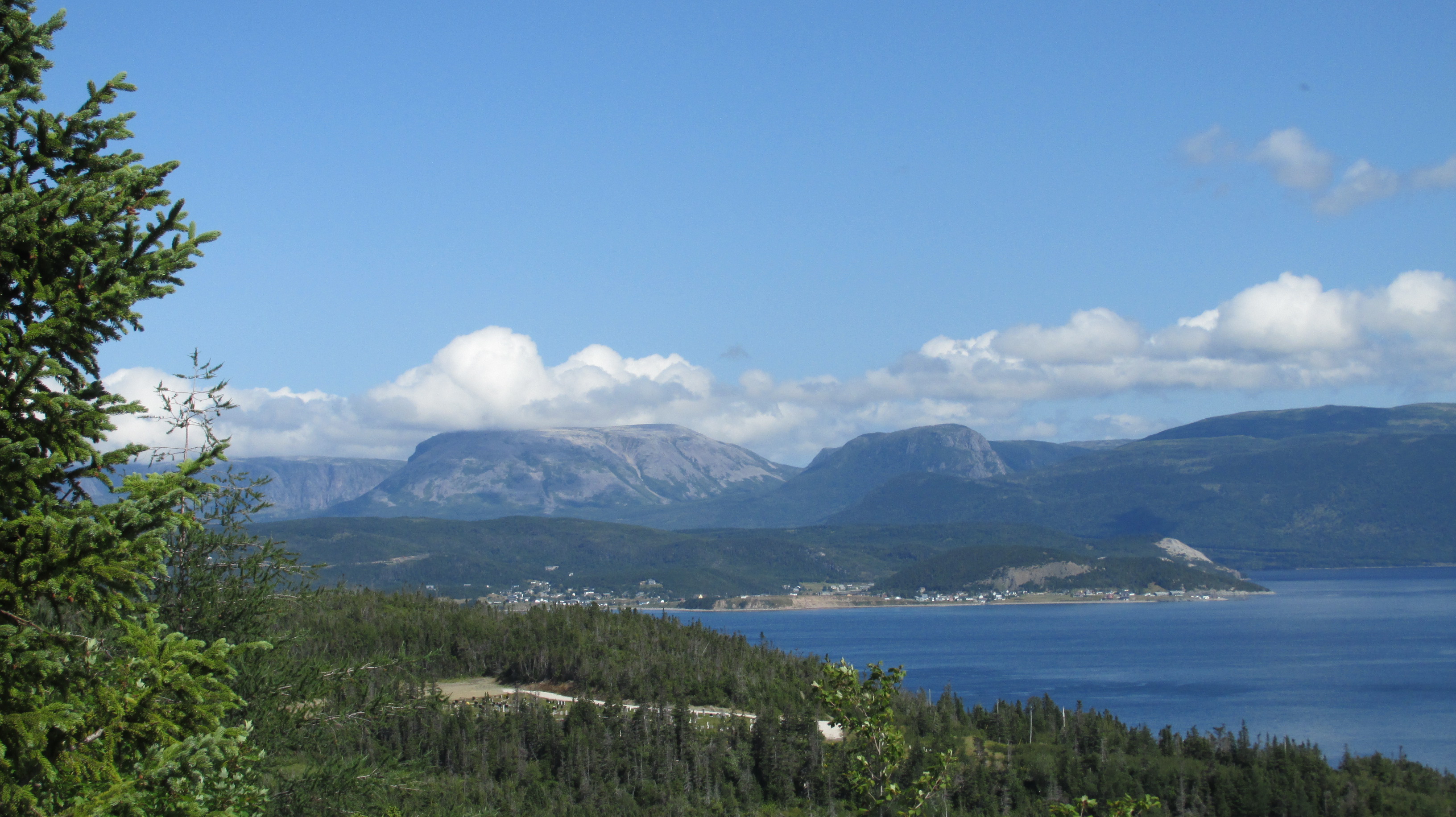
04_20170828_13GrosMorneMountainView
Mount Gros Morne and Bonnie Bay

That afternoon we picnicked on mooseburgers at Lobster Cove Head lighthouse.
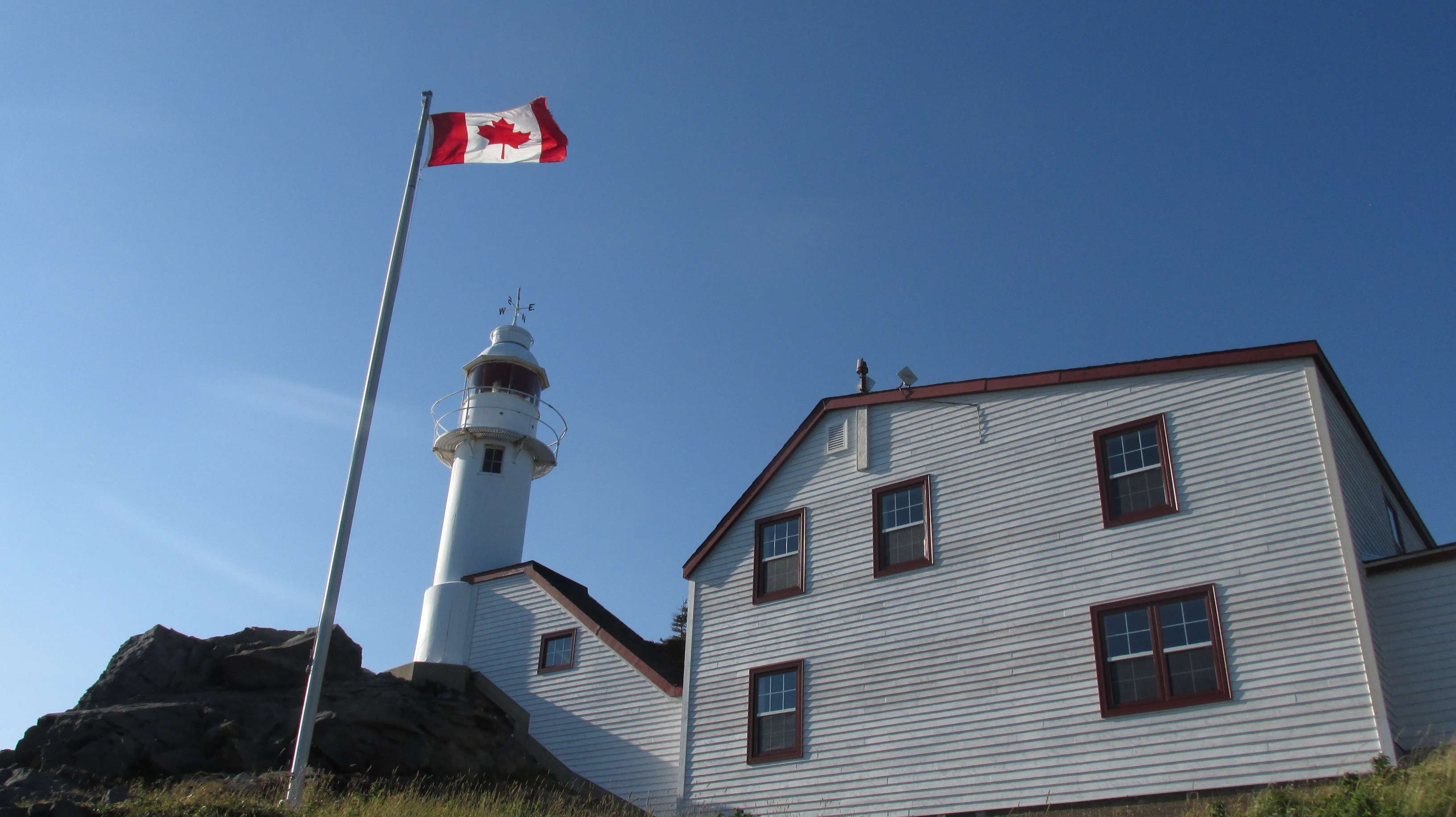
05_20170824_24LobsterCoveLighthouse
Lobster Cove Lighthouse

On our postprandial hike we scampered on fabulous layered limestone, chert and quartz stone. Their tilted and alternating layers clearly showed the geological periods in which they were created.
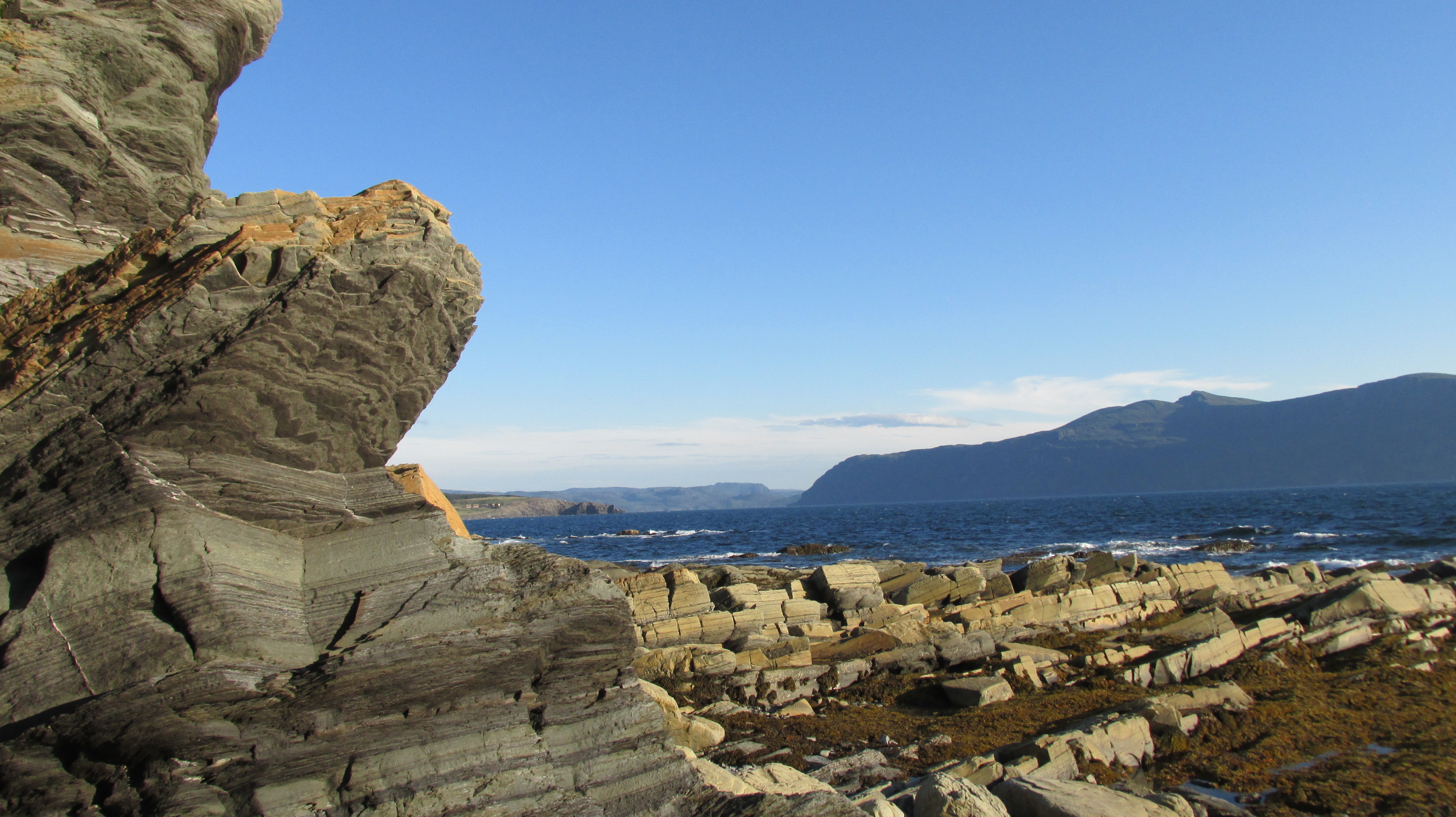
06_20170824_42RocksAndBonnieBay
Rocks at Lobster Cove Head and Bonnie Bay

We also delighted in tide pools with seaweed (the most common were Fucales sp. like bladder wrack with air bladders to keep them upright at high tide), tiny shrimp-like crustaceans, periwinkles (sea snails), and even anemones. Finally the hike took us through dense, gnarled white spruce forest that looked enchanted in the light of the setting sun.
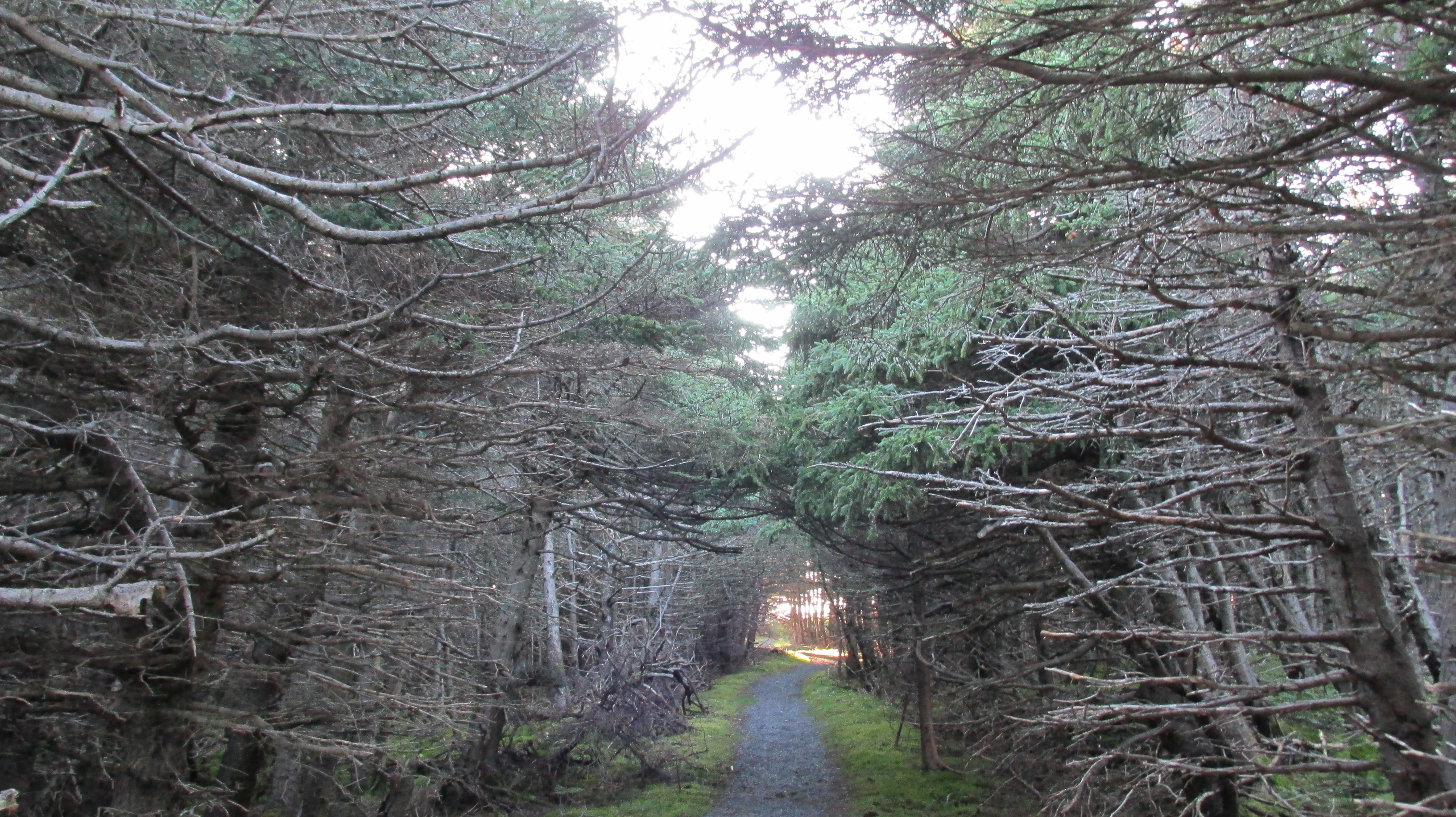
07_20170824_47EnchantedSpruceForest
Gnarled and windblown forest that locals call tuckamore and I think looks enchanted

We ended the day with a stop at the Rocky Harbour playground, which should be nominated for playground with the best view. Then it was bedtime at Mountain Range Cottages.
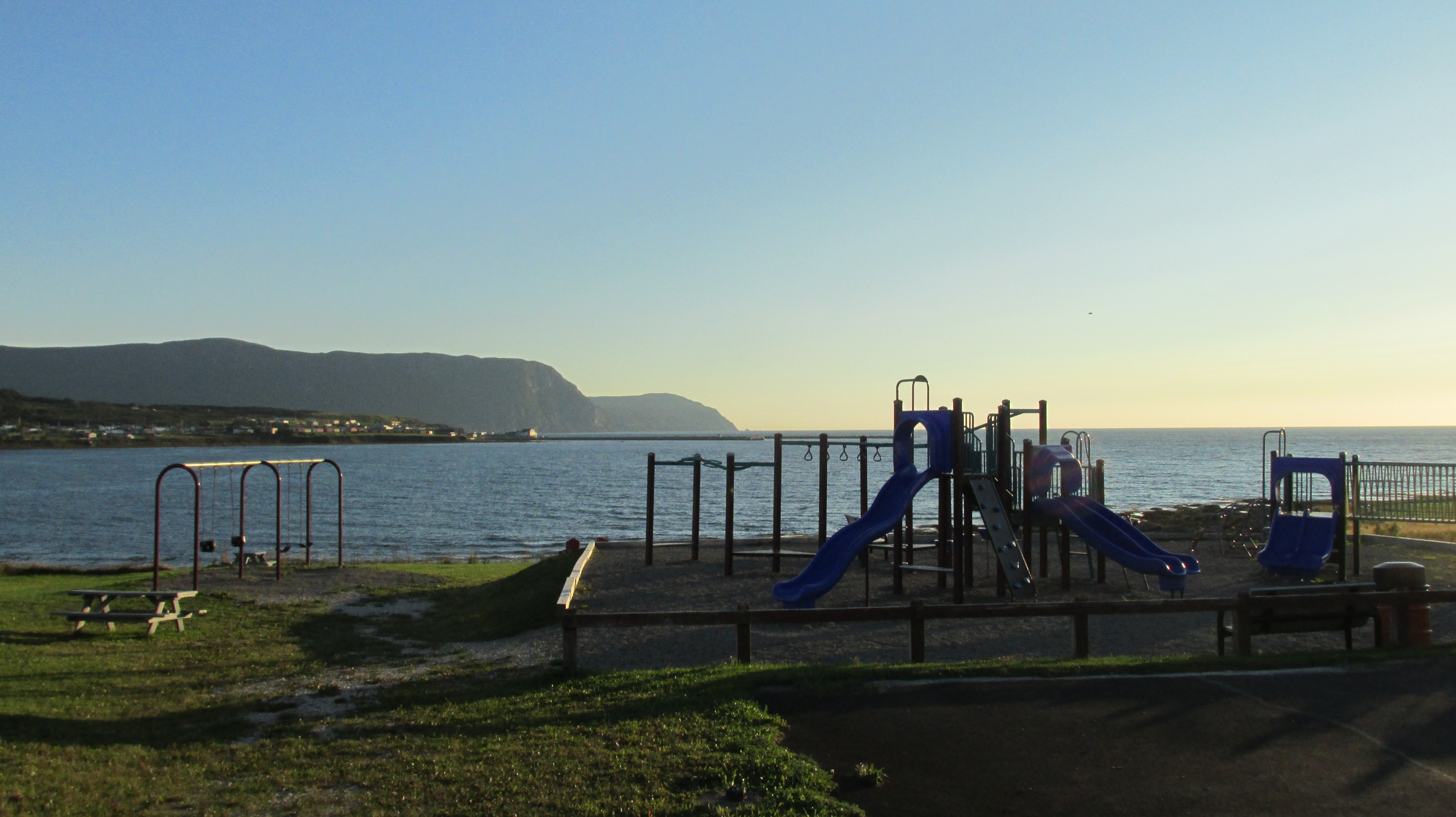
08_20170824_57PlaygroundWIthAView
Should be nominated for playground with the best view

The next day we drove from Rocky Harbour up the west coast of the northern peninsula on a highway known as the Viking Trail. The road took us past the stunning cliffs of the Long Range Mountains, part of the northern most Appalachian Mountains, and along the rugged shores of the Gulf of St. Lawrence.
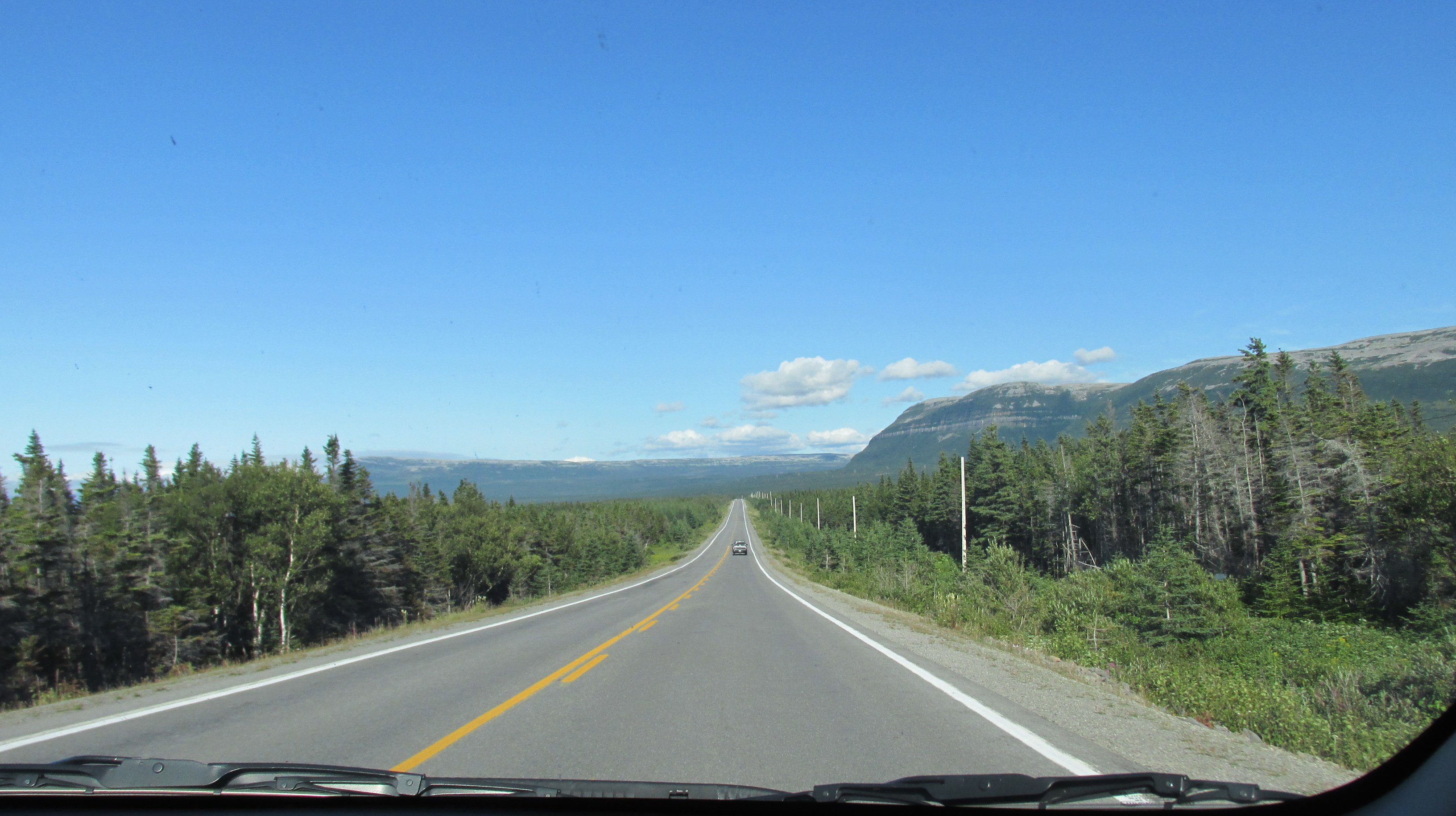
09_20170825_46NorthLoneMountainsView
The Viking Trail – a road with a view

We stopped at Port Au Choix, a UNESCO World Heritage site, which has been occupied by human groups almost continuously for over four thousand years. First came the Maritime Archaic Indians, then Palaeoeskimo groups who lived in the area from 2800 to 1300 BP when the climate was cooler, and finally with a warming climate, ancestral Beothuk natives. Equaling the cultural history of the area was Port au Choix’s natural history, which we learned of hiking through the unique limestone barrens landscape.
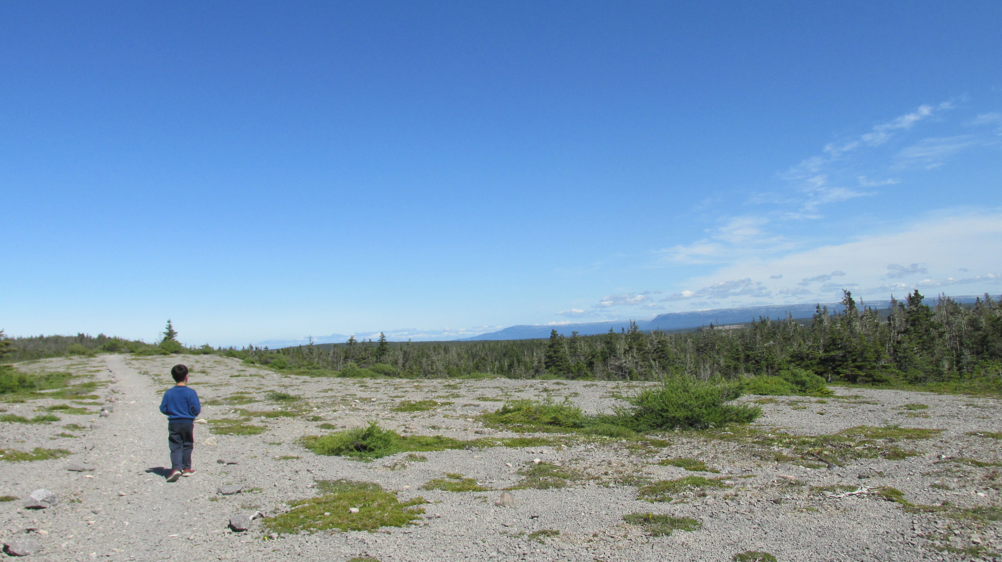
10_20170825_29DorsetTrail
Hiking the Dorset Trail through limestone barrens

The limestone and dolomite of the area originated as coral in a tropical sea 500 million years ago. The ancient seabed was pushed up when the African and American continental plates collided and has been weather by years of rain and frost. In some places, like the limestone barrens, this unrelenting weathering has shattered the rock to gravel. In other places, like the viewpoint along the trail, one can still find fossilized spirals (probably sea snails), evidence of the rock’s marine origin. From the top of the hill we also saw caribou, which use the limestone barrens in the summer and move inland to denser forest in winter.
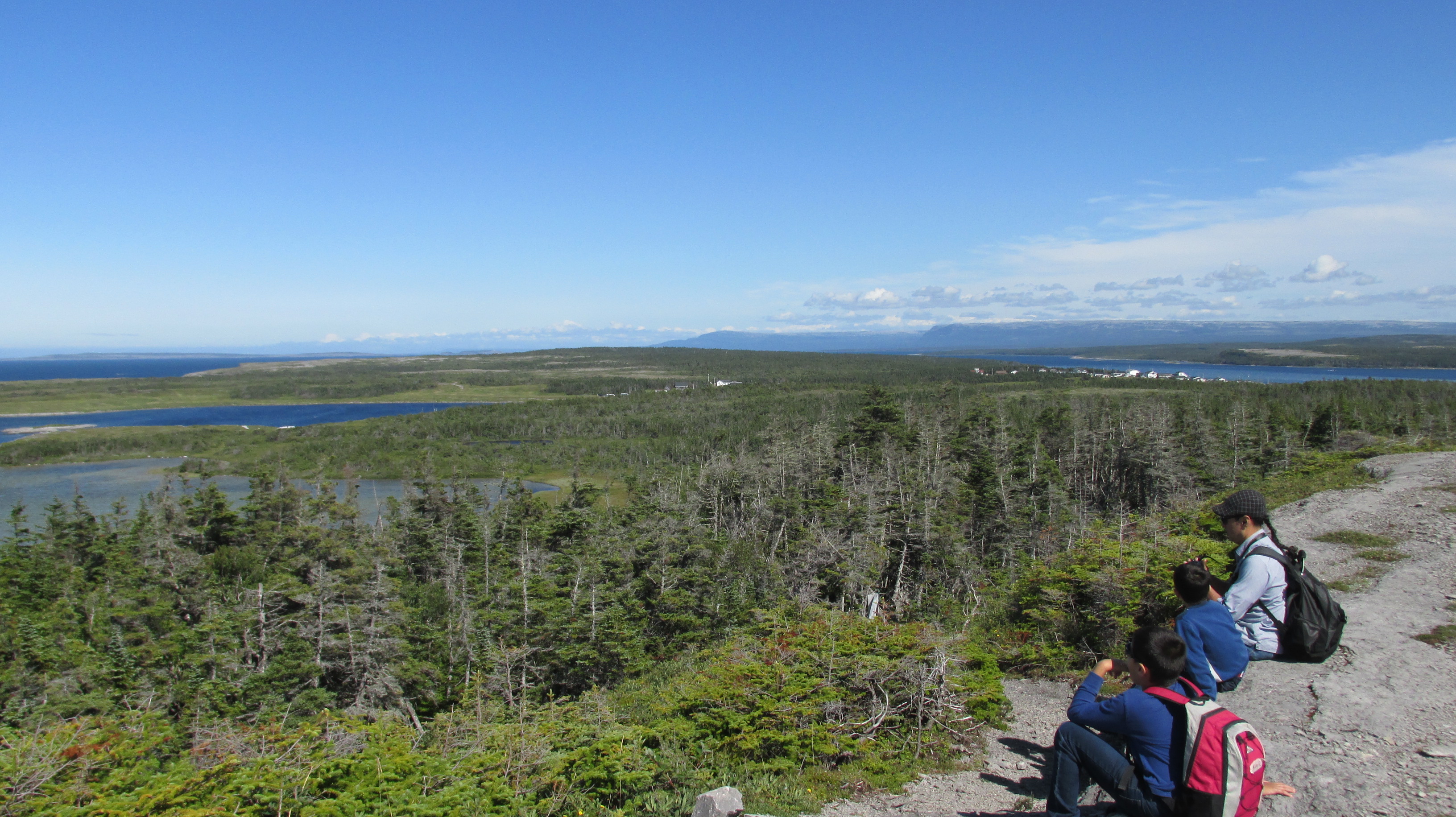
11_20170825_33DorsetTrailView
Fossil finding and caribou watching on the hill

After Port au Choix we continued to the northern tip of the Northern Peninsula where we stayed at the delightful Beachy Cove Cabins (loved the handmaid quilts on the beds). It was a mere 5-minute drive from another UNESCO Heritage site, L’Anse aux Meadows, which marks the place where Leif Erikson established a small Viking village over 1000 years ago. We needed our toques the morning we visited, but the chill north winds and gloomy sky only heightened the experience. The replica sod houses truly kept out the chill and the Parks Canada staff and volunteers, gave us a hands-on experience of what Viking life might have been like in the small settlement.
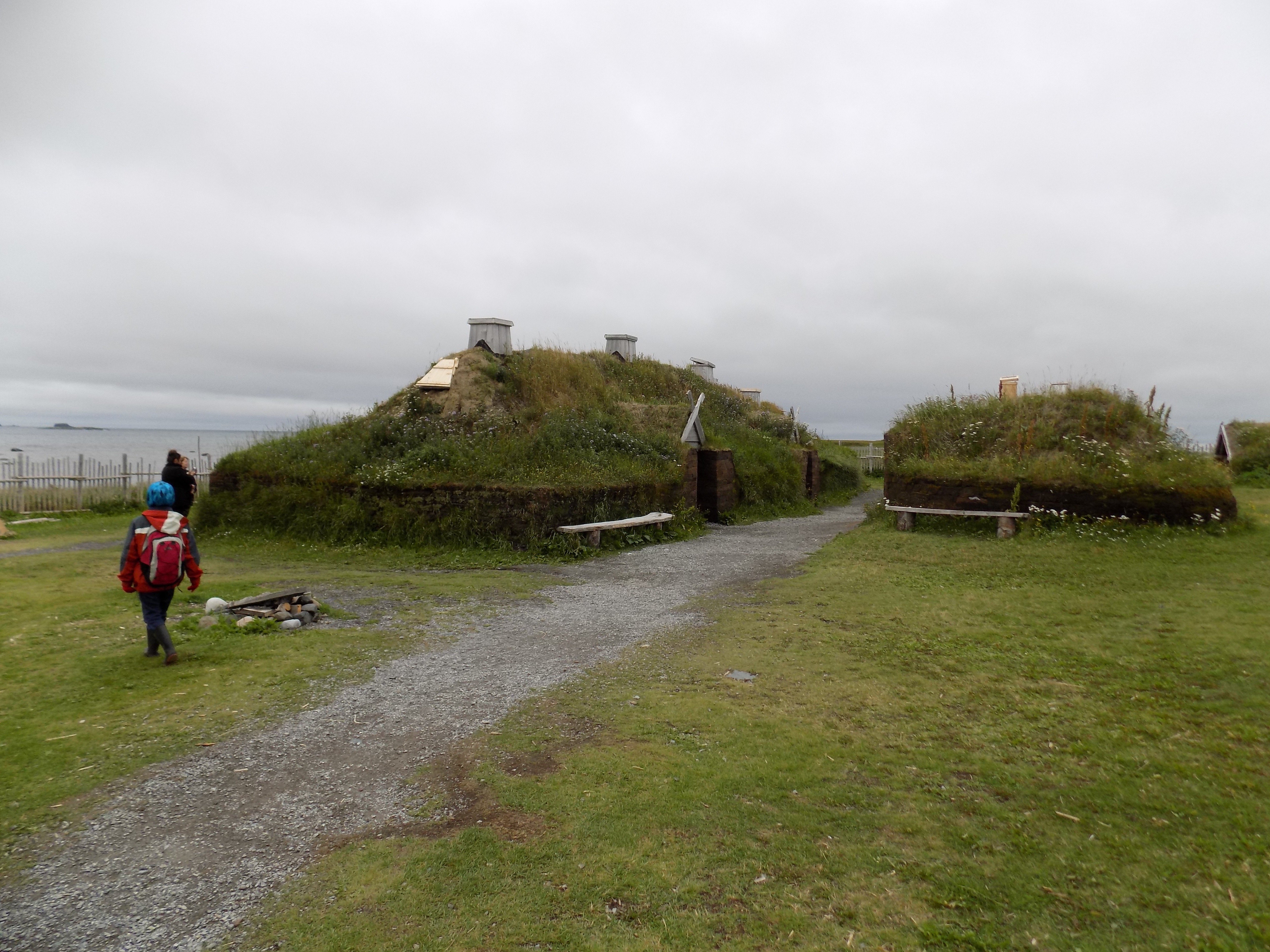
12_20170826_18VillageReplica
Replica of the Viking village at L’Anse aux Meadows

Then we wandered the soft green mounds of the actual archeological site and wondered how anyone might have found the remains of the village under this wind swept meadow. It is no wonder that the settlement remained buried for a thousand years.
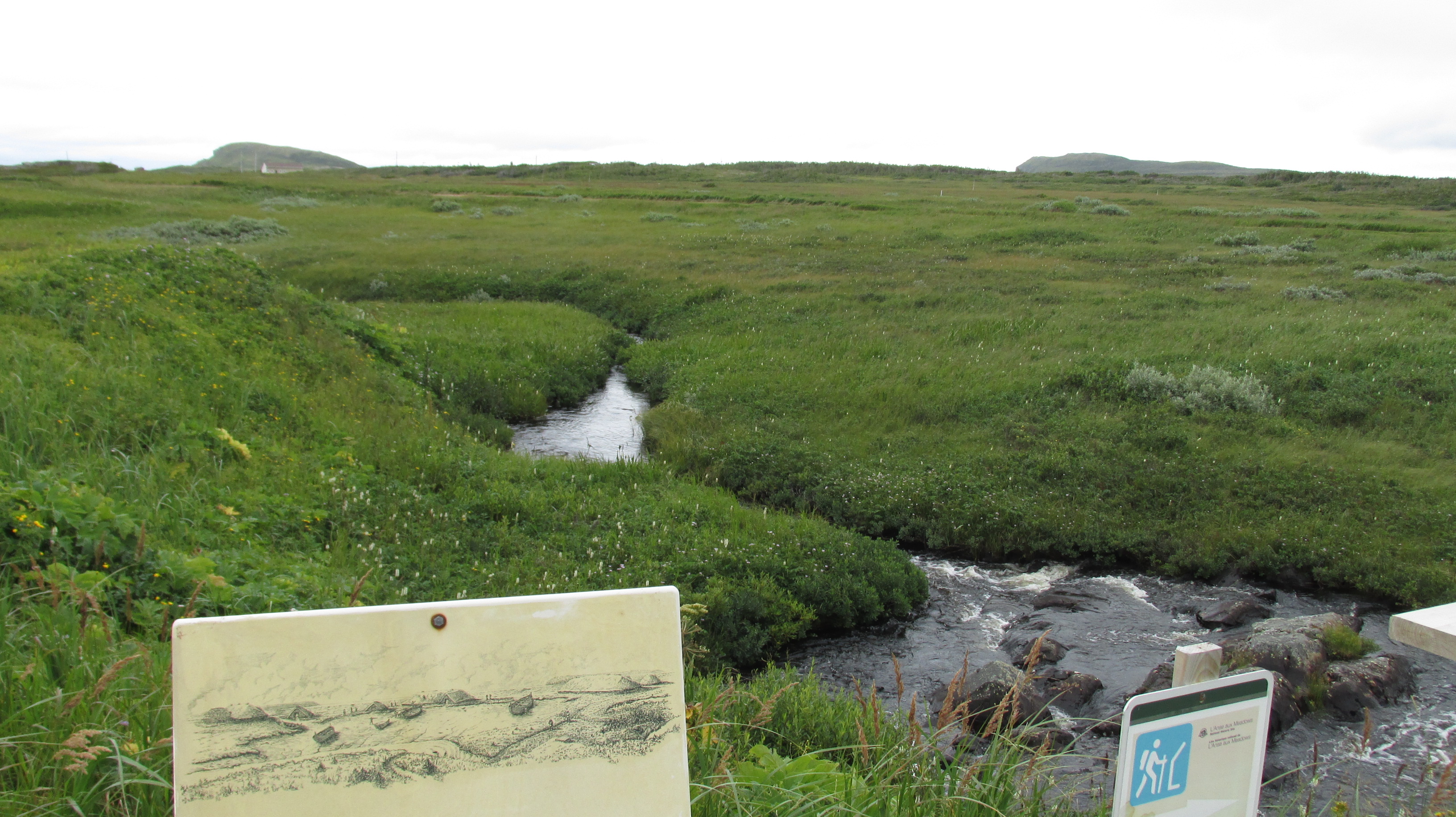
13_20170826_34VillageArchaeologicalSite
he remains of the real village lay under the meadow

Then in 1960, George Decker, a citizen of the small fishing hamlet of L’Anse aux Meadows, led explorer Helge Ingstad to what the locals called the “old Indian camp”. Then, under the direction of archaeologist Anne Stine Ingstad (Helge’s wife), they carried out seven archaeological excavations there from 1961 to 1968. The Ingstads had studied the Icelandic sagas and had a hunch that this might be a Viking site. The Norse origin was confirmed based on similarities between artifacts found at the site and artifacts at sites in Greenland and Iceland.

We learned the story of the site’s origin by listening to translations of two Icelandic sagas in the book Voyages to Vinland. The sagas describe the voyage of Bjarni Herjólfsson who sighted land to the west of Greenland when blown off course en route from Iceland to Greenland in 985. Though he returned to Greenland without making landfall, around the year 1000 Leif Erikson approached Bjarni, purchased his ship, and mounted an expedition. Lief found a rocky and desolate place he named Helluland (land of flat stones; probably Baffin Island), then a forested place he named Markland (land of forests; possibly Labrador) and finally a verdant place with a mild climate he named Vinland (land of meadows or wine – depending on the pronunciation). There he built a small settlement that lasted 20 years.

Of course, when the Norse arrived they did not find a land devoid of people. As we learned at Port au Choix, native cultures had been on the Northern Peninsula for thousands of years. On the trail at L’Anse aux Meadows there is a sculpture called “The meeting of two worlds”. Created by Luben Boykov and Richard Brixel.
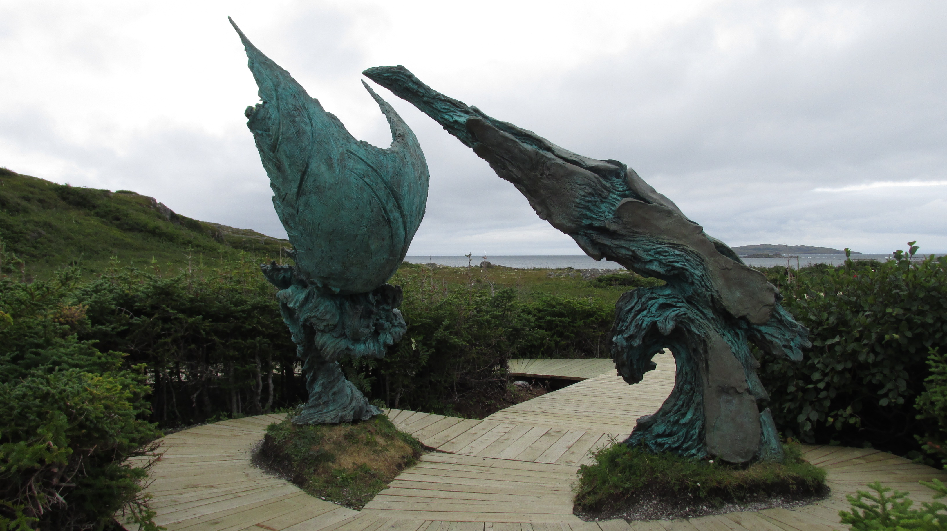
14_20170826_15aMeetingOfWorldsScupture
The meeting of two worlds sculpture, symbolizing the meeting of human migrants and explorers who had circumvented the globe.

It symbolizes the meeting of human migrations: One that spread west from Africa through Asia and entered North America by land across the Bering straight (the First Peoples); and another that spread east from Africa through Europe and to North America by sea. The two groups met – and human migration circumvented the globe – when the Norse met the First Peoples at L’Anse aux Meadows.

That evening we went to St Anthony to hike Whale Watchers Trail.
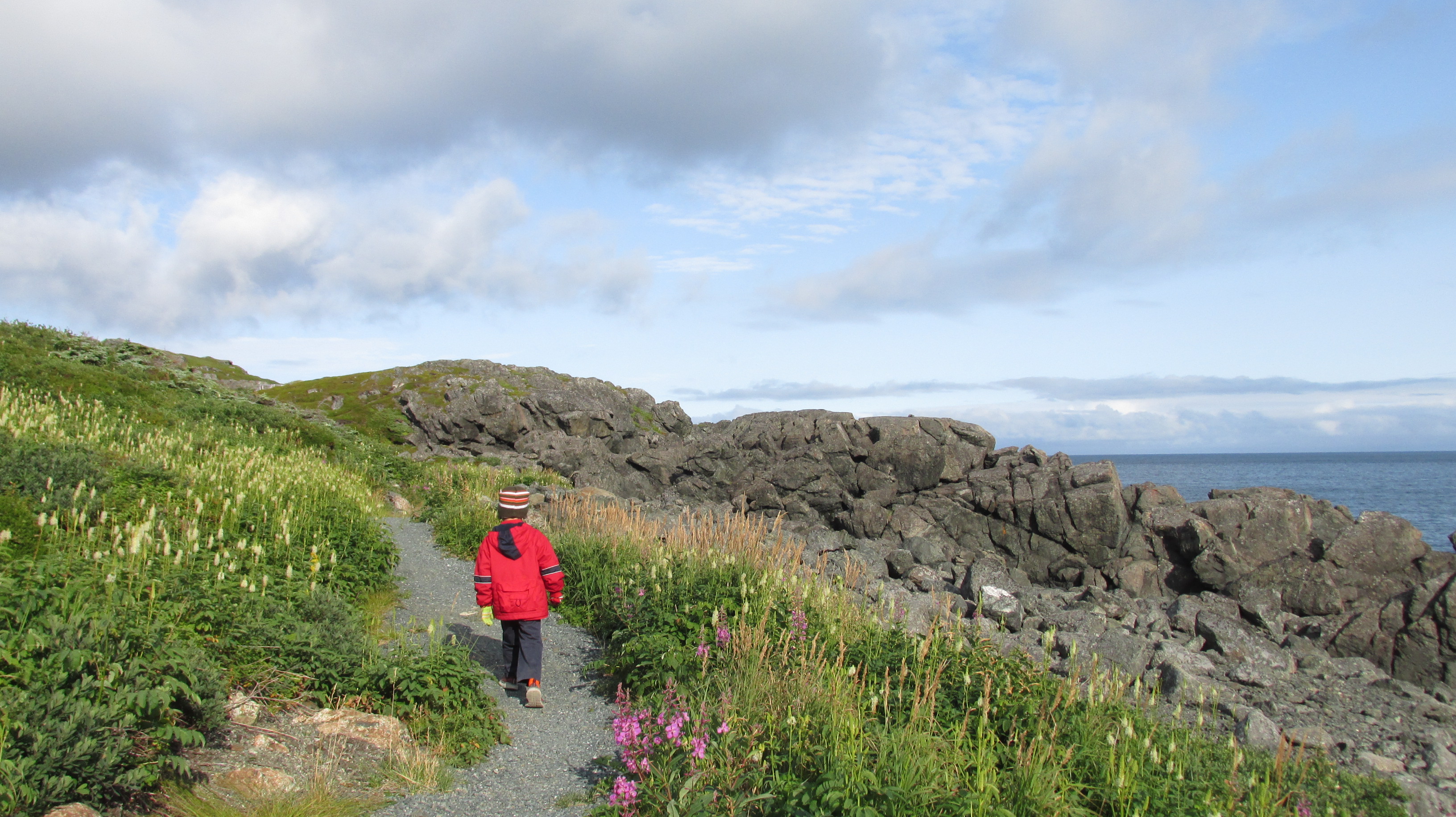
15_20170826_58StAntonyWhaleWatchersTrailMiloMeadow
Meadows in full flower on Whale Watchers Trail

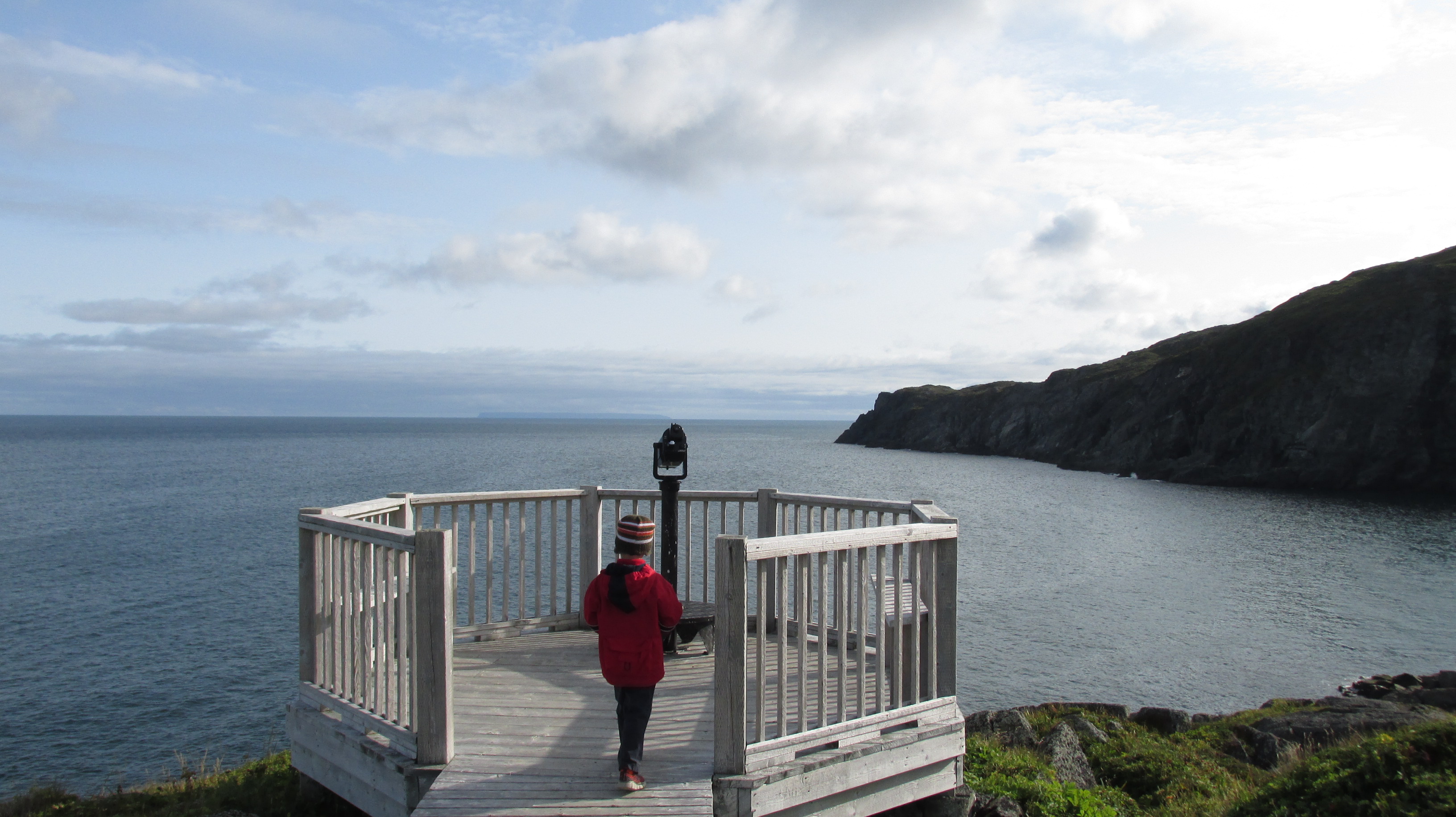
The stunning trail took us on a series of boardwalks and short stairways across cliff top meadows in full flower and to an amazing lookout over the Atlantic Ocean and the cliffs of Fishing Point.
16_20170826_59StAntonyWhaleWatchersTrailCliffsMiloView

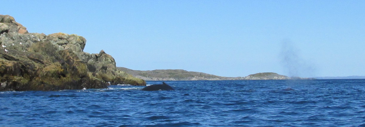
Equalling views of the landscape were views of whales. We must have seen 10 humpbacks in the hour and a half we were there. We saw them blowing, we saw their fins, we even a nice close “whale tail” (as my nearly 7 year old says). To my delight there were also Northern Gannets and Black Guillemots.

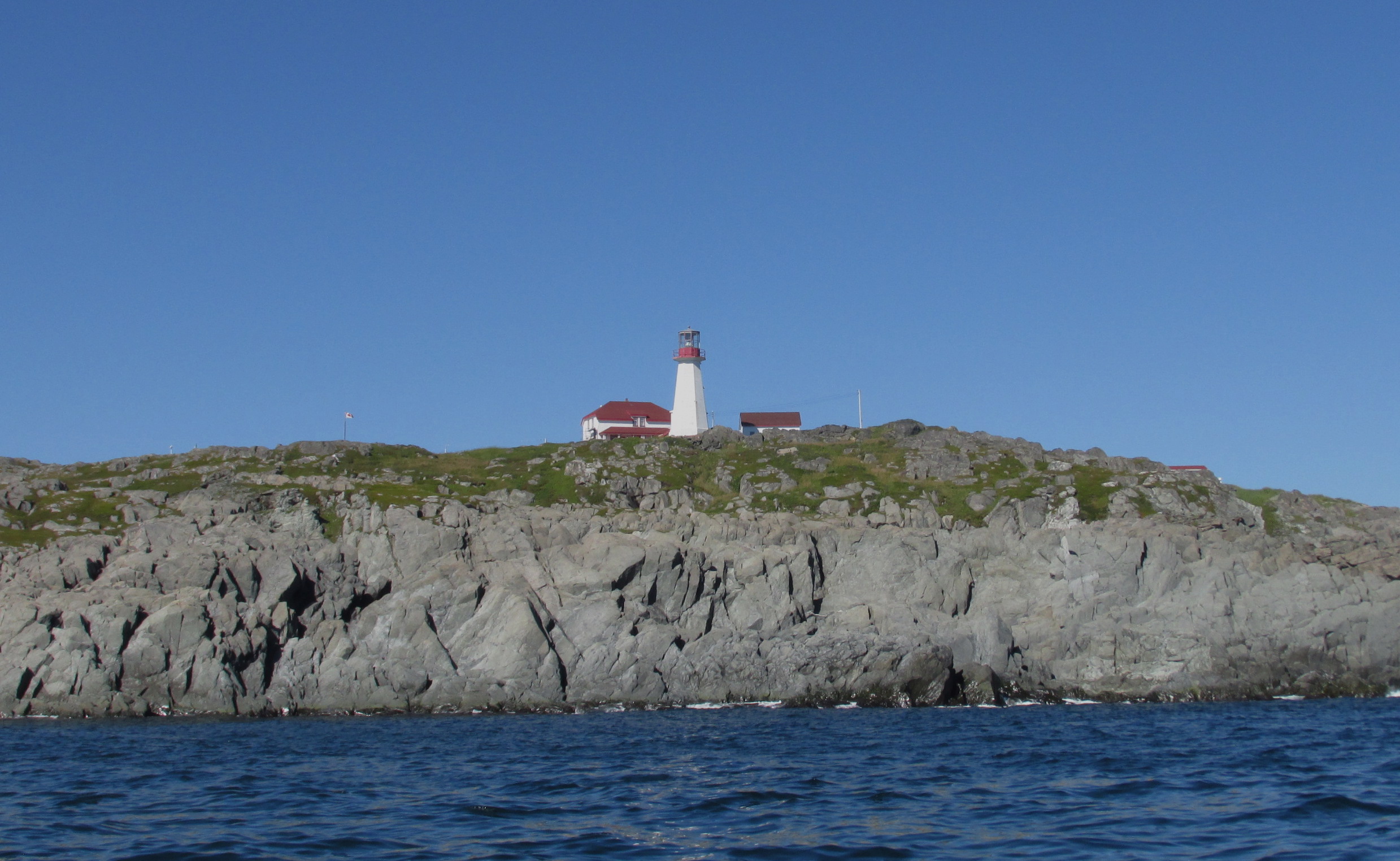
The next morning we went out in a Zodiac with Linkum Tours to share the water with the whales.
17_20170827_06QuirponLighthouse
The Quirpon Lighthouse Inn where Linkum Tours guests can stay to whale watch

We saw Atlantic White-sided Dolphins jumping quite near to the boat, and then hidden away in a cove, a mother humpback whale and her calf. We saw them both surface, blown and dive (more whale tails). Best of all, we heard them! The cliffs acted like an amplifier transmitting the whale voices into the air. Watching and hearing them was magic.
18_20170827_13Humpbacks
Humpbacks!

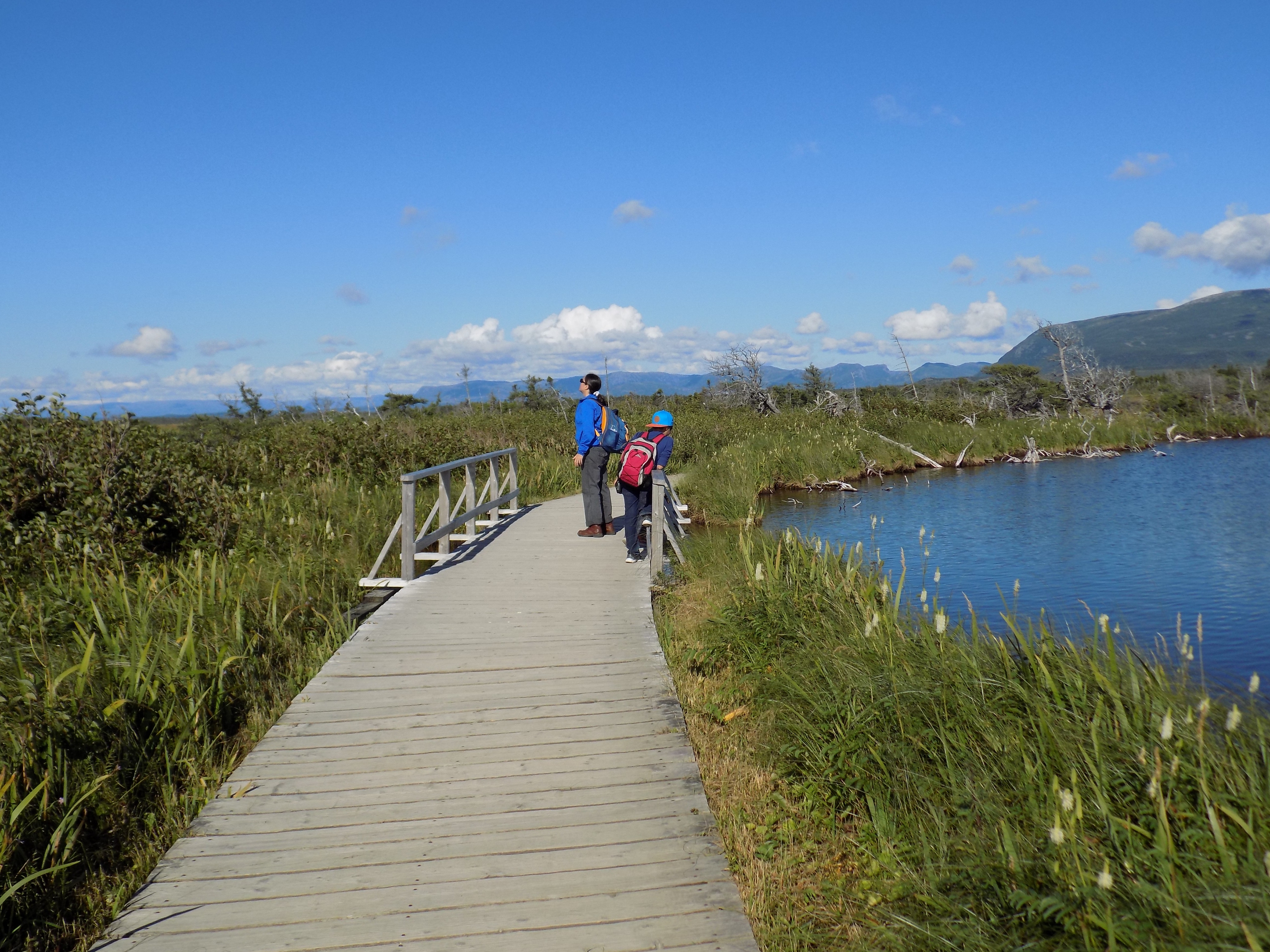
With whale voices still in our heads, we drove back down the Northern Peninsula past the low, gnarled tuckamore forests interspersed with fishing villages that dotted the coast like pearls. The air was clear and we could also see across the straight of Belle Isle into Quebec and Labrador. Our walking stop was a trail in Gros Morne National Park that took us across a huge peat bog to the base of the inland freshwater fiord of Western Brook Pond.
19_20170827_B8WesternBrookPondNaturalistas
On the boardwalk through the peat bog to Western Brook Pond

Western Brook Pond sits within the Lone Range Mountains in the northern part of the park. The fiord was carved when glaciers removed soft sediment from between the harder rock during the most recent ice age (from about 25,000 to 10,000 years ago). It became an inland “pond” (in Newfoundland inland fiords are called ponds) when it was cut off from the sea as land that had been pushed down by the weight of the ice sheets rebounded.

20_20170827_25GrosMorneWesternBrookTrailAra
The fiord, Western Brook Pond, is between those cliffs in the background

After a night in the Southeast hills of Gros Morne at Middlebrook Cottages & Chalets we were ready to explore the south side of Gros Morne National Park. We visited the Discovery Center on the South Arm of Bonne Bay and learned about the geology that makes Gros Morne famous. Then we hiked the Tablelands, a plateau of barren yellow rock, to experience it for ourselves.
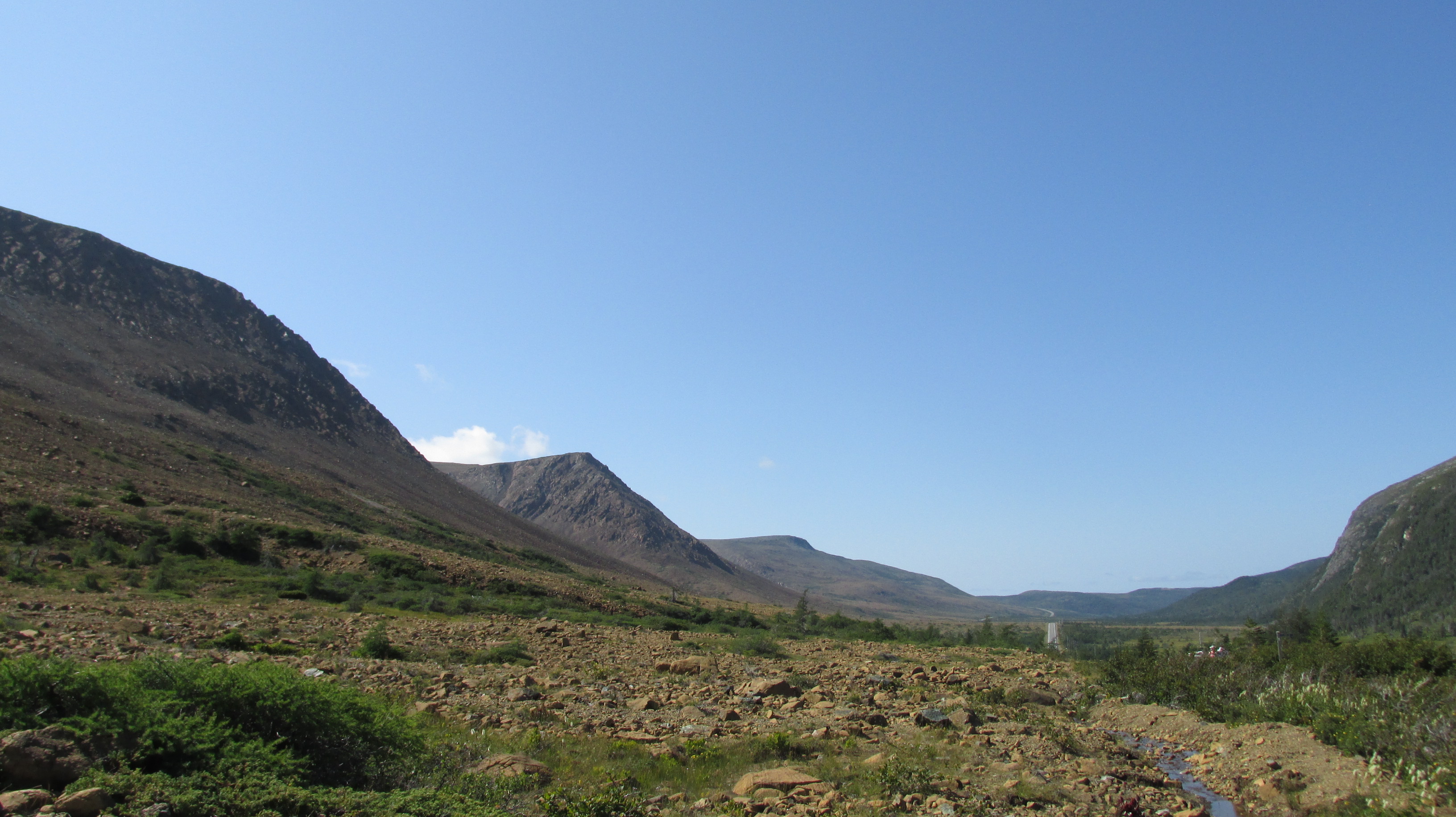
21_20170828_32GrosMorneTablelands
Barren Tablelands to the left and forested Lookout Hills to the right

From the trail it was amazing to look at the valley between the Tablelands and the Lookout Hills. On one side, the cliffs were barren yellow rock, but astonishingly just across the valley, there were trees on the slopes. Little grows on the Tablelands because the rock is not earth’s crust. Rather, it is a chuck of mantle that was dragged up half a billion years ago when Laurasia (Ancient North America) and Gondwana (Ancient Africa) collided. This chunk of mantle left on the surface, is part of what makes Gros Morne a UNESCO heritage site. This, and other wonders of geology in the 1,805 square kilometre park, provided the scientific evidence needed to support the theory of Continental Drift.
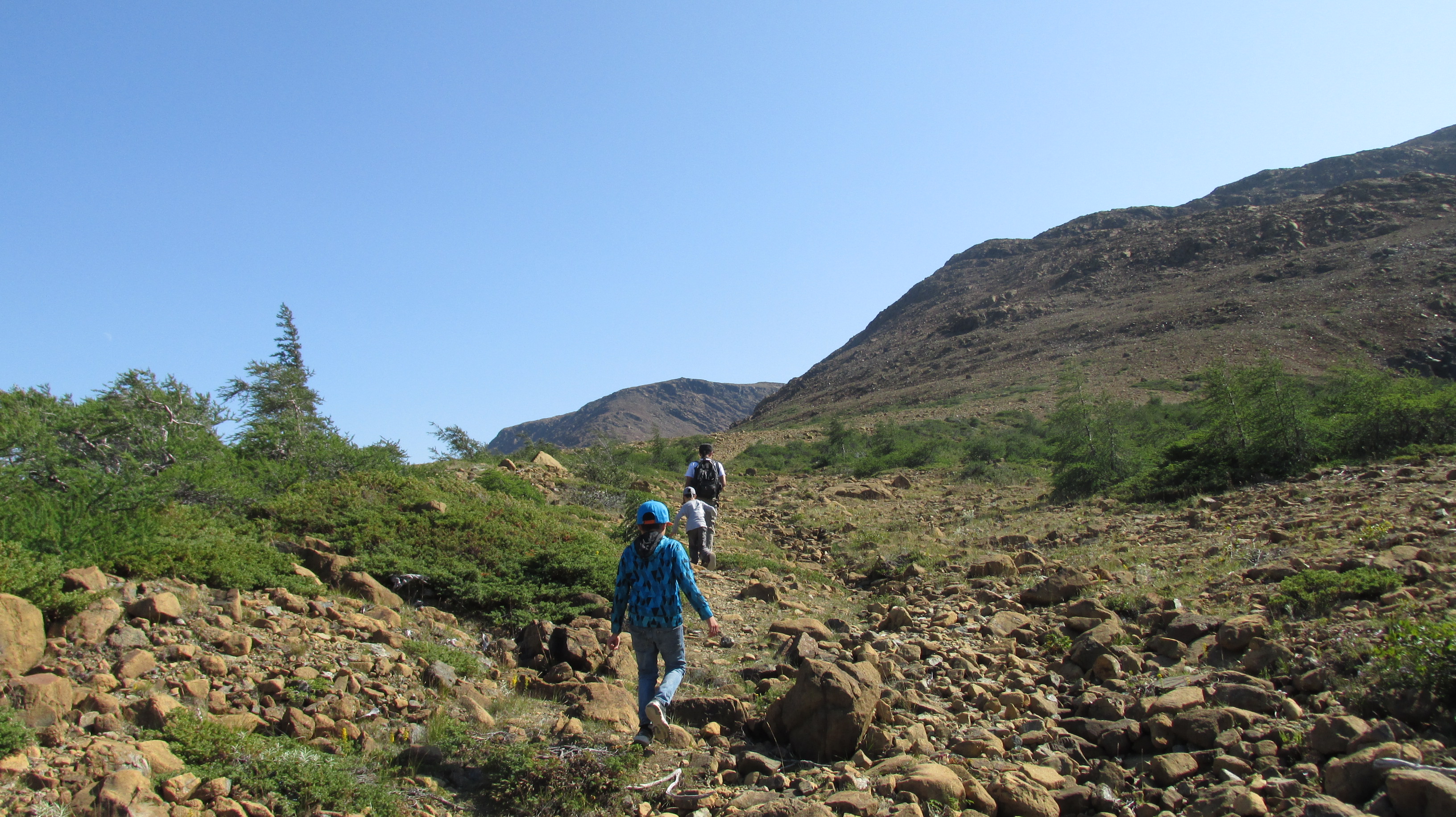
22_20170828_35GrosMorneTablelandsHikingUp
Walking off trail on the earth’s mantle in the Tablelands

The Tablelands are barren because mantle is usually buried deep in the earth and is very unstable on the surface. This mantle rock is called peridotite and it is full of heavy metals and other chemicals that are toxic to plant life. It is yellowy orange because the iron in it is literally rusting when exposed to oxygen on the earth’s surface. Nevertheless, we saw several hardy plants that managed to grow (albeit sparsely) on the Tablelands. Most do this by being carnivorous, since the rocks of the barrens provide no sustenance. One such plant is the Pitcher Plant, which is the provincial flower. Another is the Common Butterwort, which has basal rosette leaves where glandular hairs secrete a sticky glue to catch insects. After much plant and rock watching, we completed the trail and were rewarded with the stunning and glacially carved Winter House Brook Canyon.
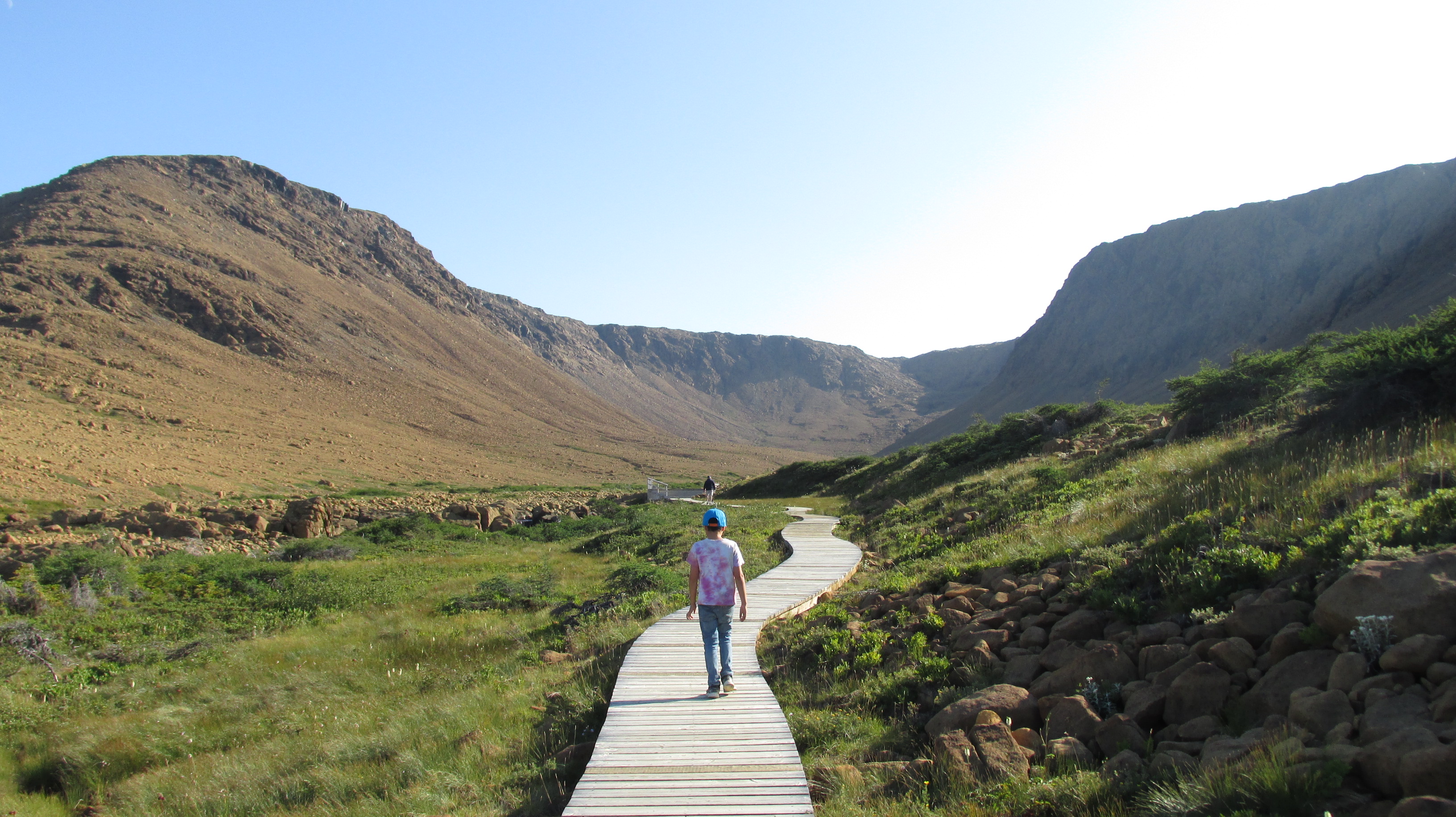
23_20170828_47GrosMorneTablelandsTrailWinterHouseBrook
Walking towards Winter House Brook Canyon in the Tablelands

We spent the evening in Trout River, the tiny hamlet where a blue whale, whose skeleton ended up at the Royal Ontario Museum, washed up in April 2014. We walked the boardwalk overlooking the beach where the whale was found and took photos of the colourful houses overlooking the water.
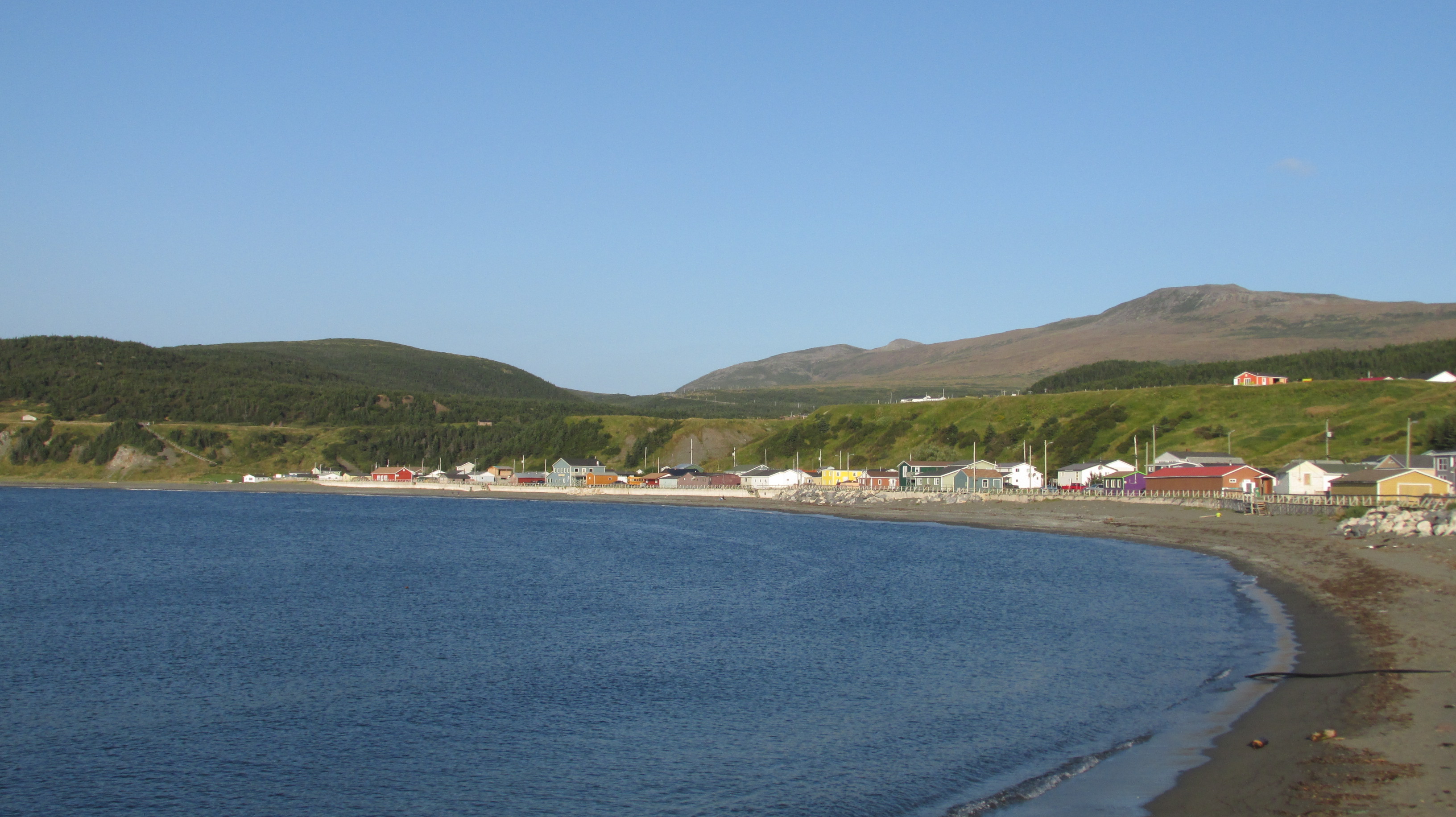
24_20170828_62TroutRiverBeach
Trout River Beach

At the wharf we saw fishing boats and fishers cleaning their catch. Then we dined at the Seaside Restaurant where we had cod and capelin fresh from the sea. Out the windows, we could see fishing boats returning to Trout River as the sun set over the cliffs. Back at the cottage, we built a fire and toasted marshmallows with the Milky Way arching across the night sky above us.

It was hard to leave the next day with the Tablelands ablaze in the morning light, but receding in the rear-view mirror. We covered the 600 km crossing of the Newfoundland from west to east much faster than the same distance going “up north” of Toronto. The Trans Canada highway was in good condition and there were frequent passing lanes to help smaller cars pass trucks as they slowed on the long inclines. As we learned in Gros Morne, the rock we crossed depicts the earth’s continental history – the collision of Laurasia and Gondwana that created the Appalachian Mountains (stretching Georgia to Newfoundland). The creation of the Atlantic Ocean after the continental plates split and water filled the space between them and the fascinating fact that the Africa plate left a small piece of itself behind. That piece now forms the eastern side of the Appalachians, including Bonavista and the Avalon Peninsula of Newfoundland. We left the rock of Laurasia behind and entered the rock of Ancient Gondwana.

Our rest stop was Terra Nova National Park where we hiked the Coastal Trail to Pissamere Falls.
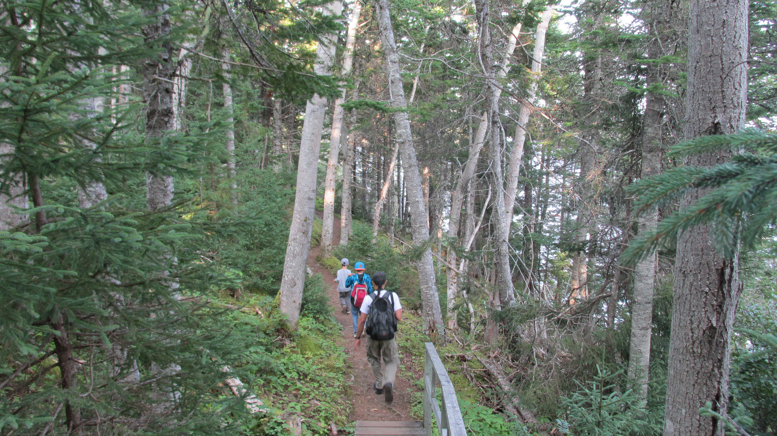
25_20170829_40TerraNovaCoastalTrail
Hiking boreal forest in Terra Nova National Park

The shore of Newman Sound looked like a lake in Ontario rather than the coast because the sea comes so far inland. But evidence that we were on the coast came when the trail met the beach and we found jellyfish, crab carapaces, and bladder wrack marking tide lines.
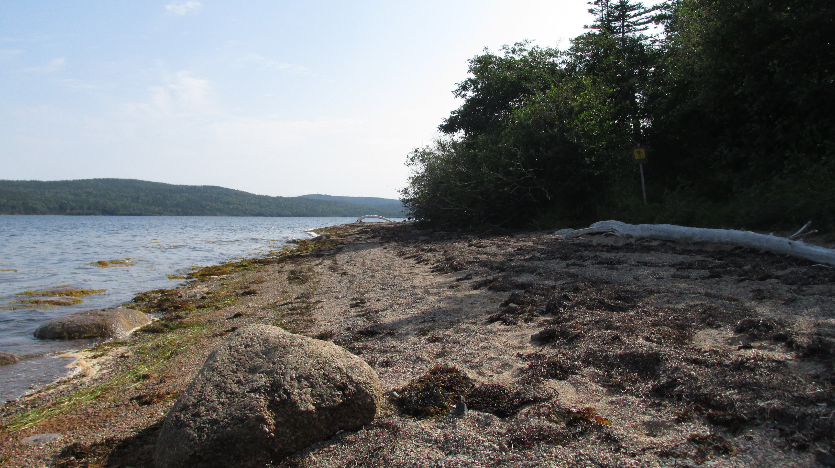
26_20170829_25TerraNovaCoastalTrail
Beach on the Coastal Trail beside Newman Sound

That night, our lodgings in Bertrem’s Beach House, a two-story cottage painted vibrant red, enchanted us all. We loved the cozy low ceilings and the kids took to hiding in the little upstairs nook beside the staircase where the ocean view was wonderful.
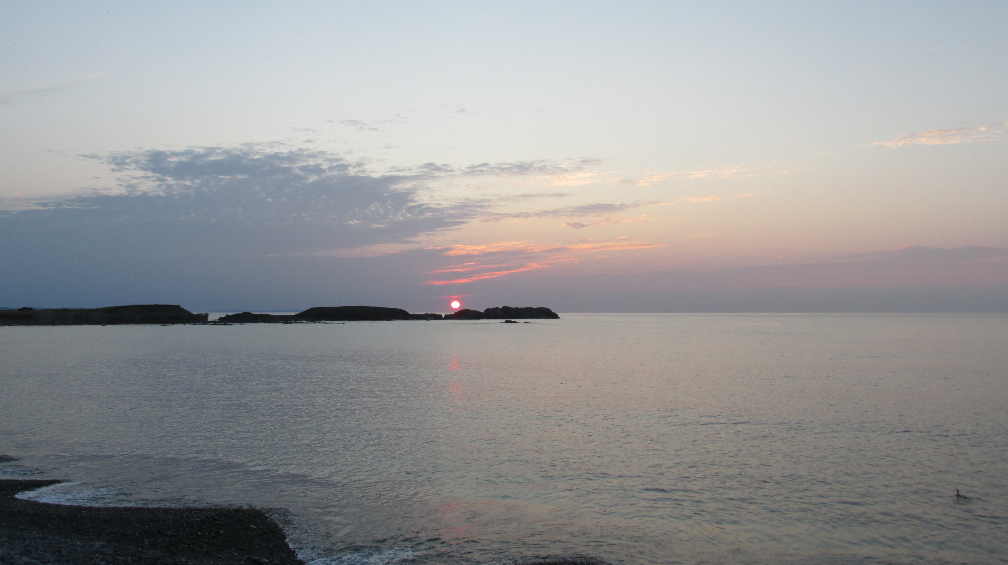
27_20170829_45SunsetAtBertremsBeachHouse
The view from Bretrem’s Beach House in Bonavista

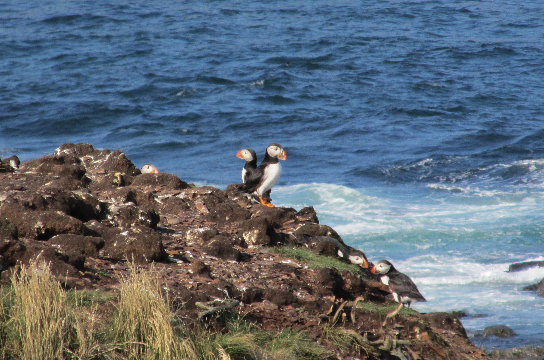
The next day, we had the puffins we’d come east to see – first at the Cape Bonavista Lighthouse and later (and even closer) at Elliston. Newfoundland & Labrador is home to hundreds of Atlantic Puffin colonies and the puffin is the provincial bird. The birds visit Newfoundland and other sea cliff islands around the North Atlantic to breed. They spend the winters out at sea.
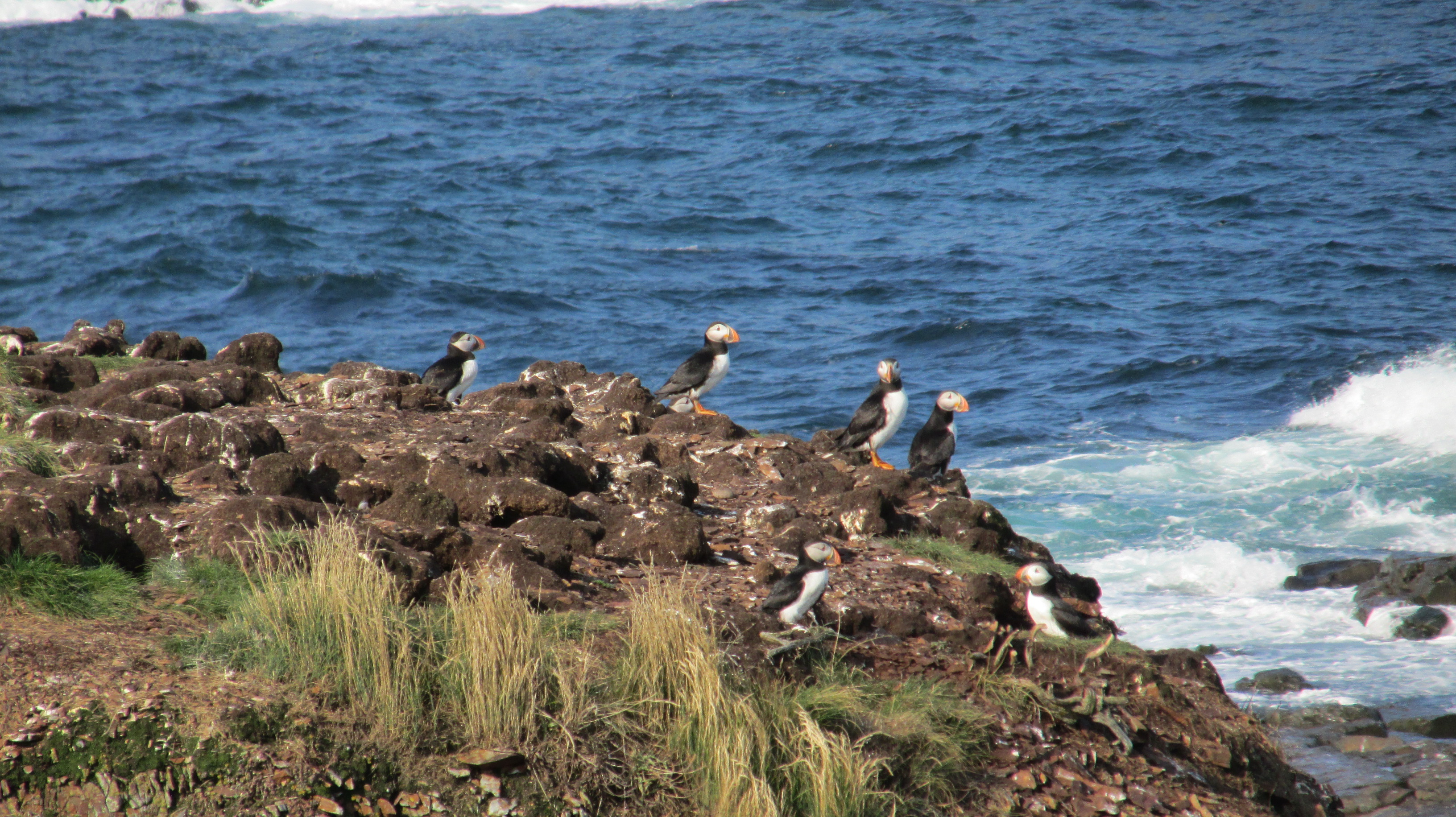
28_20170830_76EllistonPuffins
Puffins!

We watched as these delightful birds entered and exited their cliff-top burrows and brought fish for their young (they eat capelin, herring, hake and other small fish). At times they all flew up and spiralled over the colony, possibly a protective behaviour.
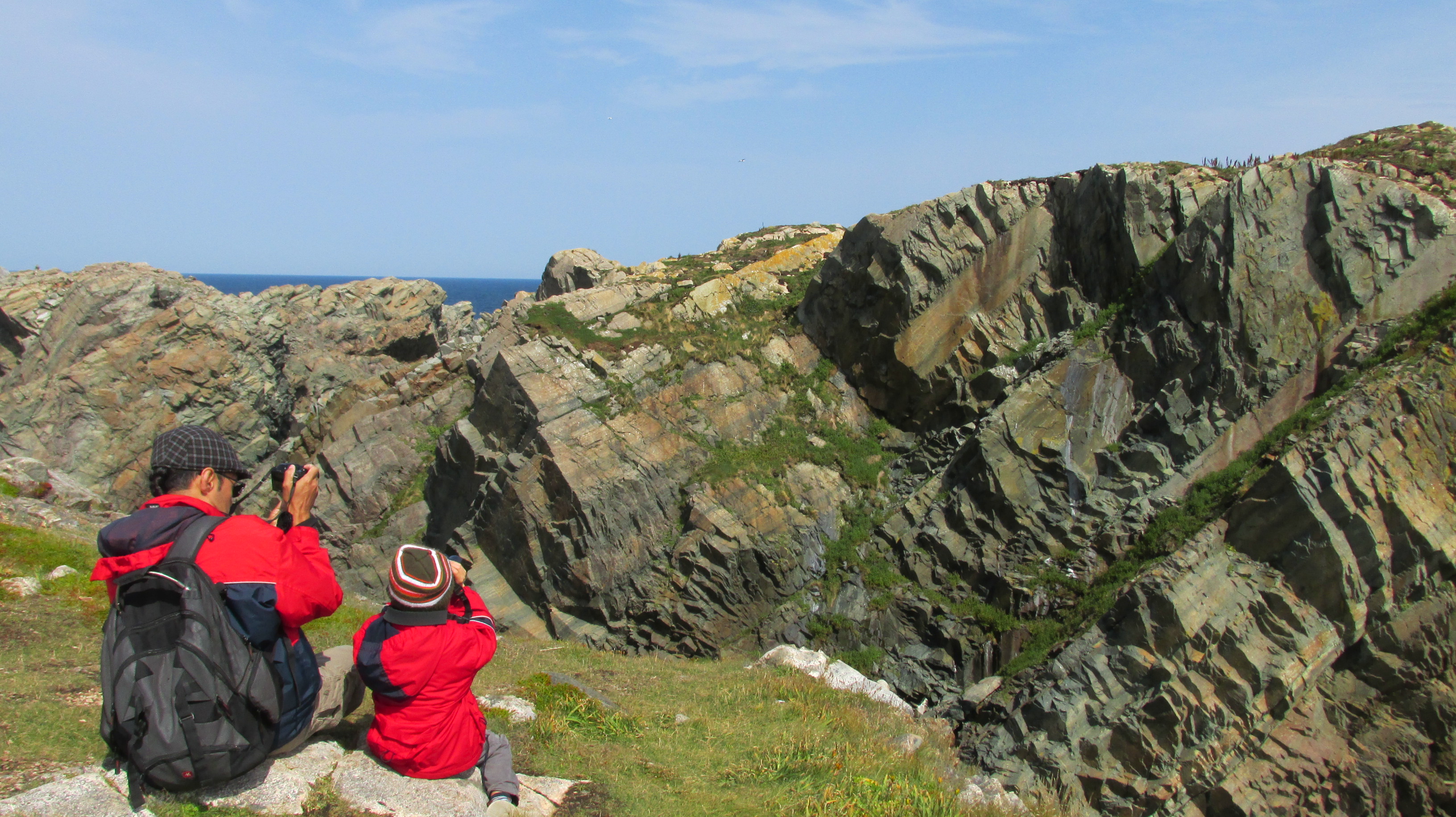
29_20170830_25CapeBonavistaMorePuffinWatching
Watching puffins at Cape Bonavista

Although few terrestrial predators can reach their island burrows, gulls are a problem and at Elliston we witnessed a gull eating an adult Puffin. This is natural, and escaping predation is part of the reason puffins mainly live at sea. It is also why their young fledge at night. But it was still heartbreaking, especially knowing that puffins mate for life and raise only one young per year over a six-week period.
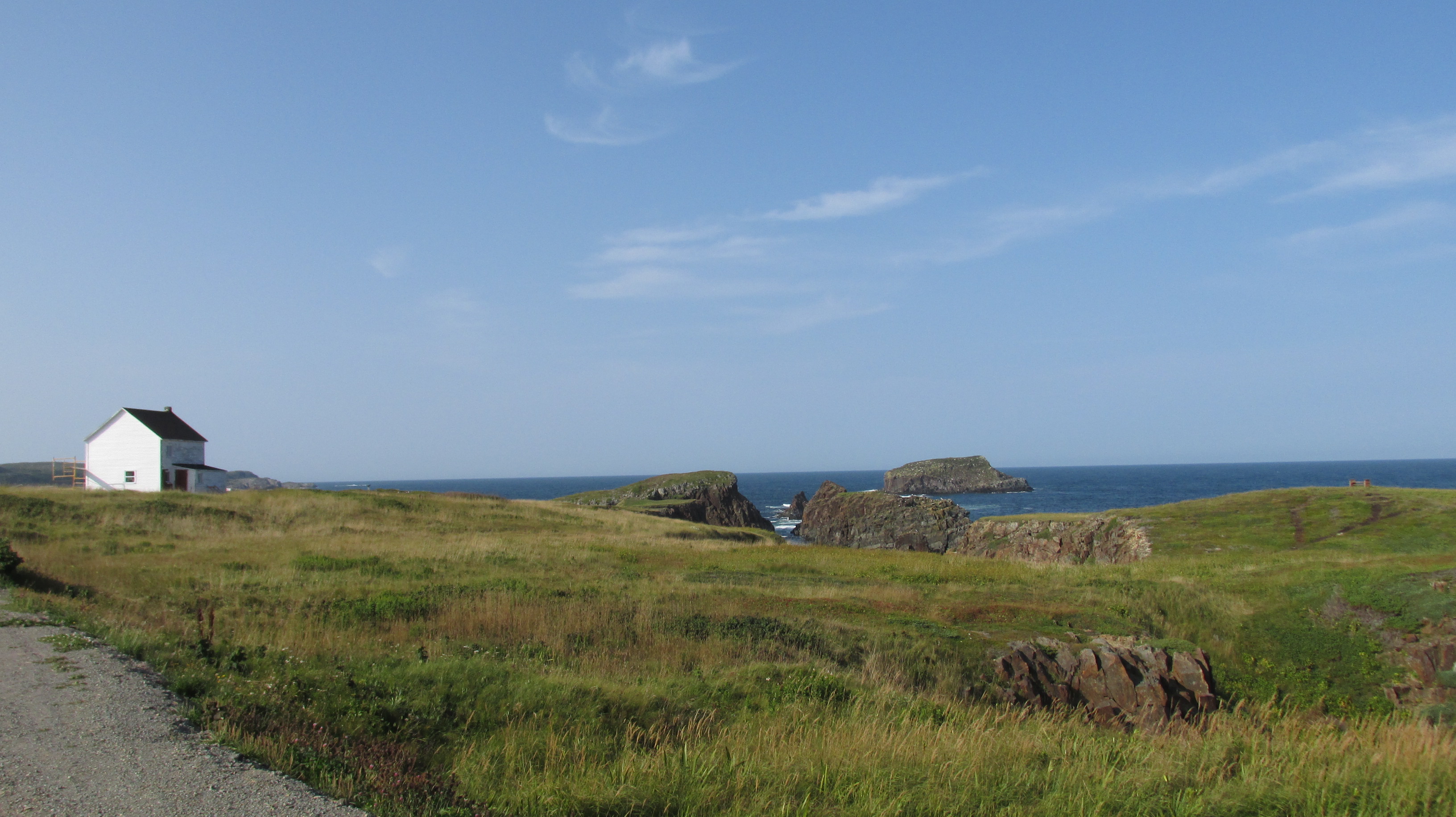
30_20170830_69EllistonApproachingPuffins
Puffin site in Elliston
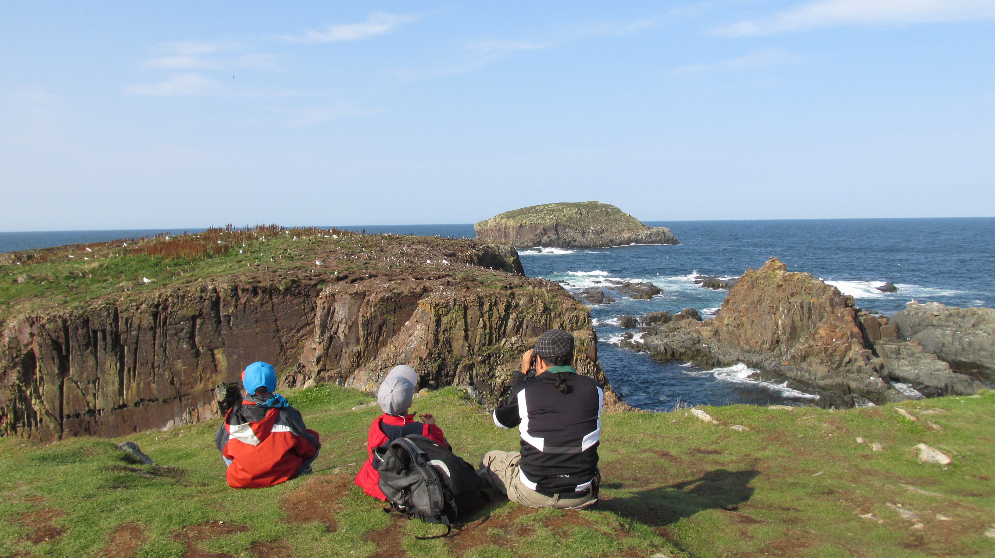
31_20170830_72EllistonWatchingPuffins
Watching puffins at Elliston
32_20170830_78EllistonPuffins

At Elliston we also stopped at Sandy Cove Beach where we joined a flock of Sanderlings wetting our feet in the cold North Atlantic waters then scurrying away from the waves. Elliston is known as the root cellar capital of the world and we explored several root cellars (one of which contained an art installation). In the days before electricity, these dug out structures kept vegetables and other foods cool in the summer and not frozen in the winter. More than 133 root cellars have been documented in Elliston and some of them have survived two centuries.
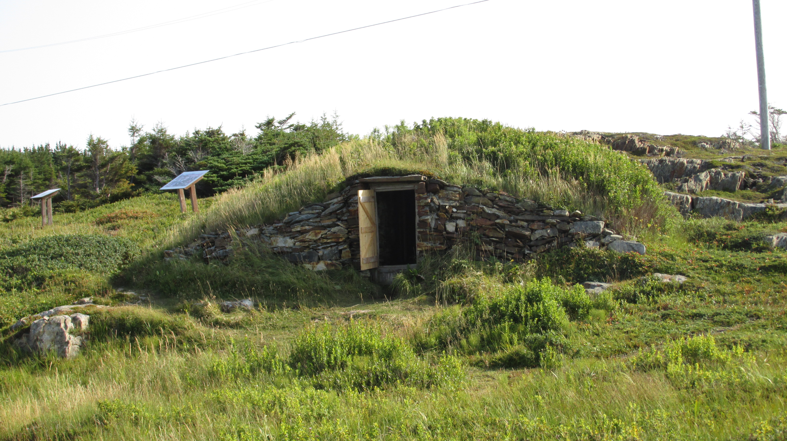
33_20170830_66EllistonRootCellar
Root Cellar at Elliston

Interspersed with puffin watching, we also hiked a small bit of the Cape Shore Trail to see the statue of John Cabot (Giovanni Caboto). In May 1497, the Italian explorer left Bristol, England on orders from King Henry VII to find an eastern passage to Asia. He found North America instead. No one knows for certain where he fist landed on 24 June 1497, but local tradition places his first steps in the New World at Cape Bonavista.

The sea caves at Dungeon Provincial Park were also a treat and we learned that such caves are formed when the sea pounds at cliffs and washes away the softer sedimentary rock. The hard rock then fractures and the waves pour into the spaces turning crevices into caves. Eventually the waves form a tunnel all the way around and when the roof collapses you get a hole – like the “dungeon”. Eventually the sea will carve out a sea stack where only a pillar of stubborn igneous rock remains.
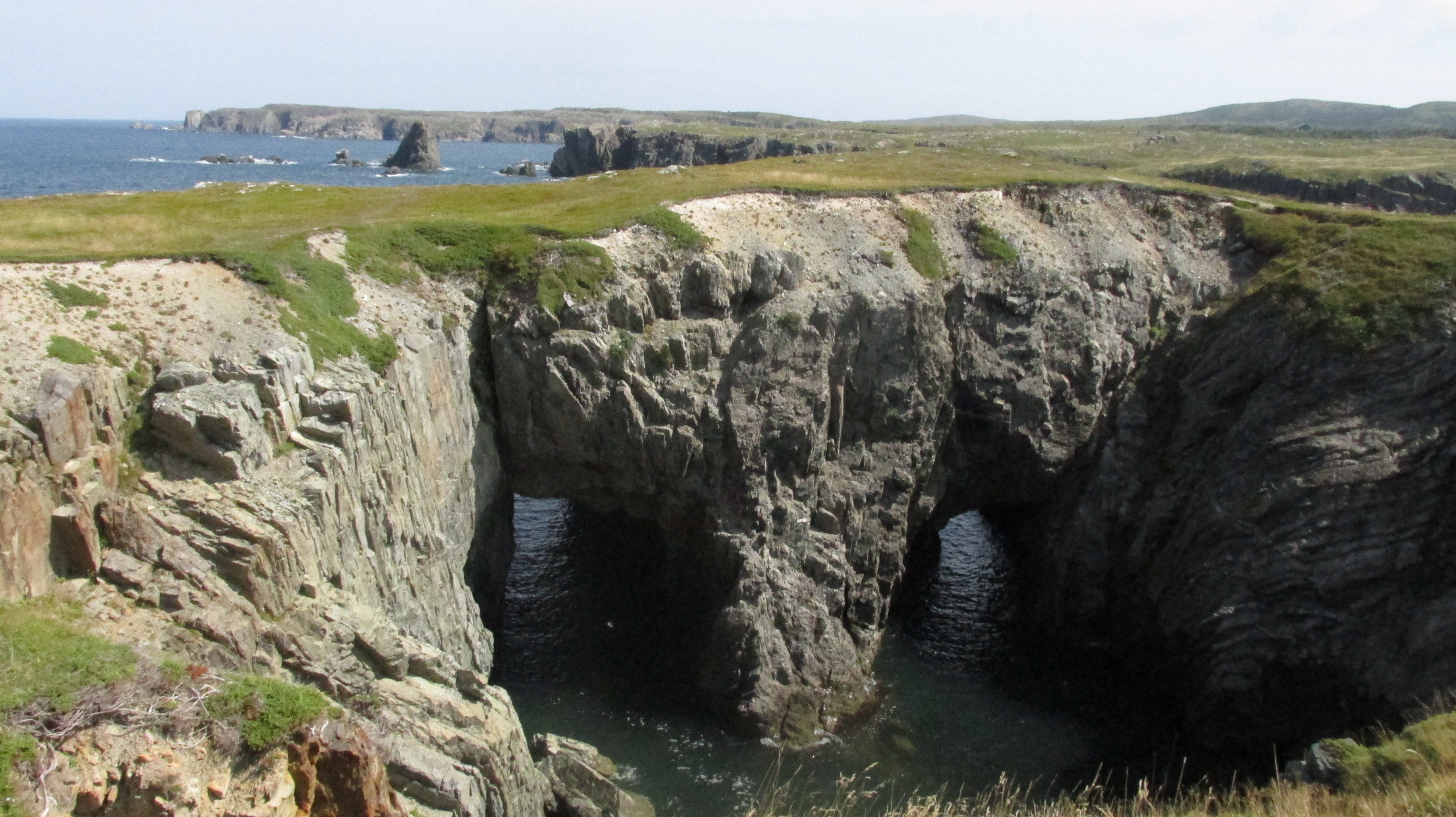
34_20170830_40CapeBonavistaDungeon
Dungeon Provincial Park

We saw many sea stacks on the Skerwick Trail the next day. This 5.3 km loop skirts the north and south coasts of Skerwink Head, a rocky peninsula between Trinity and Port Rexton. The founder of this trail says it has the most scenery per linear foot than any other trail in Newfoundland and I believe it. We picnicked at a wooden lookout overlooking cliffs and sea. It was one of many spectacular picnic spots this trip. From our picnic spot we even spotted a whale far out at sea.
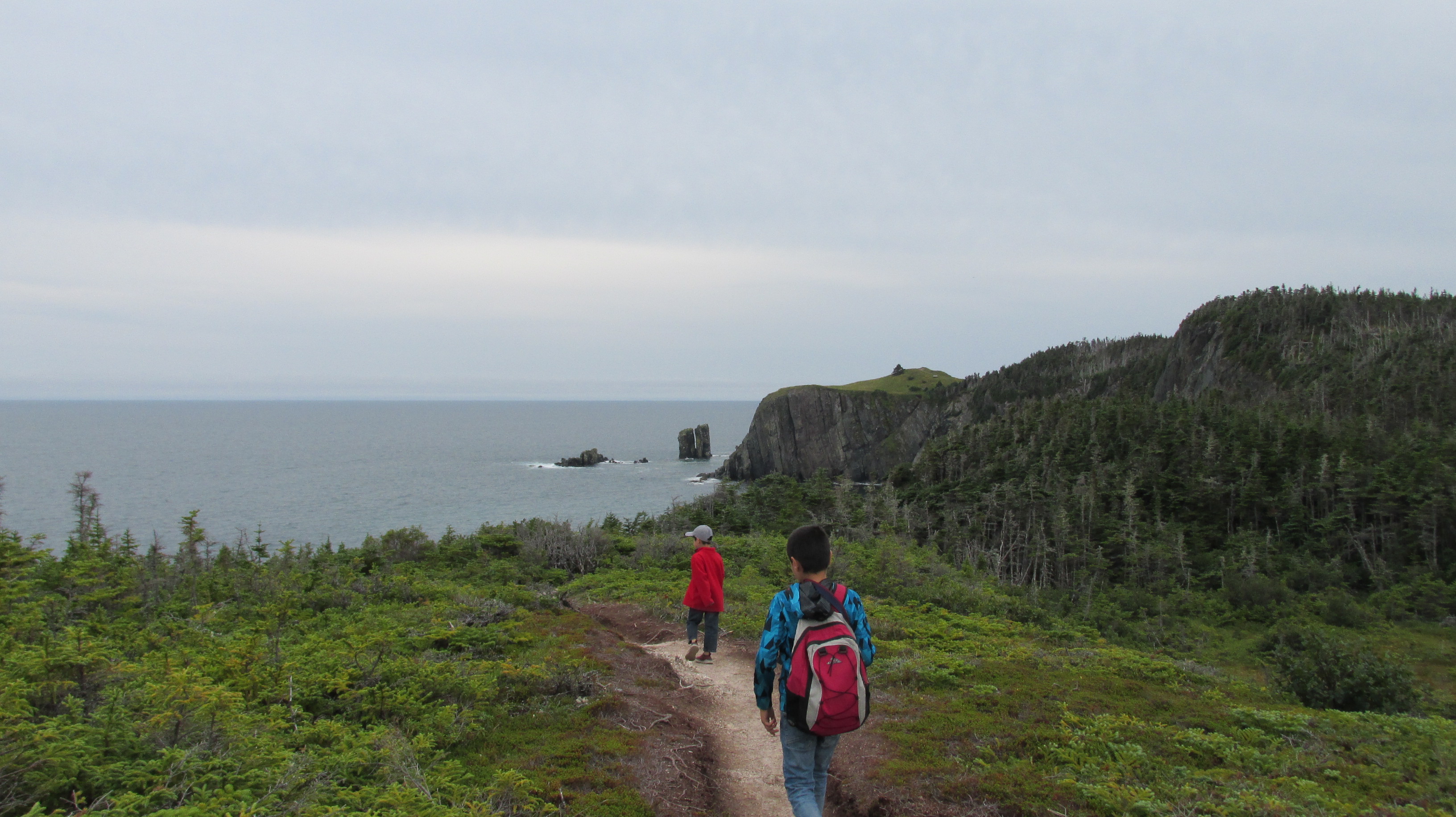
35_20170831_58SkerwinkTrail
Hiking the Skerwink Trail

We also visited the Ryan Premises, another excellent Parks Canada Heritage site housed in a cluster of 19th century clapboard buildings over looking the Bonavista harbour. There we learned about Newfoundland’s fishing history and in particular the cod. Codfish have been part of Newfoundland’s culture and history for hundreds of years. First Peoples fished them and John Cabot commented on codfish abundance when he arrived in 1497.
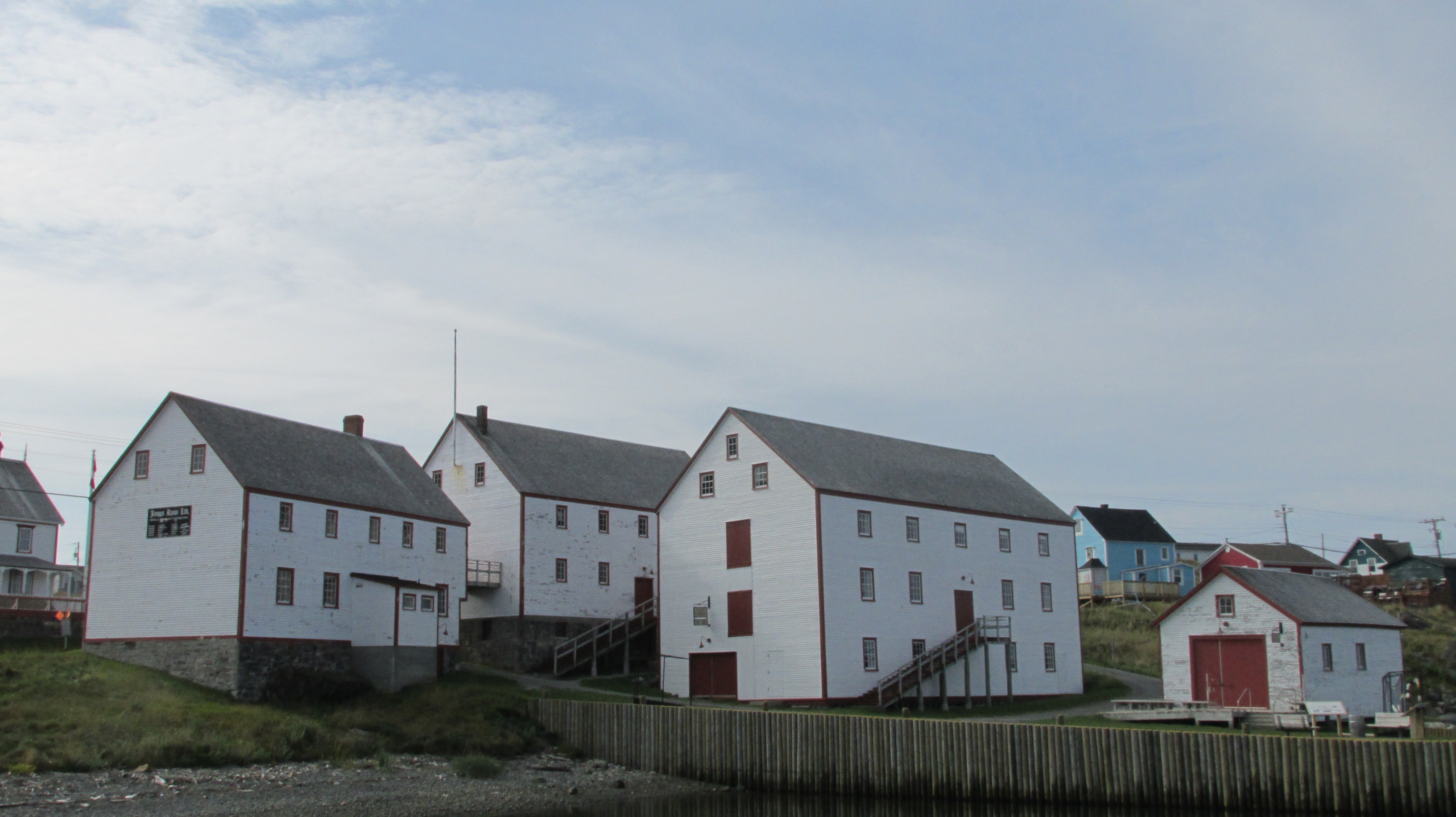
36_20170831_11BonavistaRyanPremises
The Ryan Premises in Bonavista

For centuries the Europeans joined the codfish game and salted Newfoundland cod was fished, processed, and then shipped internationally. The fresh-frozen fish industry took over from salt cod after World War I and industrialized overfishing grew after World War II. By 1992 fish stocks had crashed and there was a moratorium on cod fishing. Newfoundlanders now needed to find a new way to make a living. A few ended up as interpreters at the Ryan Premises, sharing their personal connection to the fishing industry.

After days of good weather, we got soaked along the Trans Canada Highway from the Bonavista Peninsula to St. Johns. Gusty winds made our little rental car shudder and rain came down in sheets. We’d driven right into the outer edges of tropical cyclone ten. The weather stayed miserable in St John’s into the evening and thwarted our plans for dinner and a walk around the harbor. Instead we stayed close to our hotel and went for dinner at Mary Brown’s (a fried chicken chain that originated in Newfoundland and is now the fastest growing franchise in Canada). Because Newfoundlanders are so friendly, we ended up in conversation with one of the workers and she told us that we were eating in the location that trains people for franchises all over Canada. Small world.

The next day it was still windy and wet – the perfect weather for indoor exhibits at the Johnson Geo Center on Signal Hill. In fact, most of the exhibits are not just indoors, but underground. An entire wall of the Geo Center is rock exposed during the excavation for the building.
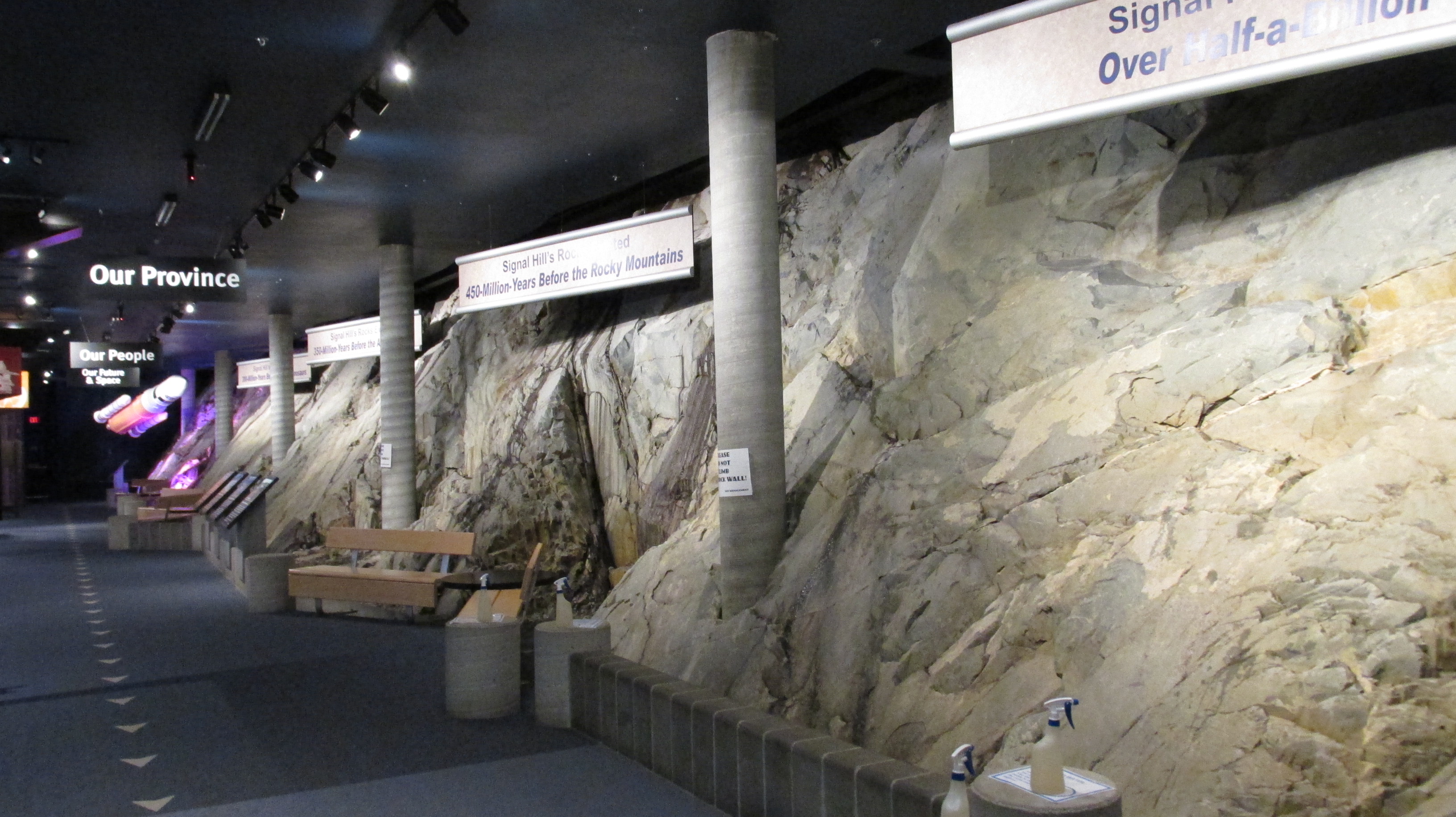
37_20170901_13GeoCenterRockWall
The rock wall at the Geo Center

Of the many things we learned is that the rocks of Newfoundland and Labrador are incredibly old. Some of the rocks in the Torngat Mountains (Labrador) are 3.6 to 3.9 billion years old. Newfoundland’s rocks are newer, but still over half a billion years old, which is 450 million years older than the rocks of the Rocky Mountains. This is why we don’t find dinosaur fossils in Newfoundland. Dinosaurs may have walked on the rocks, but couldn’t have been fossilized in them because the rocks were already made when dinosaurs roamed.
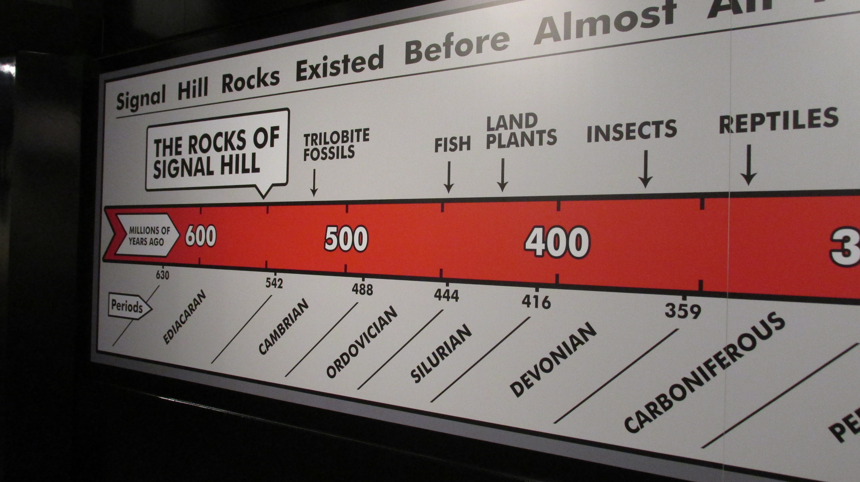
38_20170901_15GeoCenterOldRocksTimeline
The rocks of Signal Hill were there way before dinosaurs

Instead, in places like the UNESCO Heritage site at Mistaken Point, Precambrian fossils have been found (e.g., even older than the fossils of the Burgess Shale). These imprints of ancient soft bodies creatures were preserved because a volcanic eruption poured ash into the sea. The ash landed on the animals and eventually fossilized them (in much the same way that the people of Pompeii were preserved).

By the time we left the Geo Center the rain had stopped and the weather was clearing. We went to Signal Hill and hiked to the iconic Cabot Tower, built between 1897 and 1900 to celebrate the 400th anniversary of John Cabot’s landfall. The tower was also the place where Guglielmo Marconi received the world’s first transatlantic wireless signal in 1901. The Morse code signal for “S” travelled from Cornwall, England to the Cabot Tower.
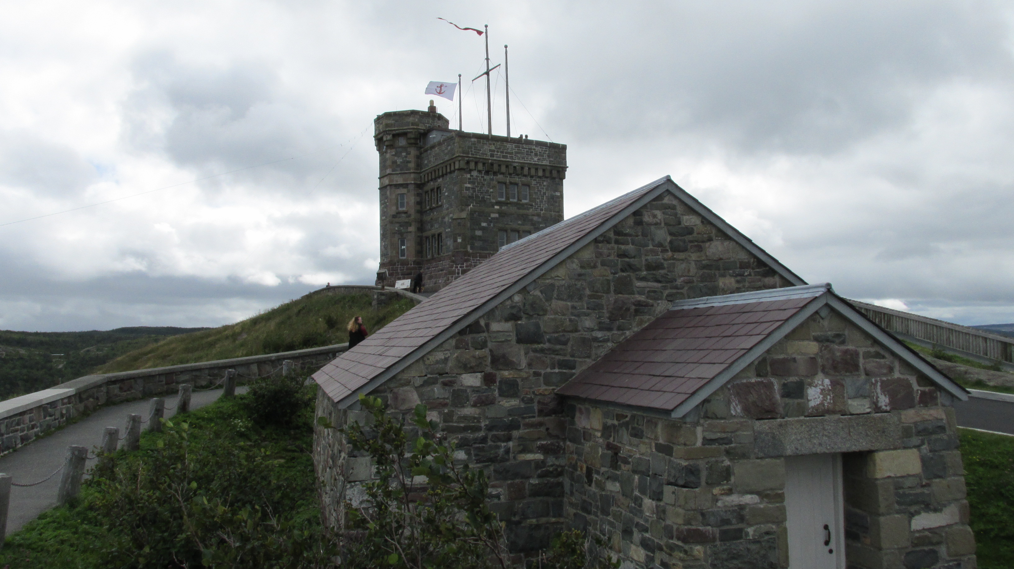
39_20170901_52SignalHillMagazineAndTower
Imperial Powder Magazine and the Cabot Tower behind

The views of St John’s, its harbor and the rugged coast were spectacular.
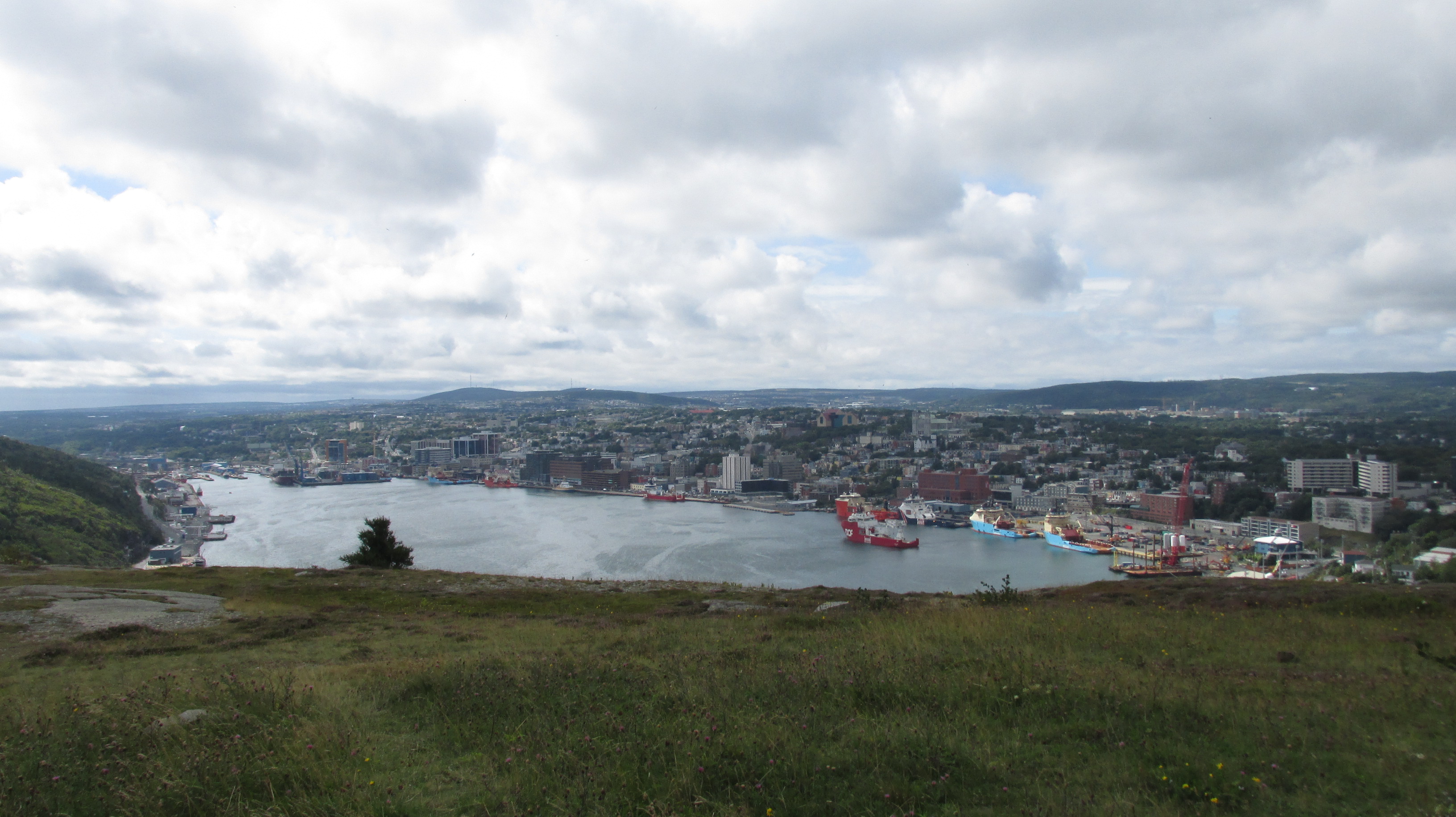
40_20170901_23SignalHillStJohnsHarbour

We could see the Fort Amherst Lighthouse across the Narrows and in the distance the two lighthouses at Cape Spear where we headed there next.
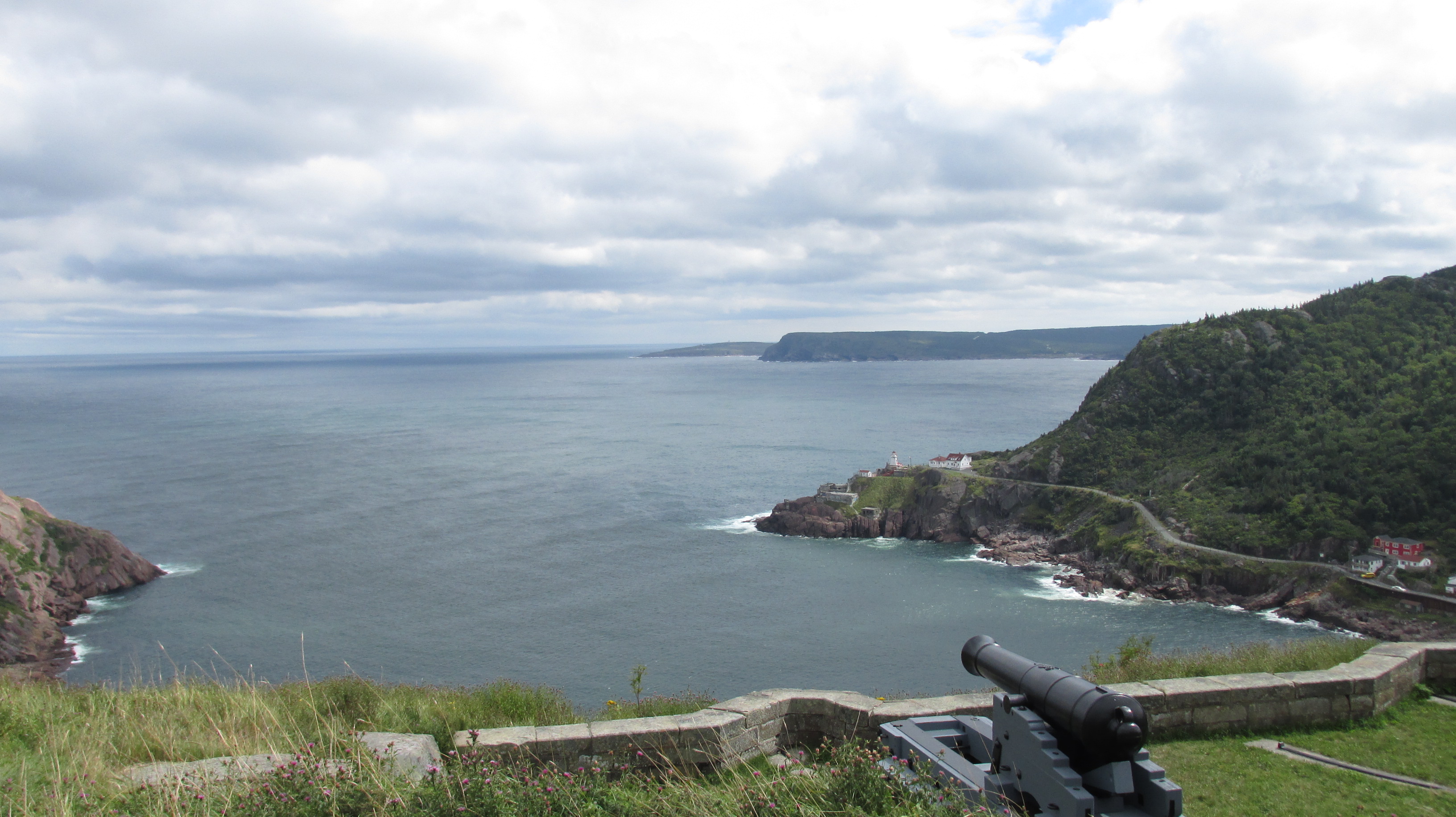
41_20170901_35SignalHillQueensBatteryView
Fort Amherst Lighthouse and the coast towards Cape Spear

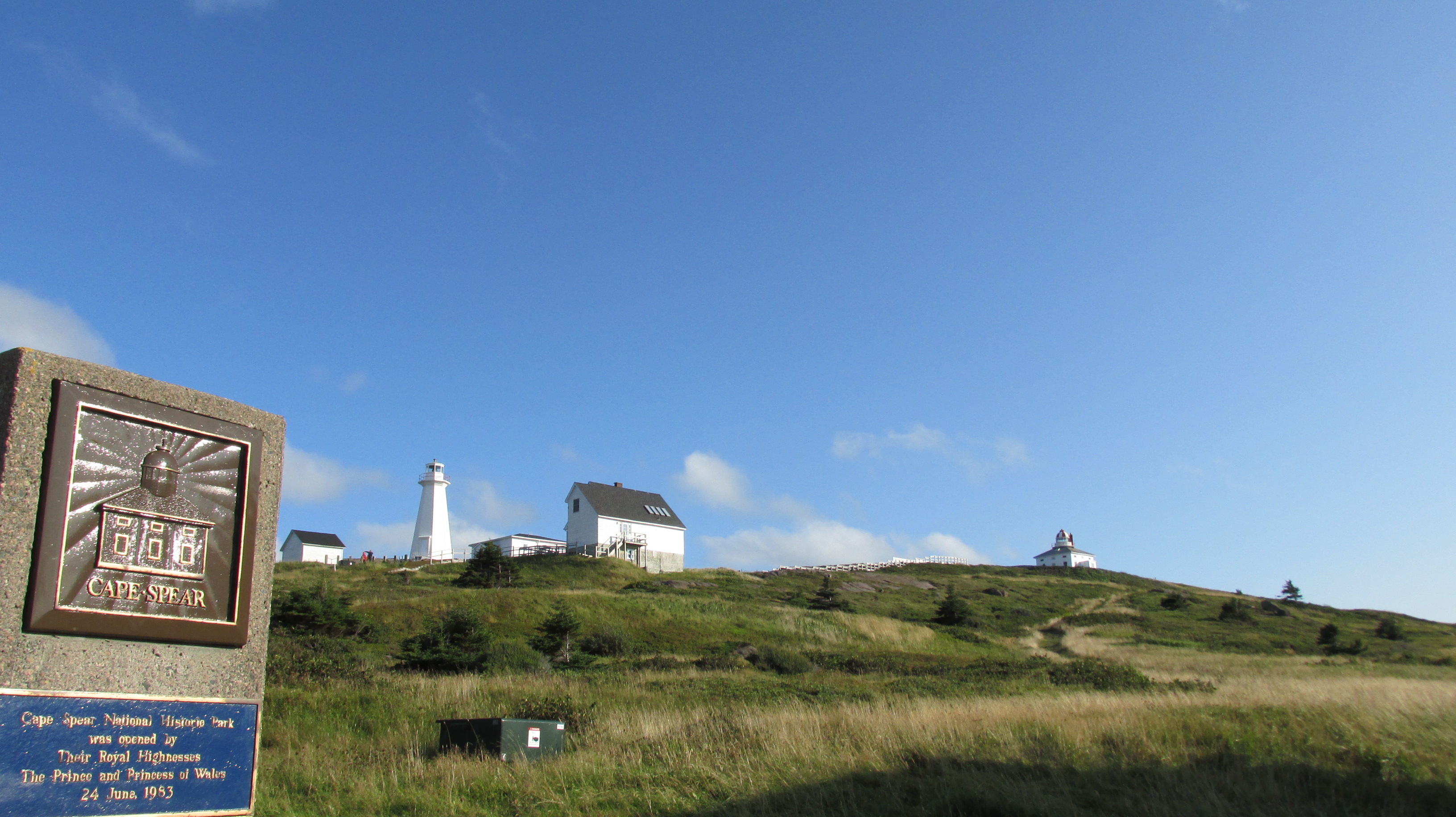
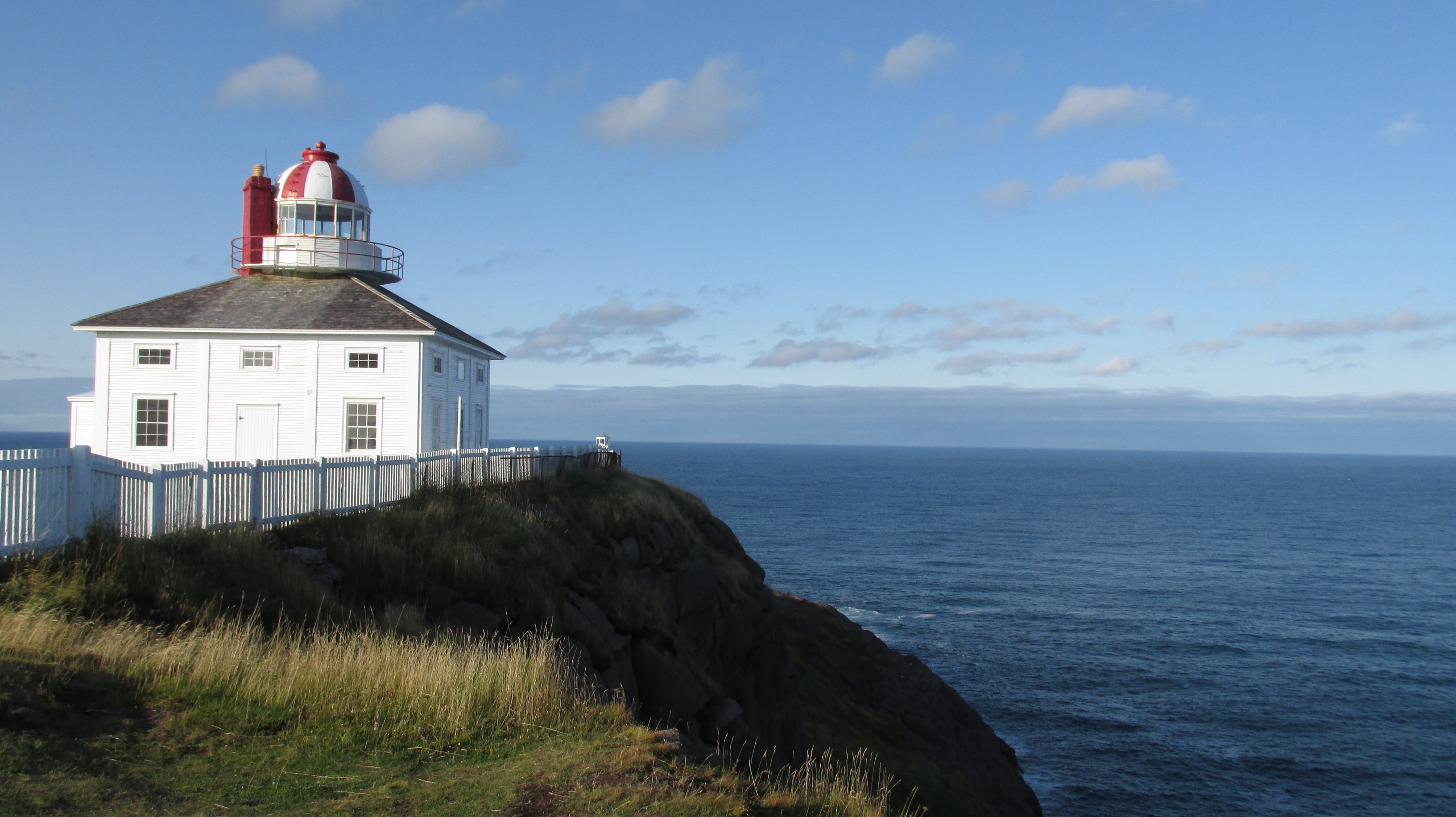
The historic lighthouse at Cape Spear is nearly 200 years old and the oldest surviving in Newfoundland and Labrador. The other is a more modern working version. We hiked up to both and got breathtaking views of pink cliffs, blue seas and waves crashing as far as the eye could see in either direction.
42_20170901_66CapeSpearLighthouses
Lighthouses at Cape Spear
43_20170901_76CapeSpearOldLighthouse
The 200-year lighthouse at Cape Spear

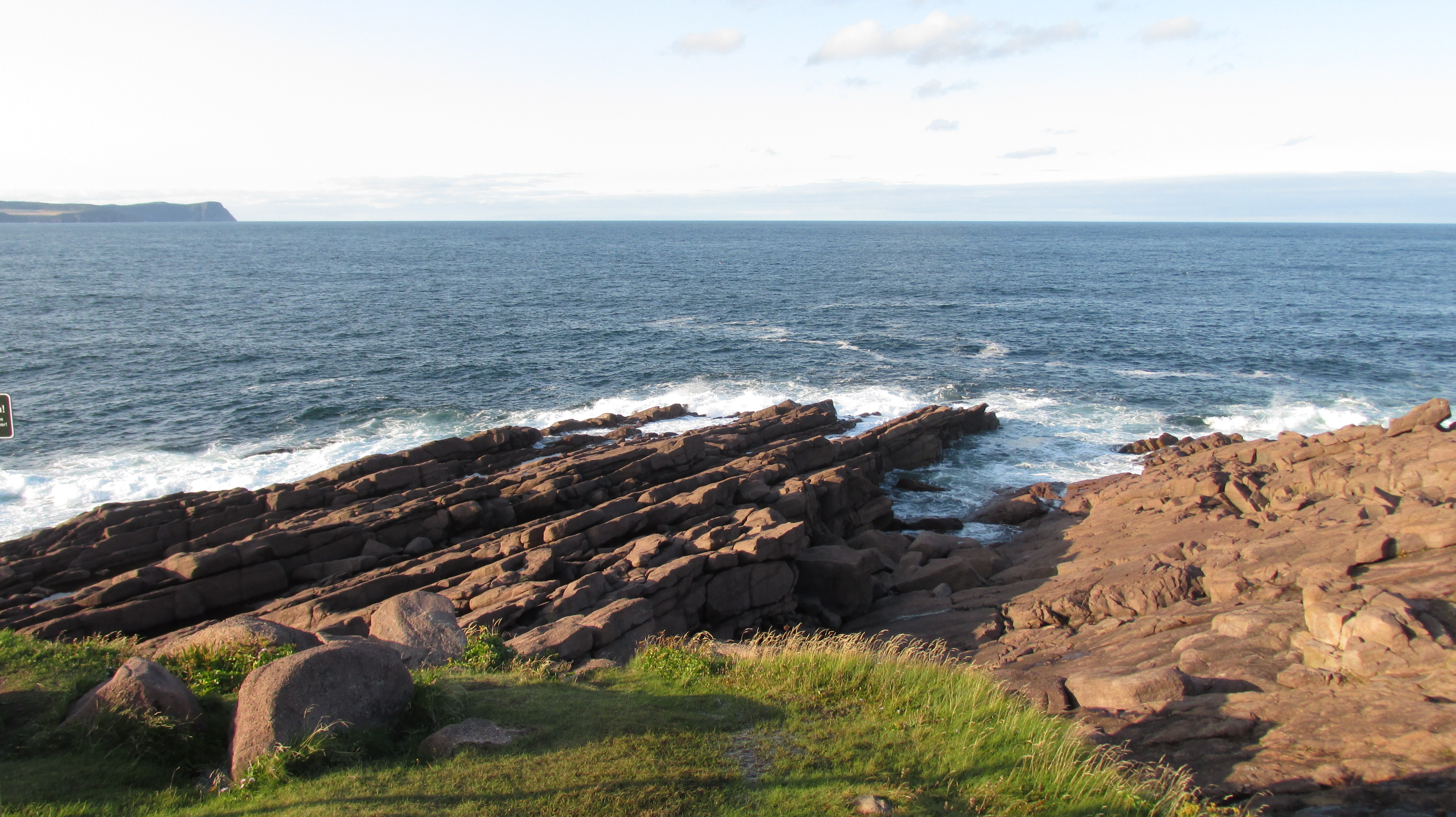
Then we hiked to the most easterly point in Canada. Standing with our backs to the sea we knew that all of North America stretched out in front of us and there was nothing behind us until Ireland.
44_20170901_82CapeSpearRocksEastPoint

We finished the day with a walk downtown (taking advantage of the free street parking after 6 pm) and an amazing meal at the Bagel Café on Duckworth St.

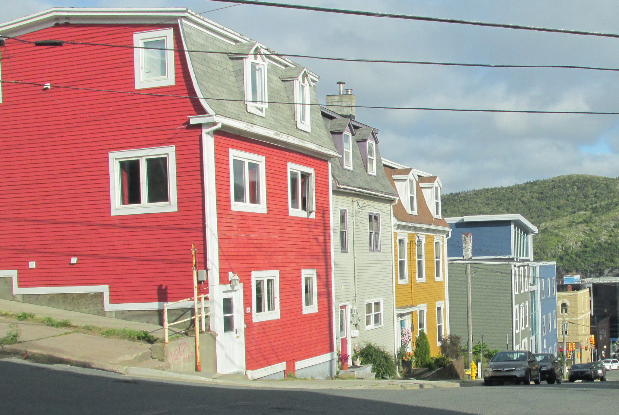
We spent our last half-day in Newfoundland wandering. First along Harbor Drive watching big container ships get packed and ready to go. Then back alternating between Water St. and Duckworth St., taking in the “Jelly Bean Rows” of colourfully painted townhouses and also exploring the old business district and the pub district along George St.
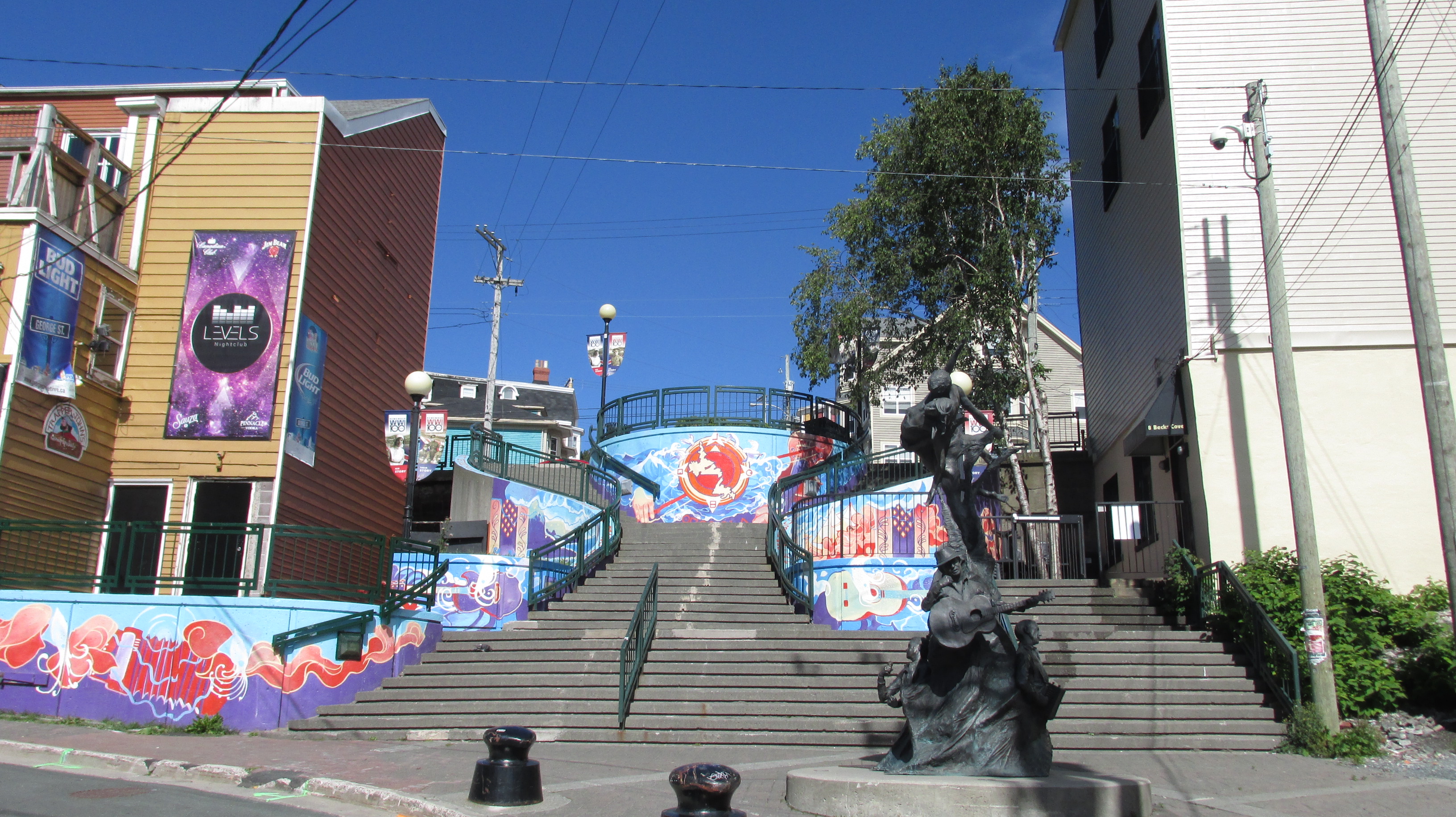
45_20170901_62StJohnsJellyBeanRows
Jelly bean townhouses, St. John’s
46_20170902_15StJohnsColourStairs
George St. Mural by Sarah O’Rourke-Whelan

Then we headed to the historic fishing village of Quidi Vidi. Where we watched artists work at the Quidi Vidi Plantation, a craft enterprise incubator (like a business incubator for emerging artists). From there we crossed a small footbridge and headed up a gravel path to the entrance of the East Coast Trail. There we joined locals out enjoying the Labour Day weekend picking blue berries and walking their dogs.
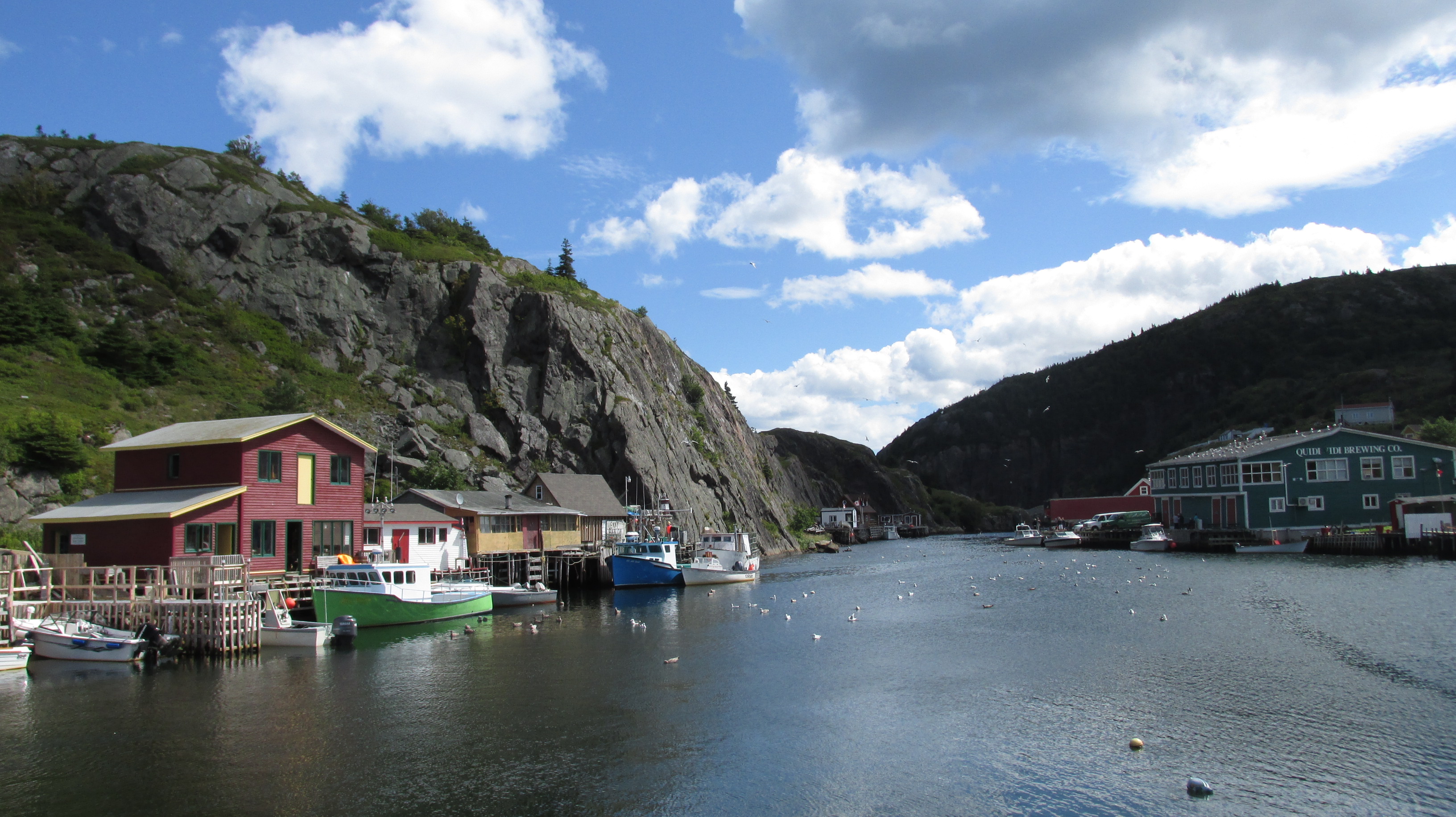
47_20170902_34QuidiVidiVillagePlantation

On the plane home – heading back to reality – I reviewed my pictures and marveled that we’d had only about 24 hours of bad weather in a 10-day trip. Newfoundland showed us her beauty in late summer glory – full of sunshine and free of bugs. We were fortunate. Still, my pictures hold evidence that Newfoundland is not a place of benign weather: from the tuckamore forest bent away from driving wind and crashing seas, to the gravel of the barrens, literally shattered by freeze thaw cycles and “death by a thousand cuts” weathering. Newfoundland’s beauty comes from this weather and its majesty was born from mountains bulldozed up in violet collision and scoured clean by glaciers.

It was an incredible trip.
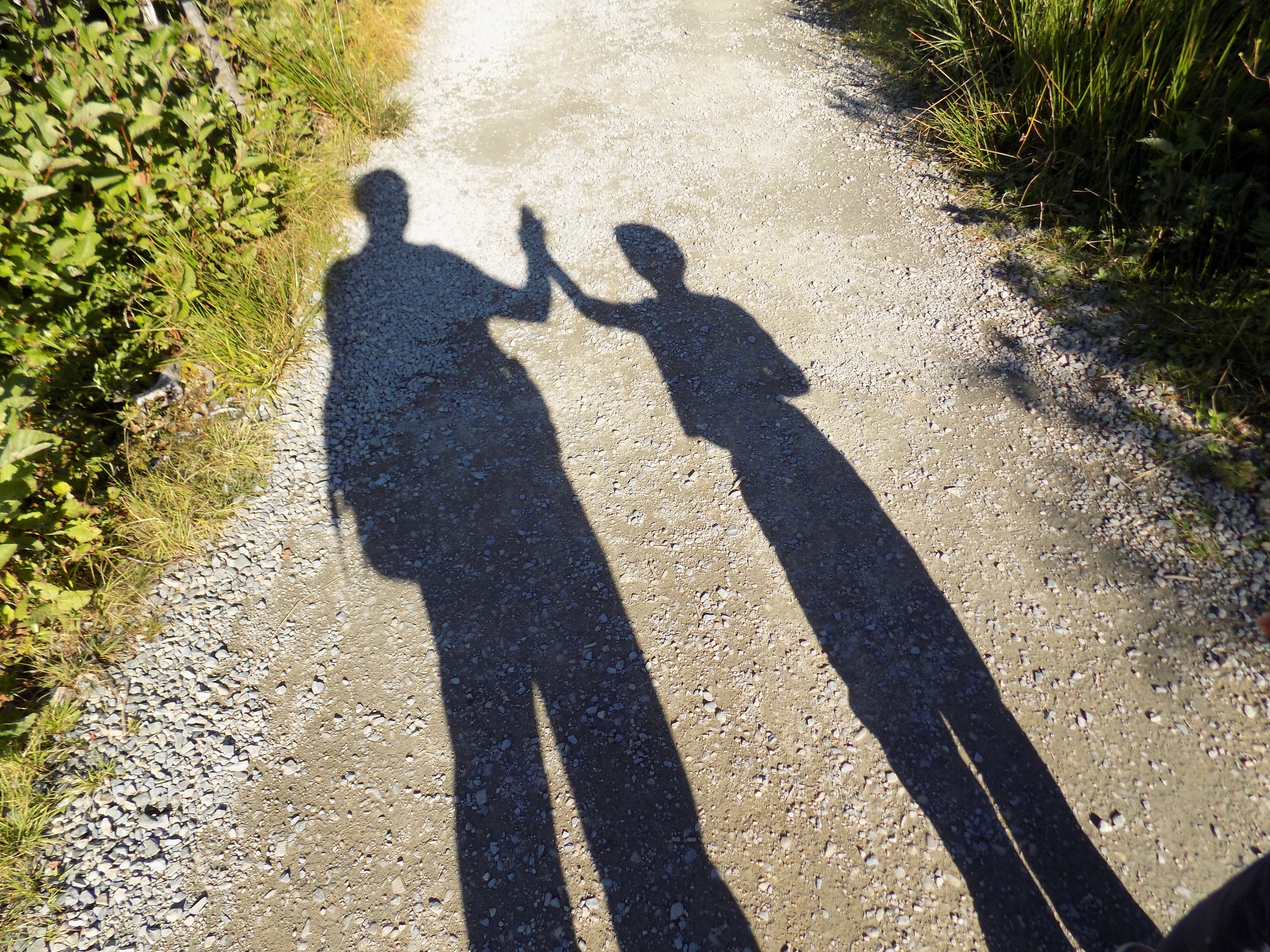
48_20170827_B10ShadowHighFive
A hugely successful trip

I can’t wait to go back. Perhaps we’ll try a different season and next time and I’ll stand on a cliff top by those bent tuckamore trees and howl right into that salty wind above a pounding surf. I’ll howl “Thank you” for Newfoundland’s raw, majestic beauty.

On this day (before)

Today seems like a good day for reflection.

By this day some of us have built homes, started businesses, taught in classrooms, had children, led companies, patented inventions, filed for bankruptcy, written books, completed theses, finished marathons, run away, saved lives, cured illness, eased pain, flown planes, climbed mountains, travelled the world, lived in monasteries, had relationships, lost relationships, survived war, or had the luxury of living in peace.

Some of us are just beginning; some of us are nearing the end. No one has done it all – and that’s okay. The paths are many and this world needs all of our contributions and all of our diversity – especially on this day (before).

One this day (before) I remember who I am: curious, compassionate, sensitive, vulnerable, able to learn from mistakes, human. Not driven by fear, greed or hatred. On this day I remember who I am and who I want to remain.

Year in Review 2016

Written 24 December 2016, Panama

20161218_26calledelaqua
How to build a snowman in 30 Celsius heat? Use plastic drinking cups!

This is my 12th “year in review”. It’s hard to believe that the first was written from Texel Island in the Netherlands in Dec 2005). In 2008, I wrote from Panama as we introduced our first born to his “abuelos”. This is the second year, since I started writing the “year in review” that I am writing from Panama. This year the “abuelos” have two big kids from Toronto with whom to celebrate. Ray is 9 and Lucas is 6. It is unbelievable how quickly the time has flown!

When I wrote this it was snowing and cold at our current home in Toronto while we were sweating it out in Panama’s humid transition from the wet to dry season. This will be Ray’s second Christmas in a hot climate, but the first that he remembers. It is certainly Lucas’s first. For hubby, it is what he knows from childhood. I’ve had several Christmases in hot climates, most in Panama from 2000 to 2003, but also one in Mauritania in 2006. For someone who grew up where it is cold in December, sweating on Christmas still doesn’t feel quite right, but I don’t miss trying to get around in the snow.

It has been a trying year for many in terms of world events (depending on your point of view), but it has been a fairly good year for our family. Other travels this year included a lovely few days for the boys and I, with very close friends, at a rented cottage in Oxbow Lake (near Algonquin Park). As a family, we also did another wonderful canoe trip, this time further north in Temagami. This trip to Panama is our send off to 2016 (though we will be back in Toronto to ring in the New Year).

Our boys continue to grow physically, intellectually and emotionally. This year they started in a new school so that Ray could begin extended French. He is in grade 4 and has 50% of his classes in French and 50% in English. This means that Ray is starting on his third language. He’s made friends at his new school and is generally doing well. Physically, he is developing skills in running (he joined the cross-country team), swimming (he joined the swim team), biking, and other general sports like monkeying on the monkey bars. He continues to be our social and talkative guy, but despite this gregariousness, he remains our pensive one. He thinks and feels deeply and he is working on strategies to deal with strong emotions. The kids and I have been experimenting with mindfulness (the book Sitting like a Frog is a great intro for kids) and we are all finding it helpful.

Lucas is in grade 1!     He struggled a bit with the transition to the new school (he missed his old school and his friends) but he is now making new friends and is doing well. He remains very kind, always quick to help others and to ensure that everything is fair for everyone. He is developing his logical, mathematical and organizational skills with patterns, puzzles and (of course) collecting rocks. Like his brother, he is developing his physical skills in biking and swimming. He also still loves singing and dancing – and to my delight – he still skip-walks when he is excited. Even though he is firmly in kid territory now (not anywhere near a baby), he will always be my baby.

As for the adults, hubby has found a place that he loves professionally. As bike culture continues to increase in Toronto, he found a job as a bike mechanic at Urbane Cyclist. It is a workers co-op with like-minded colleagues and it is close enough to bike commute. In fact it is also close to the University of Toronto, so he and I can sometimes meet for lunch. The job allows hubby to use his technical skills on something he is passionate about – getting people riding safely by building and fixing bikes. He is basically getting paid for his hobby. Not bad. The job is still somewhat seasonal, but even that works since it allows us to do things like visit Panama for the winter holidays.

This has been a busy year for me professionally. Last year I learned the day-to-day operations of graduate student education and funding (it reminds me of ecology in its complexity) and I began to research several topics around enhancing graduate funding. This year I added to that by deepening the research and data analysis and working with senior leaders to implement several major projects that included an increase to grad student funding, better transparency around that funding, optimizing international student funding, and new programs for professionalization and progress through PhD programs. There were certainly challenges, but overall I have learned an immense amount this year! I’ve deepened my understanding of the intricacies of graduate education and funding, and how senior leaders make tough decisions in higher education amid multiple, and often conflicting, demands. Next year I will start a yearlong secondment doing similar work but around research and research funding.

The year 2016 has been trying for many, but for my family it has been a year of strengthening our souls and our relationships. It seems prudent to look for solidity in oneself and close relationships when other aspects of life are turbulent. I wish you all the best for 2017!

Temagami

Temagami sunset. Photo: D. Buehler.

Temagami is a land steeped in natural and human history. People have lived on the land for thousands of years. More recently, people have come to conquer the land and take from it, while others have come to conserve it.

Temagami became part of my history three years ago when my father told me that it was on his “bucket list”. It was wild places like Temagami that drew my Swiss father to Canada in the first place. Now that he was dying of cancer, it was time to see this wild place. Before the cancer struck he would have been able to hike, canoe and camp. Even with cancer eating away at his body, he was able to take a trip with my mother to a lodge in Lake Temagami and hike out to some of the ancient trees. Temagami became part of my parent’s history. This summer I decided to take my family out to Temamagi and, the week before Labour Day*, it became part of our history.

Last year we took our first family canoe trip and loved it. Temagami was further north and we planned to stay out longer. Again, we wanted a guided family trip. It seems decadent; but as working parents, we needed a restful vacation even if out in the wild. And paying guides to do what they love, while sharing their expertise with us, fits with our values. I found Camp Temagami online and was taken by their philosophy. I wanted to experience a bit of that with my family.

***

“The forest looks pointy, Mami”, nearly 6-year-old Lucas observed.

It did.

We had watched remnants of Carolinian forest around Toronto switch to rich farmland, then to mixed deciduous forest (maple/beech) in the area around Algonquin Park. Now, as we approached the Lake Temagami Access Road about 100 km north of North Bay, the forest was mainly boreal (pines, spruce and other conifers with the odd paper birch and alders in the wet areas).

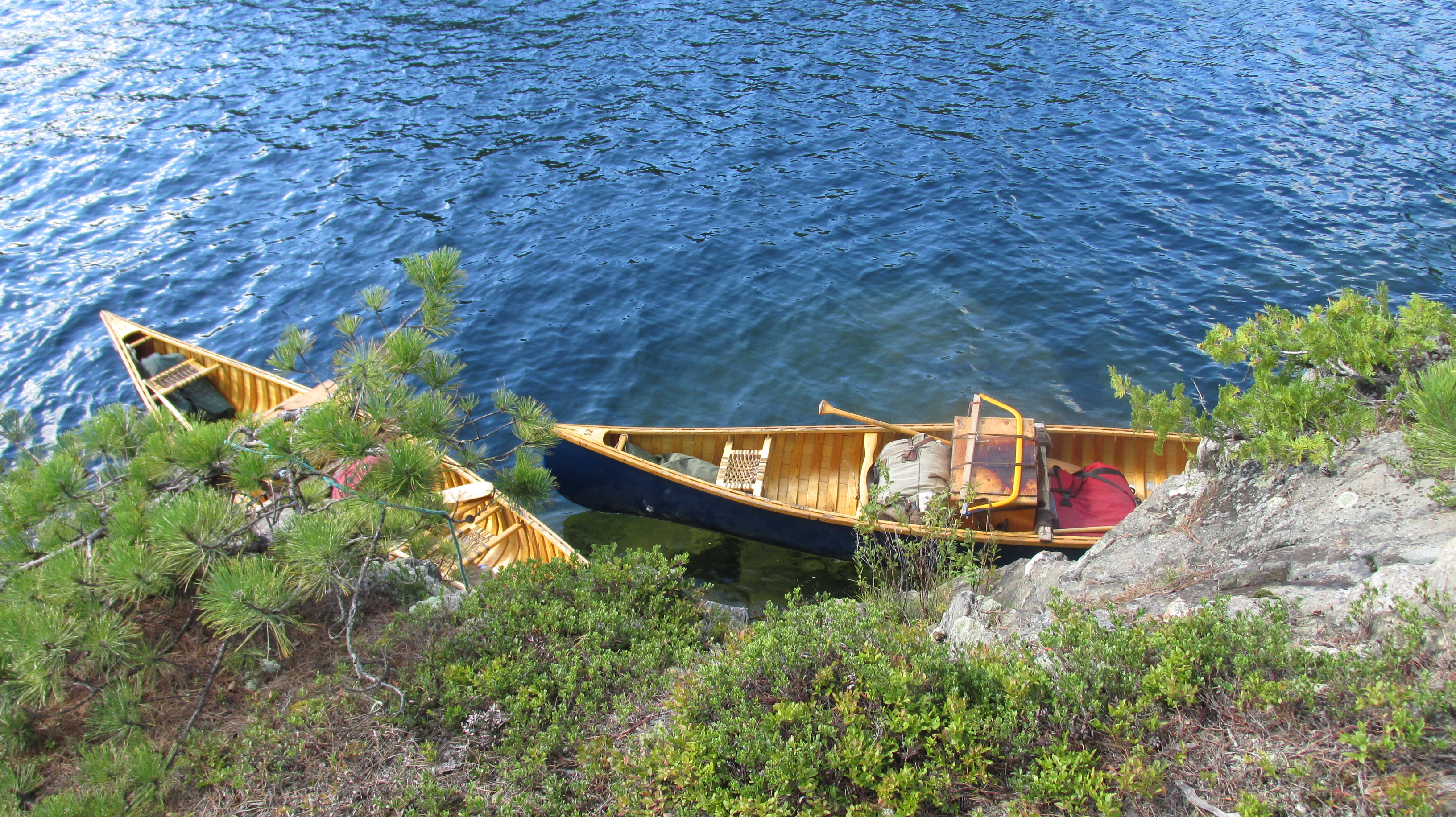
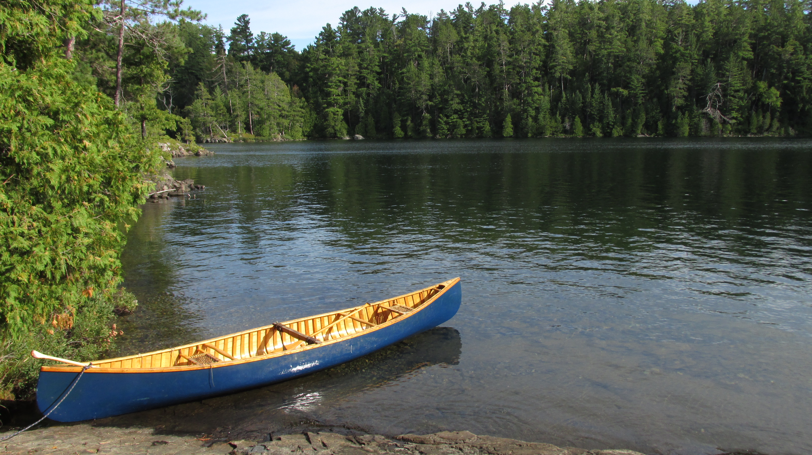
It felt pretty good to leave our car, and civilization, behind at the end of that access road. We reached “base camp”, at the top of the southwest arm of Lake Temagami, by boat. The name of the lake comes from Te-mee-ay-gaming in Ojibwa and means “deep water by the shore”. Then next morning, we left the shore and headed into that deep water in gorgeous, blue wood canvas canoes (built by Hugh Stewart). The canoes were well packed by our guides Emily and Sophie with traditional canoeing gear. I’ve been canoe tripping before and am used to back packs and even bear barrels. But we were stocked with gear similar to what the Voyagers traditionally used. The wooden boxes are wannigans. They look cumbersome, but can be carried quite efficiently with the aid of tumplines. They also fit well into a canoe and double as tables and chairs at camp.

20160831_05temagamicanoesantisland
Packed canoes off Ant Island. Photo: D. Buehler.

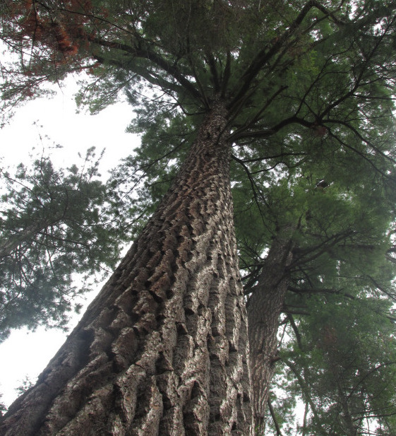
Our first stop of the trip was a short hike to several very large and old white pines. They towered overhead and their circumference at the base was large enough that the arm spans of my husband and I – together – were not enough to encircle them (we’re talking some serious tree hugging). This was just a taste of Temagami’s old growth forest. There was majesty in the towering trees. There was life in the air, fragrant with the smell of pine needles. There was a sacred stillness when we walked with footfalls muffled by years of fallen pine needles (well, until the kids started asking questions, but that was wonderful too).

20160830_27temagamibigwhitepine
Towering white pine. Photo: D. Buehler.

The land that produced these magnificent trees was scoured by glaciers more than 10,000 years ago. The Anishnabai have been enjoying the area’s beauty for at least 6,000 years after migrating from the east coast of North America. They too find spiritual significance amongst the towering trees – in particular the Wakimika Triangle. Although we were far from that sacred area, we were connected by trails and canoe routes – called nastawgans – that have been used by the Anishnabai for thousands of years.

Of course “tree huggers” like us are not the only visitors to Temagami. Clashes between loggers and environmentalists have been going on for years. Perhaps the most famous was the Temagami Wilderness Society’s Red Squirrel Road blockade from September to December 1989. The conflict involved the extension of the Red Squirrel logging road into Anishnabai territory. The dispute even reached Toronto in April 1990 when protesters came to Queens Park and then followed the Premier David Peterson around for a week with a 4-meter chainsaw emblazoned with the words Temagami Chainsaw Massacre.

However, all was peaceful for us on Lake Temagami in late summer 2016. We enjoyed three nights out, each one different and each one in a lovely, secluded campsite.

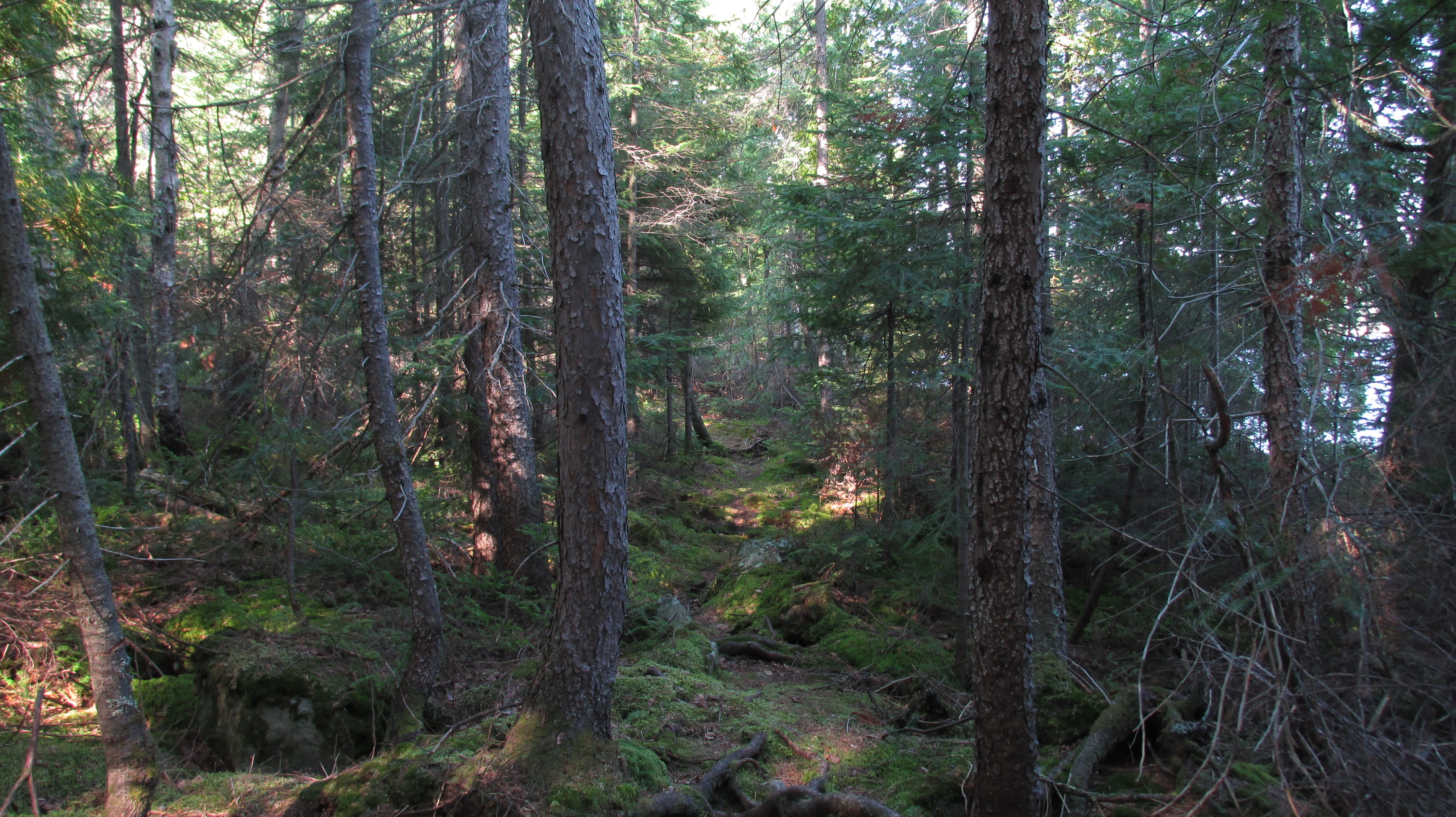
There were trails to explore,

20160830_11camptemagamitrail
Temagami trail. Photo: D. Buehler.

breath taking “dining room” views

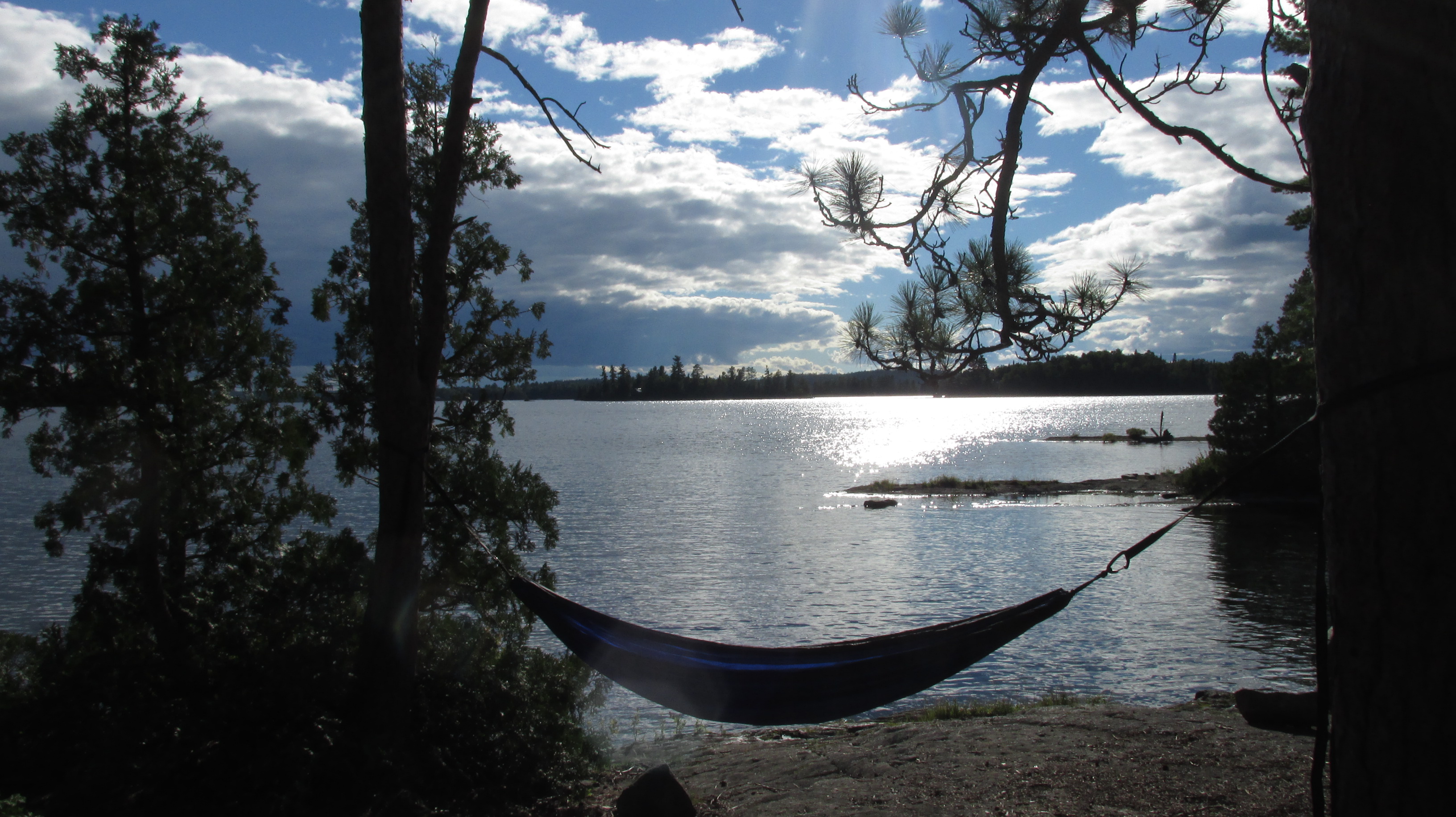
20160831_15temagamihammocksite2
A room with a view. Photo: D. Buehler.

and quite bays for an evening paddle or swim.

20160901_22temagamicanoesite3
Anyone for a paddle or swim? Photo: D. Buehler.

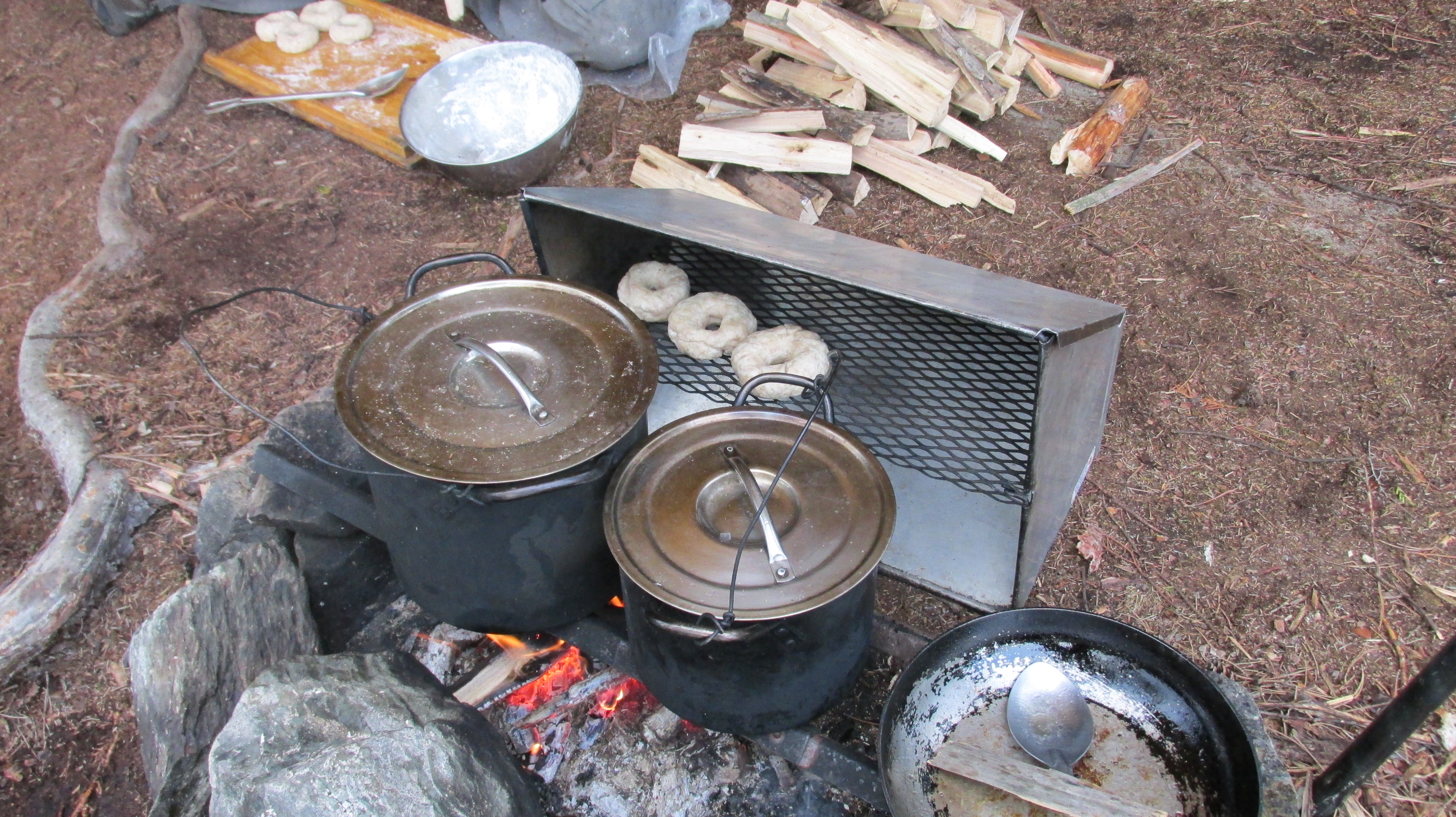
We slept in tents, had campfires, and learned lots of skills. For example, I learned how to chop wood, and doing it the way it is taught to 10 year old campers is also much easier for fully grown campers (no more over-the-head axe swings for me, thank you). I also learned that chopping the makes camp cooking much easier (even after heavy rain) without the use of a fuel stove. Cedar and red pine are the best for cooking fires. Spruce and maple are also good, but spruce burns very hot. Balsam fir doesn’t burn well – it is too sappy. Our guides even baked daily (bagels, cornbread, biscuits, brownies, even truffles!) on open fires using a reflector oven. The equipment and the skills our guides possessed gave us a link to the past and a deeper connection to the landscape we traveled through.

20160830_47temagamibagelsinreflectoroven
Bagels cooking on the reflector oven. Photo: D. Buehler

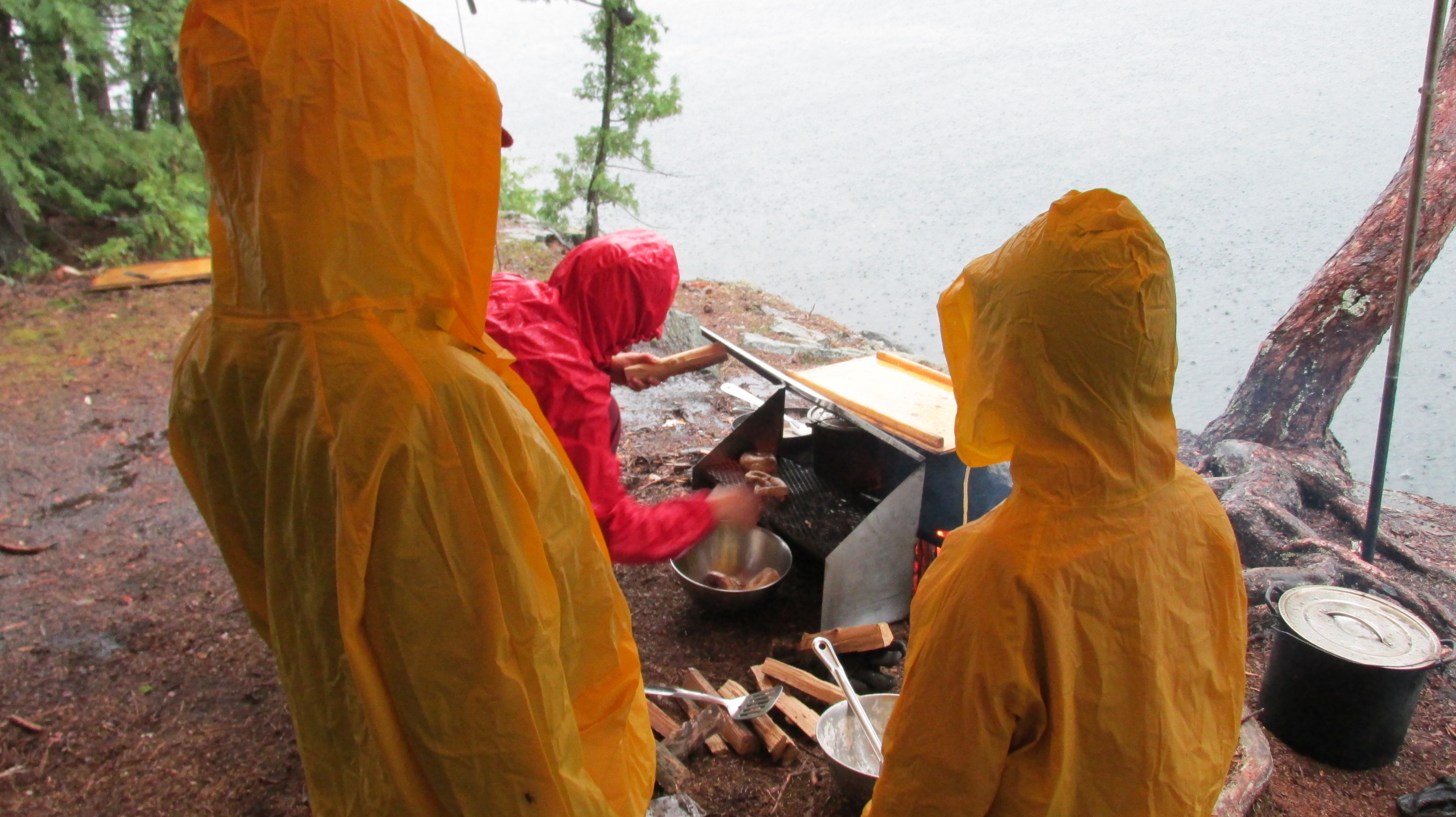
There were a few challenges – no canoe trip is complete without them – but it was nothing our guides couldn’t handle. They kept the fire going (and astonishingly the bagels baking) through a thunderstorm that eventually had our family take refuge in the tent.

20160830_51temagamiboysraingearback
Sometimes it rains. Photo: D. Buehler

The Temagami area has been described as “Algonquin on steroids” and on days with fairly strong north winds, I stared at an expanse of white caps (on just a tiny piece of Lake Temagami) and knew why. But our guides skilfully detoured us south (riding the waves) through wind blocking islands to make crossings safely.

All of us stretched our boundaries: Last year Lucas was afraid to ride with the guides in the canoe, this year he vied with his gregarious brother for turns in the guide’s boat and talked their ears off too! My tropical husband swam in Temagami’s bone chilling water. Nearly 9-year-old Ray jumped from a 6 foot high rock (several times). I portaged the camp’s heaviest canoe with a tumpline (only about 50m, but still).

Even back at base camp the trip had lessons to teach. Ray wanted to continue expanding his jumping skills from the camp’s 15.4 foot (nearly 5 meter) jumping platform. In the end he chickened out (to my relief), but I jumped off it (to test the fall). I’ve jumped from a similar height before, but it was still scary. The way to do it was to walk to the end, then walk right off, no looking down, no over-thinking. Commit and just do it. Perhaps this is a good metaphor for other things in life.

20160829_13camptemagamijumpplatform
Commit and just do it. Photo: D. Buehler.

Being a night owl, my favourite parts of the trip were the evenings when Ray and I would stay up after everyone else had gone to sleep and chat by the campfire under a canopy of stars. The Milky Way stretched from the southern horizon in a huge arc over our heads. We wished upon shooting stars and, on our last night out, even saw a few flickers of the Northern Lights. In the deep darkness of Temagami it was easy to understand why humans before us saw God (or Gods) up there in the heavens. As a trained evolutionary biologist I saw no traditional God, but standing awestruck with my son, I knew I was surrounded by a power much greater than myself.

* I realize this is posted just past the Thanksgiving weekend. Fall is a busy time. I am thankful for the long weekend that gave me time to blog about the last week of summer :-).

Moving beyond survival in Iceland

DCIM100MEDIA

At times it was hard to breathe in Iceland.

Sometimes it was the scenery that literally took my breath away: waves and white sea spray against black sea cliffs, rift valleys glowing red and yellow with autumn heath and birch, glacier capped volcanoes, thundering waterfalls, or all of the above in a single day!

20151006_3727_ÞingvellirÖxarárfossCrop
Þingvellir rift valley in autumnal colours with Öxarárfoss waterfall in background. Photo: D. Buehler

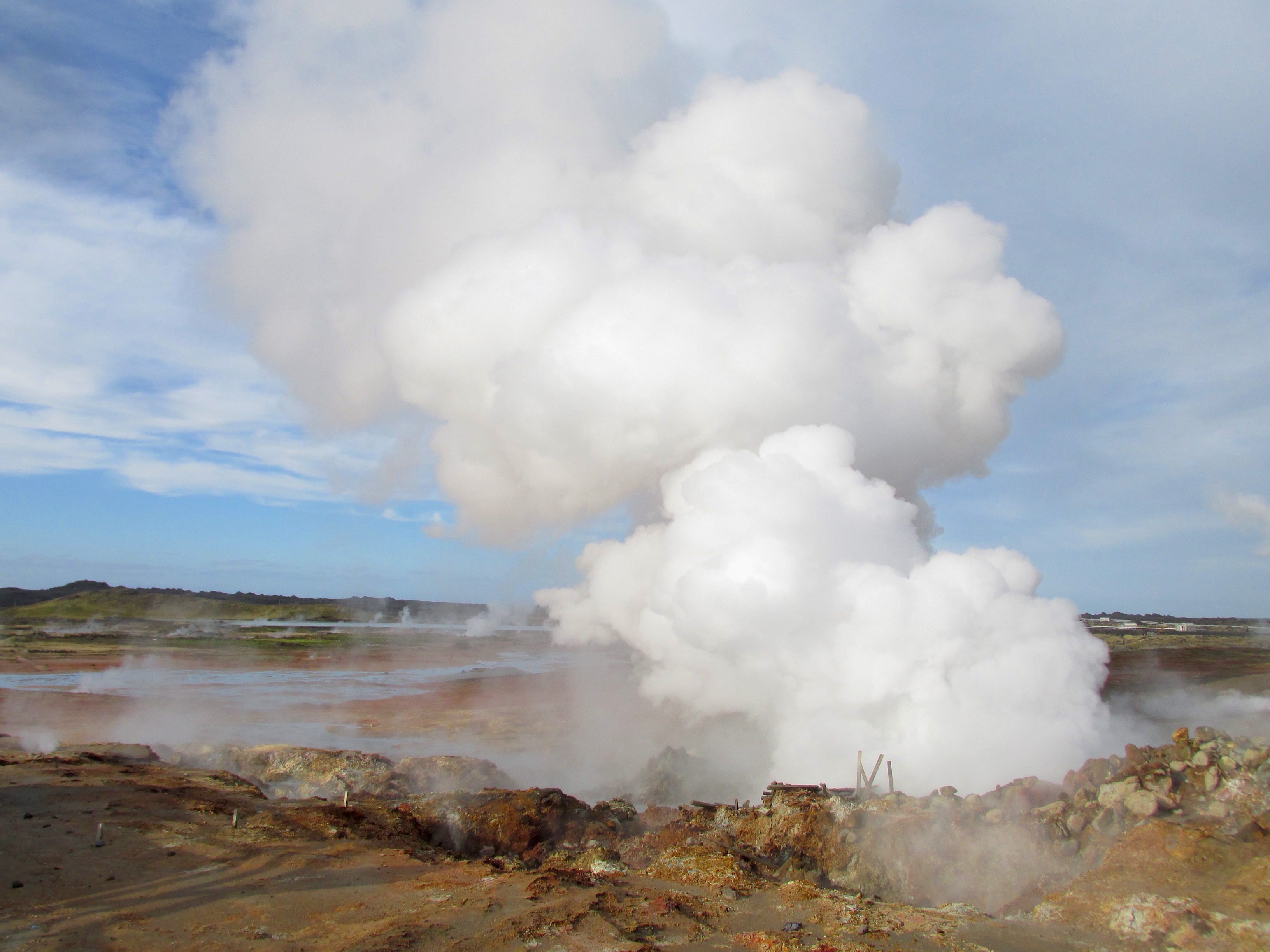
Other times it was a sulfuric stench rising from geothermal mud making it hard to breathe.

20151005_3582_GunnuhverHotSpringsSmall
Steam plume from the GunnuhverHotSprings. Photo: D. Buehler

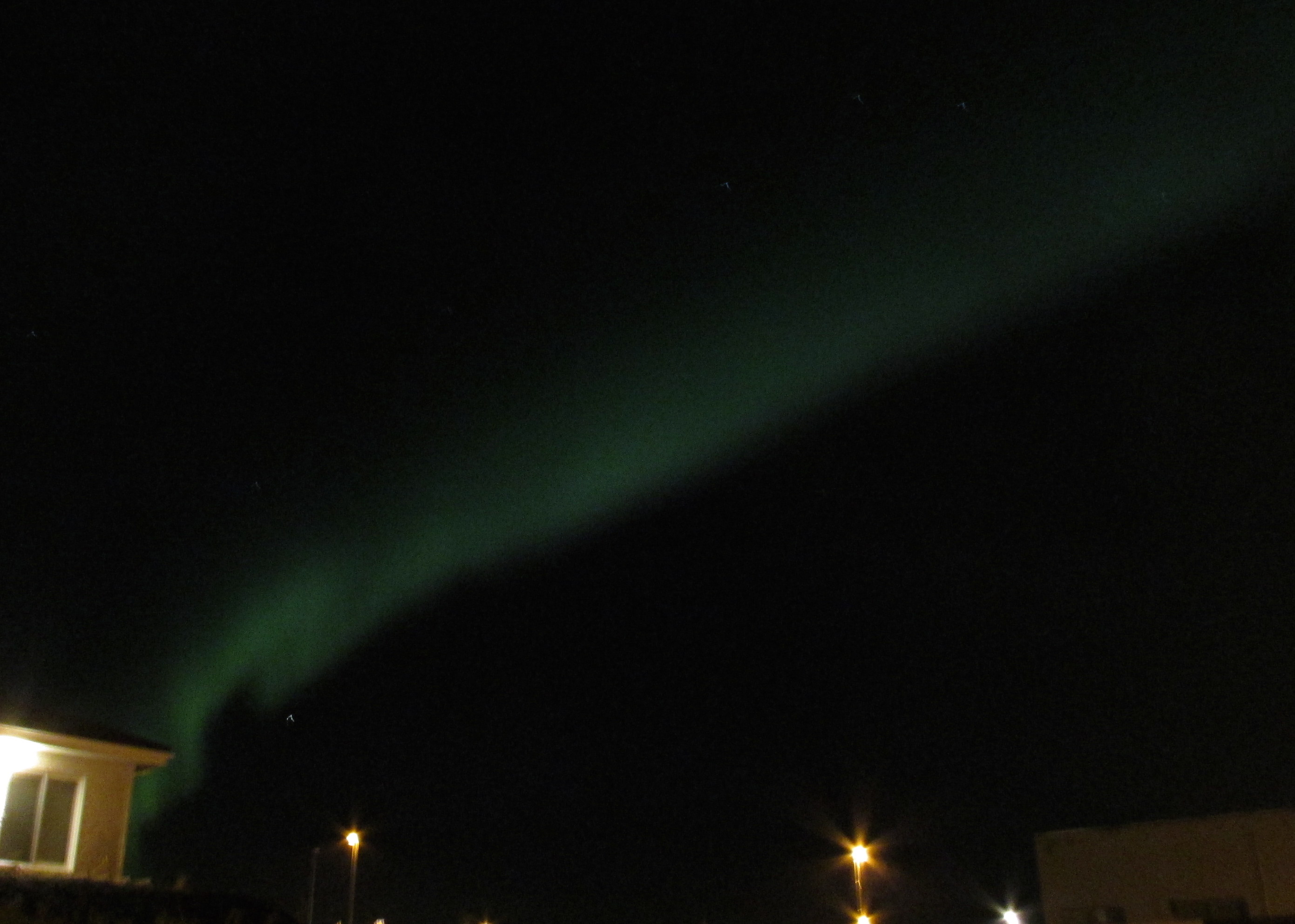
Still other times it was tightness in my chest, released by tears of awe and joy, at the dancing Northern Lights.

20151006_3782_NorthernLightsCrop
Aurora borealis – right outside our accommodation! The photo doesn’t do it justice. Photo: D. Buehler

I returned from Iceland in early October after a conference and a week of family vacation. But I struggled for months to write a post about it. Somehow just describing the beauty of the place seemed insufficient. The island sits atop a seam in the earth’s crust where two continental plates are pulling apart. This rift between the Eurasian and North American plates creates large scale faulting that forms fissures and breaks in the land through which magma can seep (or explode) to the surface. I needed some time to delve into the geophysical phenomenon that created the stunning landscapes. I needed some time to understand the hardships and terrors that created tough, saga writing, parliament making, and fiercely independent people. I also needed some time to deal with rifts in my own life.

The Free Dictionary defines a “survivor” as “a person or thing that survives” and remains alive or in existence despite hardships or trauma. Iceland is a geologically new addition to this earth and to me its landscapes and people epitomize not just survival, but the notion that one can take tough circumstances and embrace them to build a stronger, more efficient and more beautiful whole.

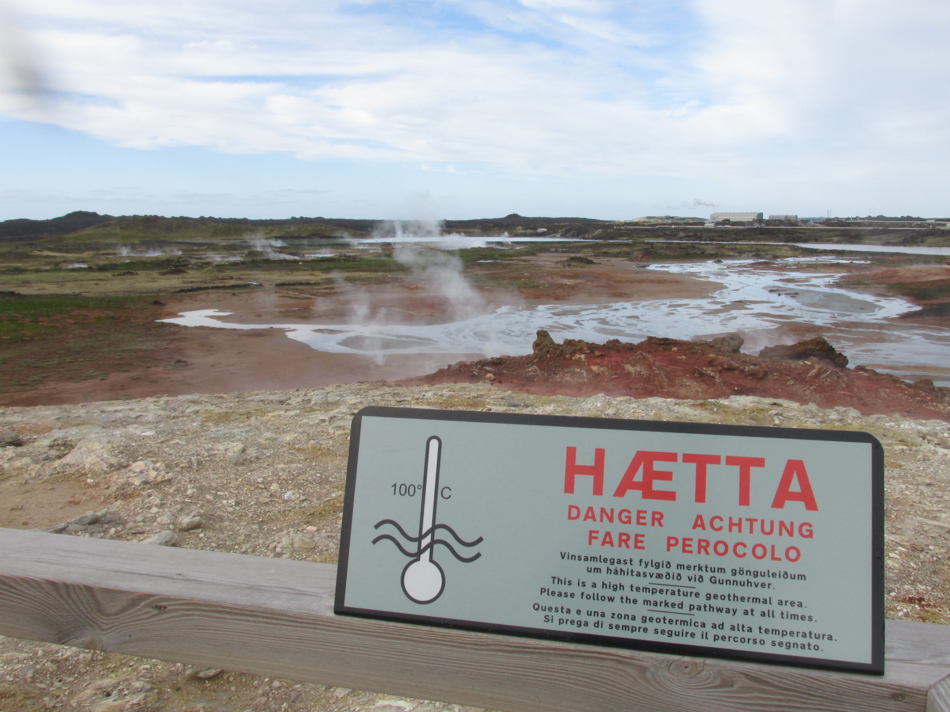
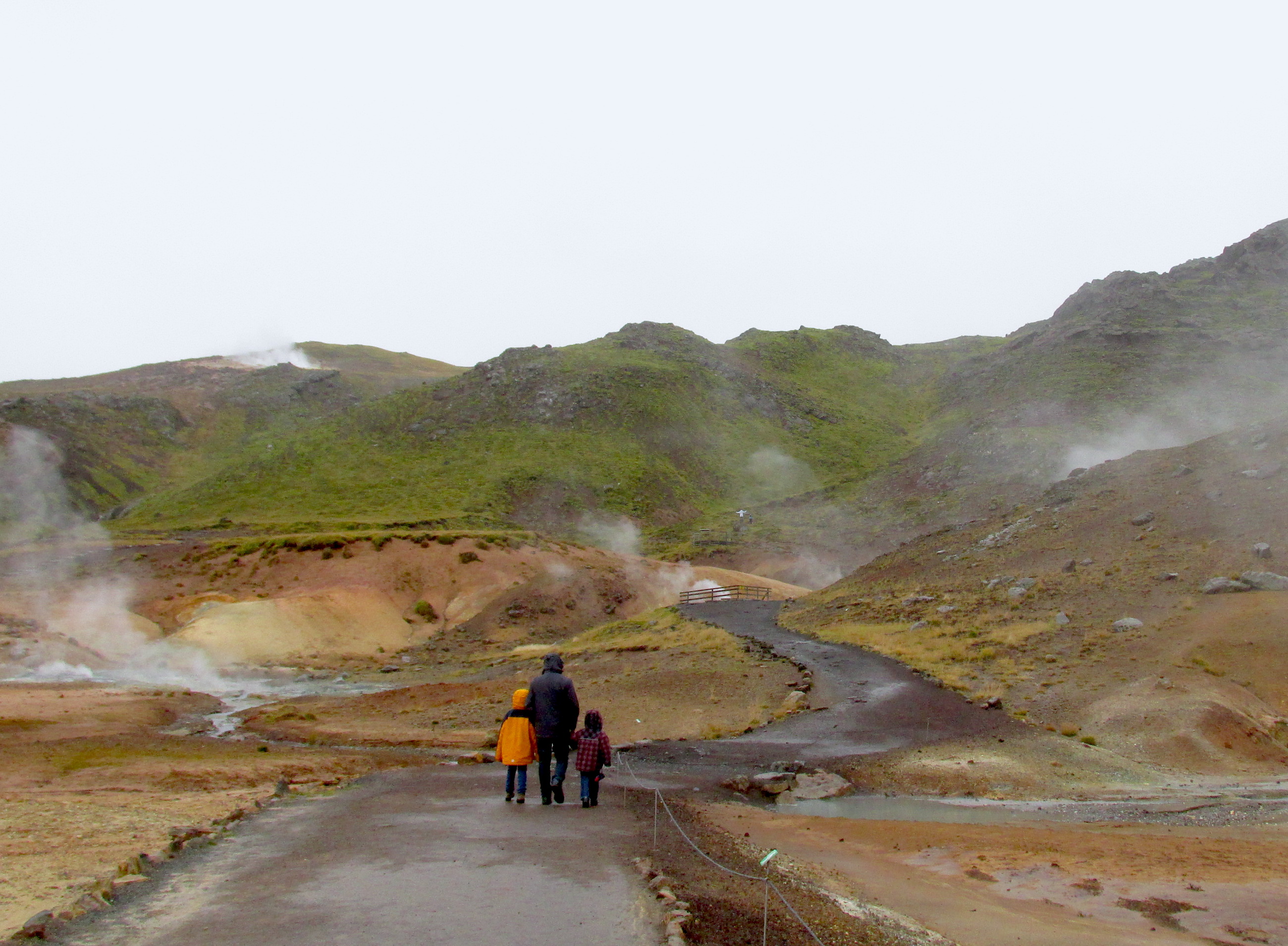
Icelanders inhabit a harsh and unforgiving land. To survive and thrive they work with its harshness rather than fighting against it. For example, the Reykjanes Peninsula could be described as desolate. Lava fields cover the land right to the edge of the ocean where waves crash against stark black cliffs. No rivers flow here because the ground is too porous. The ground is also hot! In places it steams and is too hot to walk on without melting the soles of your shoes. We visited two geothermal areas on the Reykjanes Penninsula: Gunnuhver and Krýsuvík Seltún.

20151005_3592_CautionGunnuhverSmall
The ground is hot at the Gunnuhver geothermal area. Photo: D. Buehler
20151005_3613_BoysKrýsuvíkSeltúnCrop
Stay on the path amid the steaming earth at Krýsuvík-Seltún. Photo: D. Buehler

To some, this lava strewn and steaming ground looks (and smells) like hell on earth, but others see geothermal activity that can be harnessed. Geothermal energy accounts for about 25% all the electricity produced in Iceland and, even more impressively, provides for the space heating and hot water requirements of approximately 89% of all buildings in Iceland and 90% of all swimming pools. (And there are a lot of pools!)

The geothermal forces that provide for Iceland’s space heating and hot water originate about two kilometers below the surface where freshwater and seawater combine and are heated by magma. This magma is much closer to the surface in Iceland because of its unique position between two diverging continental plates. Icelanders access this superheated water via deep holes that lead to geothermal power plants. One of the most famous is Svartsengi the plant that provides power for much of the Reykjanes Peninsula. Superheated water is vented from the ground and used to run turbines that generate electricity. After going through the turbines, the steam and hot water pass through a heat exchanger to provide heat for the municipal hot water system.

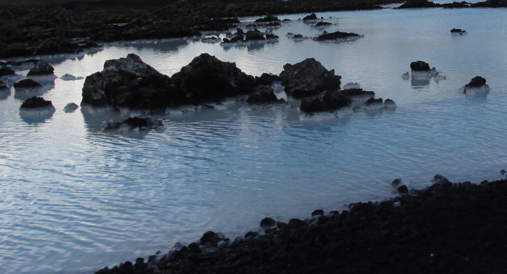
Svartsengi is also the source of another Icelandic phenomenon – the Blue Lagoon. The world famous spa is a by-product of the power plant. On its way to the surface, geothermally heated water picks up silica and minerals. These minerals are helpful to a host of ailments and the soothing temperature of the water is wonderfully relaxing. Though we chose to experience Iceland’s geothermally heated water through its wonderful public pools (the kids were far more impressed with water slides than silica and minerals) it was still a sight to behold. The Blue Lagoon is a shining example of the way that Icelanders can harness the good in something that might otherwise be considered waste.

20151008_3924_BlueLagoonCrop
Mineral infused water and encrusted lava rocks at the Blue Lagoon. Photo: D. Buehler

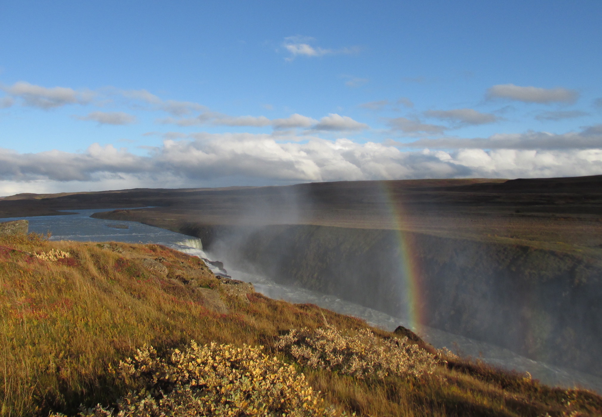
Beyond the Reykjanes Penninusla, the ground is less porous and plentiful rainwater collects into rivers – lots of them – strong and powerful. Tumbling from high glaciers in enumerable waterfalls and rapids these rivers produce ~75% of Iceland’s electricity through hydropower. They are also a huge draw for tourists. The mighty Gullfoss (Golden Falls) attracts hordes of tourists each year. However, unlike the great waterfall of North America – Niagara Falls – there are no casinos at Gullfoss. Icelanders seem to have a greater understanding that the power and beauty of nature alone can be the main draw for tourists. With tourism surging in Iceland, I hope it stays that way.

20151007_3871_GullfossRainbowHighSmall
Rainbow-clad Gullfoss surrounded by nothing but natural beauty. Photo: D. Buehler
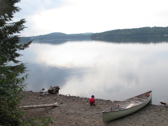
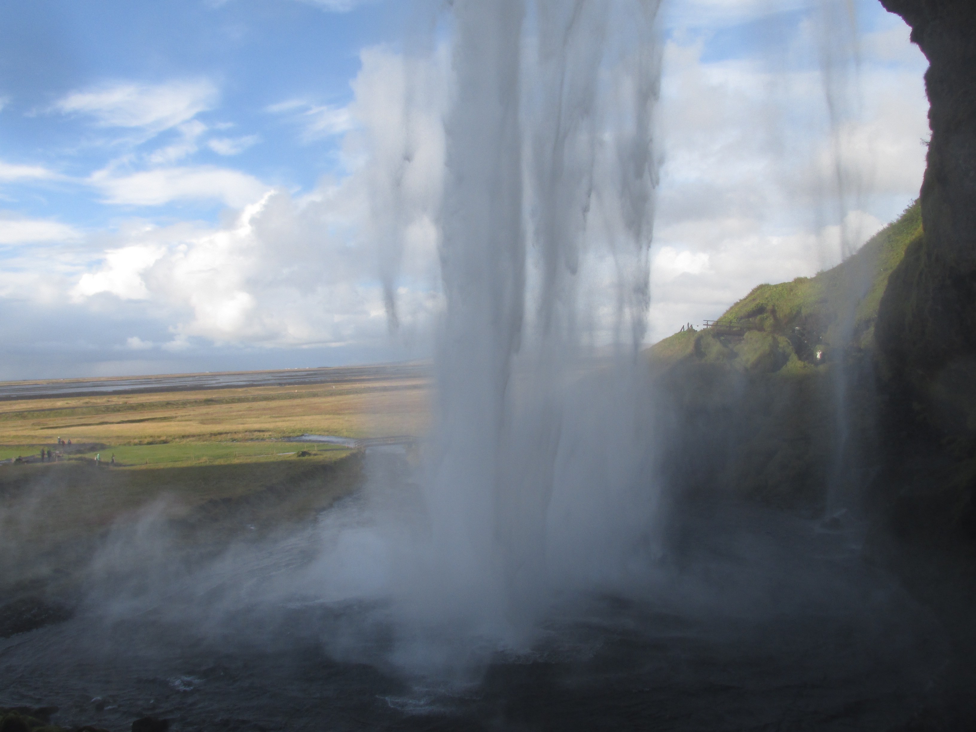
Another breathtaking waterfall is Seljalandsfoss, which literally means “selling the land of waterfalls”. The waterfall certainly lives up to its name, as it plunges 60 meters from the top of a moss and health covered sea cliff. A footpath leads behind the falls and my 8-year-old and I found the walk behind the falls so exhilarating that we did it twice! I loved the thundering of the water and the misty wind it blew up into our faces. I loved seeing the countryside through the waterfall. Awesome (in the true sense of the word)!

20151008_3952_BehindSeljalandsfossSmall
The view from behind Seljalandsfoss. Photo: D. Buehler

The Icelandic landscape certainly inspired my imagination, and it has inspired people for centuries as the backdrop to a rich literary history. This history began with oral story telling about Norse gods. Driving through the countryside, it was easy to imagine how angry Gods might have helped early Icelanders to explain steaming lava fields and mountains that spewed glowing rock, clouds of black ash, and flashes of electricity. Yet pagan deities and magical creatures also fit more peaceful aspects of the landscape. It was equally easy to conjure fairies dancing in the rainbows around waterfalls in misty, moss-covered cliffs.
Iceland moved from oral traditions to written sagas in the 13th and 14th centuries. The sagas contain 40 narratives describing the life in Iceland during the Viking age around the year 1000. This was a time when Icelanders abandoned ancient gods and adopted Christianity. Viking Sagas are filled with larger-than-life heroes and epic voyages. For example, the sagas describe Leif Eiriksson’s expedition westwards on what many believe is the true first voyage by a European to North America. But there are also “family sagas” about ordinary people, independent farmers and tradespeople, who formed the main class of a society free from kings, hereditary aristocracy, and taxes.
Myths, legends and stories are everywhere in Iceland, and they do much to enrich the experience for the visitor. Though I must admit not having read any of the sagas, we did visit the giant Giganta’s house in Keflavik.

20151010_4166_GiantessHouseCrop
Giganta’s house fits perfectly into a sea cliff near the Keflavik harbour. Photo: D. Buehler
20151010_4170_GigantaCrop
Giganta herself enjoying some sun. Photo: D. Buehler

Iceland was created under harsh and often violent circumstances. It is the clash of fire and ice: magma, glacier and crashing sea that creates the startling natural beauty of the place. Icelanders live in this harsh environment and rather than fight it they embrace it. They integrate it, harness its power, and weave it into their legends and culture. This trip came at a moment in my own life when pressures building within and around me caused a rift that felt somewhat like the spitting apart of continental plates. Iceland has much to teach about embracing what you are given and emerging stronger, smarter and more aware than you might otherwise have been.

Year in Review 2015

20151206NathanPhilipsMenorahXmasTree

This year’s review begins on a note of sadness and gratitude. The two people who first inspired me to write these reviews – Paul and Louise Herzberg – both passed away this year. Louise passed at the end of September at age 78 and Paul followed her, only two months later, at the beginning of December at age 79. They lived full lives and they both had a huge impact on me. I am grateful to have known them, and though I am sorry to have lost them, I am consoled by the fact that, even this year, they are together for the holidays.

Within our family, the boys are growing immensely: physically, intellectually and emotionally. Lucas is a confident senior kindergartener and, although he remains reserved at school, he is always quick to help others. He is incredibly kind and fair. If he has something, he makes sure that others get some too. He loves patterns and counting and he remains our little geologist – always collecting and organizing rocks. He is also starting to read by sounding out simple words. In the pool, a pair of good goggles helped him to overcome his fear of putting his face in the water. He is now an avid explorer of the underwater world. If 2014 showed us his love for singing then 2015 showed us his love for dancing. Wherever we went he found a dance floor: the stonework in a cabin in Algonquin Park, the dirt around a campfire, even surrounded by adults at the closing dinner of a conference in Iceland. He showed us how to dance with unembarrassed rhythm and joy!

Ray shot up physically this year and several times we looked at him and wondered, “Where did he get those Capri pants?” (They weren’t capris; he’d just grown two inches.) He remains our pensive one – always thinking and feeling deeply. He is an incredibly sensitive and compassionate child. Now in grade 3, he has worked hard to improve his reading (which has become much more fluent). He is an articulate speaker and is exploring ways to express himself in writing to the same extent that he can when using spoken words. He has also become quite the cyclist, even able to do tricks with his dad. In the pool, 2015 brought the success of passing the deep end test. I am incredibly proud of his persistence and perseverance and I hope he is also proud of himself.

Like his boys, Hubby was in school for part of this past year, juggling parenting while churning out a steady stream of assignments, reports and exams. In October the hard work paid off and he graduated from Seneca College with an Environmental Technician diploma. He also gained valuable experience working as a bike mechanic at a high-end shop in downtown Toronto during the height of the cycling busy season. Hubby wins Super Papi points for singlehandedly managing the kids and work while I was away in the Arctic for three weeks in June. He is a bit of a legend at the Canadian Wildlife Service. Apparently most mothers aren’t as lucky as I was, though – social commentary here – generally fathers are. He also gets kudos for making the whole family Halloween costumes from scratch! We went as characters from Star Wars Rebels.

For me, this has been a year of highs and lows. On Jan 1st 2015, I found myself walking alone on the Leslie Street Spit feeling contemplative. The cold rain and strong wind matched my mood. The winter and early spring were stressful with many challenges at work and at home. In contrast, the summer and early fall brought amazing opportunities for travel and adventure: the Arctic in June, outback Algonquin before Labor Day and Iceland in early October (I still owe you a chronicle for that one). Indeed, this was my biggest travel year since 2006 (pre-kids) and I still love it. My wanderlust hasn’t abated a bit. Travelling on my own this year reminded who I am. Travelling with my family showed me that the kids are now old enough to share my wanderlust with them. The question for 2016 will be how to integrate the adventurous researcher/writer with the settled and breadwinning parent. Working together, rather than in conflict, these parts of me could bring my children stability, flexibility and wisdom.

For us it has been a year of travel and opportunity, but also a year of exhaustion and soul searching. We hope that 2015 has treated you well and wish you all the best for 2016!

Carrying a canoe hurts – but it’s somehow empowering

Campfire. Photo: D. Buehler.

Canada is a country of lakes and rivers. For centuries a canoe was the main form of transportation in Canada. Today, travel by canoe remains symbolic of wilderness and adventure.

I have experienced my share of wilderness, including several canoe trips into Algonquin Park. For a while now I’ve wanted to share that experience with my kids, but I’d always canoed with someone more experienced. I didn’t feel comfortable leading my family in the backcountry alone. A guided trip seemed the way to go, so this year, just before the Labor Day weekend, we did it.

Our guide, Kieran, was there to greet us when we arrived. He showed us around the Northern Edge Algonquin grounds and to the log cabin where we spent our first night. Rescued from demolition by Northern Edge’s chef, architect, and stonemason, it is more than 100 years old. There was a beautiful stone area in front of a woodstove that Lucas called his dance floor. I have never seen him dance so much!

Century old log cabin. Photo: D. Buehler.

After a swim in the lake, we met our second guide, Alissa, who joined as a guide-in-training. Kieran and Alissa were fabulous. They kept us safe and comfortable, while still making us feel capable ourselves. They shared their knowledge and they taught by example: how to build a campfire, how to portage a canoe, how to saw wood, how to use tree sap as a match, how to find the North Star, and much more. By the end, I felt that we could do it on our own, but it was so much nicer having someone else cook, make sure that everything was safely stowed at night, and help out with the kids.

That night we learned about the wolves of Algonquin. When I first started canoeing in the Park these wolves were not considered their own species, but a study on recently obtained DNA data now suggests that eastern wolves are distinct from more southerly red wolves, more northerly grey wolves (timber wolves), and coyotes. Each evening of our canoe trip we howled for wolves.

The next morning we set out on our adventure.

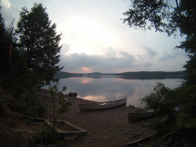
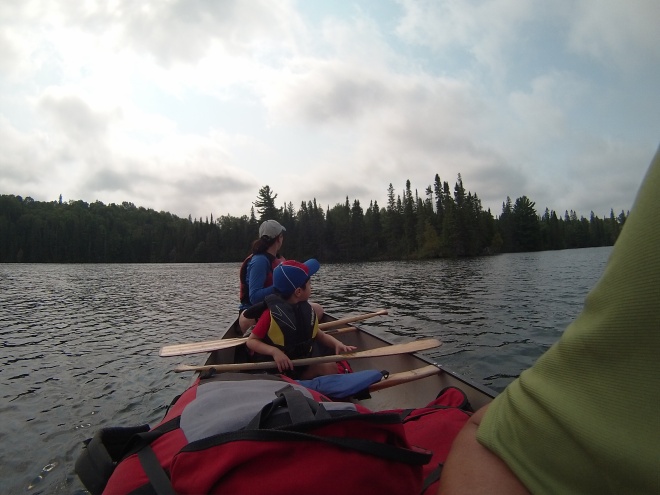
Everyone in canoes. Photo: D. Buehler.

Instead of entering the Park through Kawawaymog Lake, we took a 10 km drive south and put in on Nahma Lake. This was a secluded route. On the busier lakes, the first portage is a highway of backcountry paddlers moving into or out of the park. Not Nahma. At Nahma we performed our first portage without meeting a soul. Portage, French for ”carrying place”, is a nice way to describe carrying all your gear (canoes, tents, sleeping mats, kitchen barrels, food, tools, etc.) on your back overland. I don’t think anyone really likes portaging, but it does give a sense of accomplishment when the water at the end comes into view. We paddled and portaged to Craig Lake where we chose a campsite nestled within a hemlock grove on a tiny island. The trees gave shade and their needles formed a soft carpet for sleeping.

The view. Photo: A. I. Castillo.

We loved the site so much that we decided to use it as a base for day trips. We paddled into a narrow river and encountered a huge beaver dam. While crossing it, I got a sandal stuck in the mud and snapped the straps. Luckily I had sewing supplies in my first aid kit and was able to fix it during lunch! We paddled past a beaver lodge and then into a meandering river through a wetland. Along the way Isaac and I practiced our teamwork through the tight turns. Ray saw a stick hanging over the water and made up an elaborate story about it being a chipmunk diving board.

We portaged to Pishnecka Lake where Lucas requested a shallow sandy beach and Kieran obliged. Lucas was in heaven. I have never heard him say “Yipee” as much as he did on this trip. We saw fresh moose tracks and moose droppings. The moose were near, but we did not see them. While at the beach thunder rumbled and we had a short rain shower. We decided to keep moving and portaged a longer and hiller trail back to Craig Lake. At the end of the portage we found a muddy bog. No water in which to put the canoe, but meters and meters of mud. We had to brave the mud or portage back. With thunder rumbling, we wanted the shortest route. Kieran scoped out the area and found water. Alissa piggybacked Ray, Isaac carried Lucas, Kieran carried both canoes, and I carried the food and gear barrel. I wore no shoes. I knew my sandals wouldn’t survive the mud. Through it all the boys were fabulous. As we paddled back to our campsite, thunder still rumbling in the distance, Lucas was so chill that he took a nap!

Indeed, the kids did great the whole trip. They paddled, enjoyed the scenery, asked questions, and sang. They found ways to amuse themselves without toys, screens, or the myriad other distractions of the city.

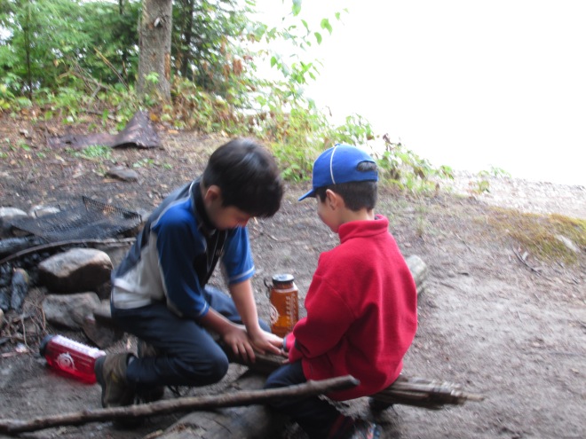
They made a seesaw out of firewood.

Kid-made seesaw. Photo: D. Buehler.

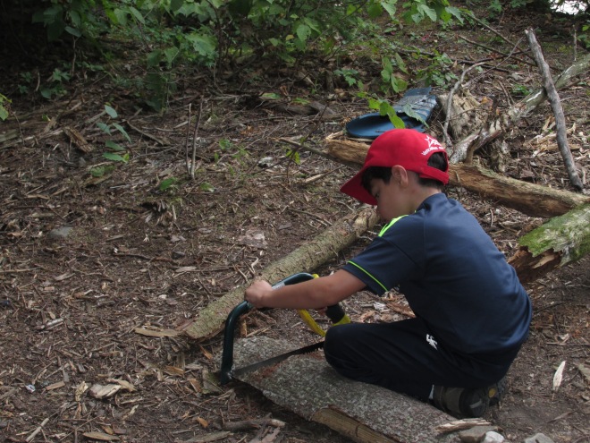
They sawed wood.

Sawing. Photo: D. Buehler.

They built fire pits (strong enough to be used to serve dinner on).

Building a fireplace. Photo: D. Buehler.

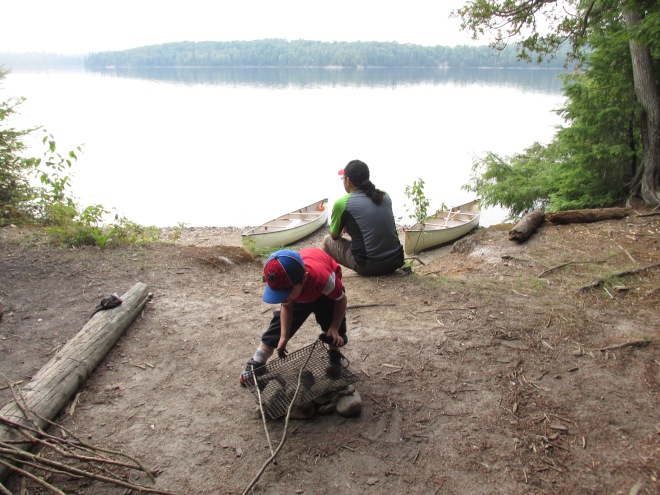
They enjoyed our private beach.

Enjoying "our" beach. Photo: D. Buehler
Enjoying “our” beach. Photo: D. Buehler

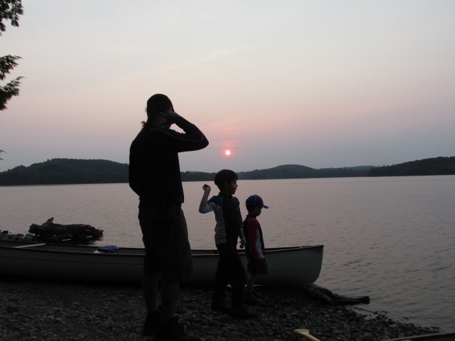
Indeed, we all spent time learning to skip stones in the sunset.

20150901_3322_SunsetStoneThrow

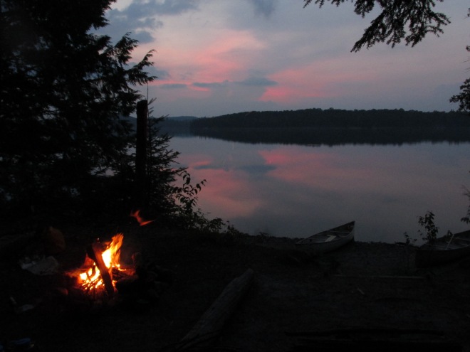
In the evenings we sat around a campfire, talking and learning. As the fire crackled and threw up sparks, the kids saw fire fairies. I saw the fairies too, just as I had as a child. We roasted sausages and marshmallows, then poked our sticks into the embers and wrote with the glowing tips in the darkened sky. How often are kids allowed to play with sticks and fire? But out here, supervised, relaxed and safe, it all seemed fine.

Campfire. Photo: D. Buehler.

After the campfire on our last night, Ray and I sat out watching stars and lightening simultaneously. Loons called to each other, and then we heard two long howls. They might have been loons wailing, but the sound seemed deeper and longer. It might have been a wolf. I hope it was the latter. That night the storm finally broke. Lightening lit up the tent and thunder woke Lucas and I. Amazingly, Ray and Isaac slept through it!

The morning of the third day, Kieran guided us to one of the most peaceful places I have been – a hidden cove just south east of “our” island. The water was shallow and still. We saw fish, kingfishers, ducks, and even a snapping turtle. We all hated to leave, but eventually it was time to paddle out. On the way there was one final delight – a bald eagle flying low and fast right over the canoe!

Loon and eagle watching. Photo: A. I. Castillo.

We returned home closer and stronger. I was proud of the kids and proud of myself. I learned that I could still steer and portage a canoe (solo). The first try was a bit dodgy. I forgot to put the nose down to rest and instead tilted the canoe backward. The yoke slide off my shoulders and I found myself calling for assistance with it balanced on my head! By my last portage, I had remembered the zen-like concentration needed to keep the canoe up on my shoulders the entire way.

Ray asked Kieran what it feels like to carry a canoe.

“Empowering” he said.

I couldn’t agree more.

How travelling helps me appreciate life – examples from the Arctic

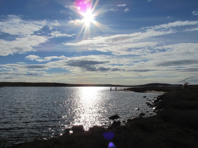
Sun at 10 pm over Hudson Bay near Rankin Inlet

While walking at lunch the other day I saw a bumblebee, and I stopped, and I watched it. In that moment I was fully present. Thoughts about work evaporated and my mind was focused. I smiled because there are bees in this world and because they do amazing work.

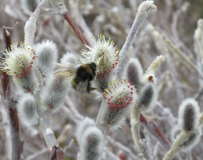
Then my mind wandered to the bumblebees I saw while volunteering with the Canadian Wildlife Service in the Arctic this June*. There, I marvelled at the bees even more than at home in Toronto.

Bumblebee in a dwarf willow, Baker Lake, Nunavut. Photo: Debbie Buehler

Arctic bumblebees, and other Arctic insects, face severe cold in winter, unpredictable cold snaps in summer, and almost endless wind. The bees beat the cold by being large (lower surface to volume ratio) and by “shivering” (rapidly contracting their flight muscles). They also sit in the center of bowl-shaped flowers on cold, but sunny days. The petals of the flower focus the sun’s rays making a perfect basking spot. Other Arctic pollinators, like flies and mosquitoes, do this too. And Arctic pollinators don’t hover lazily around flowers like my Toronto bee. In a land of winds that can knock a human down, insects often eschew flying altogether, preferring to crawl from flower to flower.

In the Arctic I paid attention to bees because I was fascinated by how they survived in a place that is cold and windy most of the year. That fascination made me more attuned to bees back home as well.

This is what I love about traveling. It wakes me up and makes me pay attention. The effect is especially potent when I travel to places that take me to the boundaries of my experience. While on such trips – whether navigating a new and exotic (to me) city, or surveying wildlife in a remote plot – I must be present, must take in my surroundings, must live in the moment. I am wide open to the stimuli around me, and because I am paying full attention, I can fully appreciate my experience.

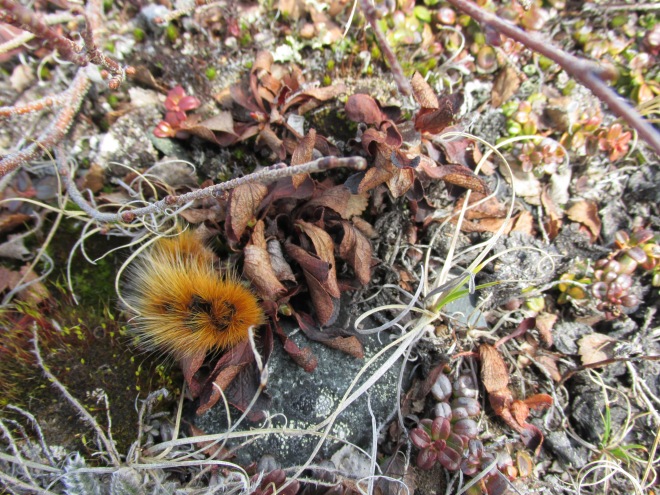
My trip to the Arctic offered many moments of appreciation. I appreciate caterpillars more because of the Arctic Wooly Bear** (Gynaephora groenlandica).

Arctic woolly bear, Kivalliq region, Nunavut. Photo: Debbie Buehler

 If you look closely at the Arctic tundra (which one does when looking for nests) you are bound to see a big caterpillar completely covered in long rusty coloured hairs (hence “Wooly”). These caterpillars spend nearly 90% of their lives frozen! They feed and grow only in June, then retreat to a protective cocoon for the rest of the short summer and go dormant for the winter. Such a protracted life cycle means that it can take 7 years to go from caterpillar to moth***. So the caterpillars I saw could have been 7 years old!

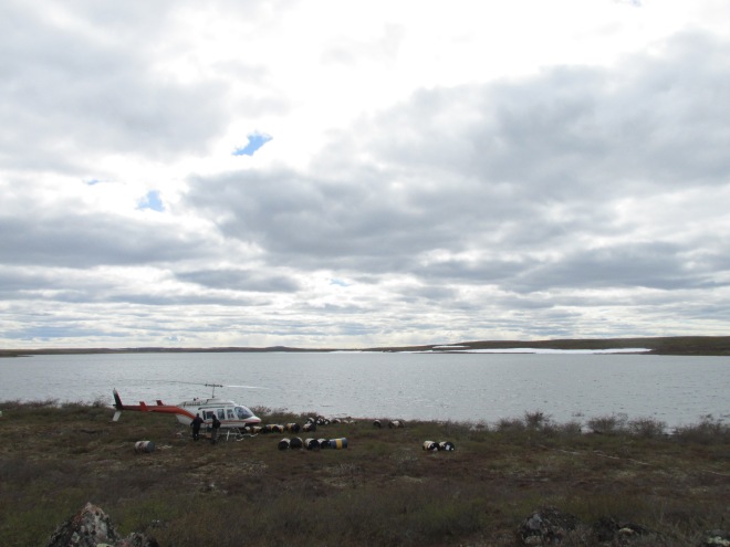
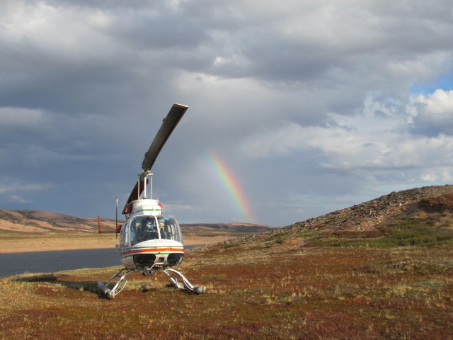
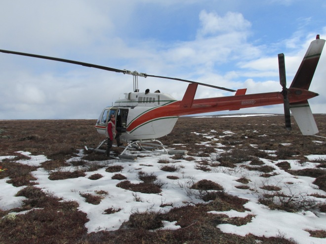
I appreciate helicopters more because there were no roads to the places I visited in the Arctic. We used our helicopter like a taxi, sometimes travelling hundreds of kilometers a day.

Me and “my ride” on the tundra. Photo: Jennie Rausch

When people ask me what super power I want, my answer is invariably soaring flight, Flight in a helicopter is as close as I’ve ever come to soaring. I loved the feeling of flying, and I especially love the freedom of simply floating off the ground without a runway. The freedom to hover and to land anywhere is essential for Arctic fieldwork. Now when I hear a helicopter buzz by in Toronto, I am brought back to the tundra and the sound of “my ride” approaching to pick me up.

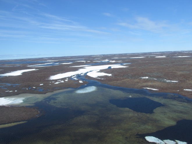
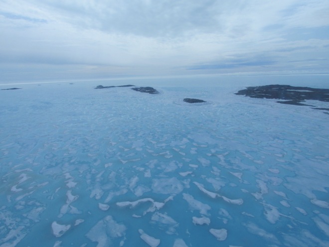
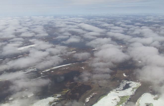
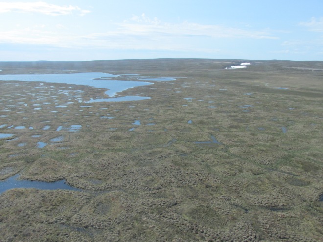
From the helicopter I had a bird’s eye view of a landscape that many “southerners” like me have never seen.

Landscape near Arviat, Nunavut. Photo: Debbie Buehler
Melting sea ice on Hudson Bay. Photo: Debbie Buehler
Tundra beneath clouds near Arviat. Photo: Debbie Buehler

From the helicopter I saw herds of caribou – one day we had hundreds – and from the air I could easily see that the ground was crisscrossed with their migration trails. The aerial view also made it easy to see landforms made by glaciers and permafrost: hummocks, frost boils, tussock wetlands, eskers, raised beaches and tundra polygons.

Low-centered tundra polygons. Photo: Debbie Buehler

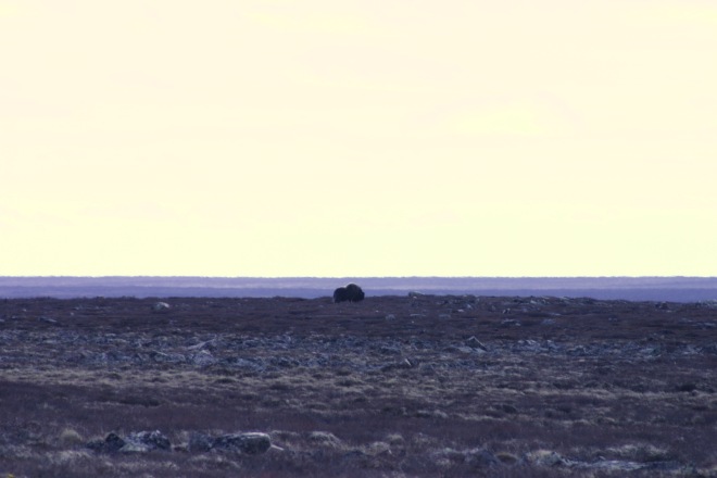
To my delight, we also saw muskoxen from the air in small herds, including a few young. After landing at one plot, I was even able to snap a picture of one from the ground.

Muskox in the distance as seen from the ground. Photo: Debbie Buehler

One particular sighting truly made me appreciate the helicopter – a mama Grizzly and her cub (sorry no photo, though I do have a very unprofessional video). I can assure you that I only wanted to see bears from the helicopter!

Beautiful places arrived at by helicopter. Photo: Debbie Buehler

I appreciate satellite technology more because sometimes you need to make a call because you are almost out of fuel and are, literally, in the middle of nowhere. This happened when our team was deep in the Barrenlands of the Northwest Territories. Our cabin was over a hundred kilometers to the northeast in Nunavut. We had just finished a productive day of fieldwork and our pilot set a course for the fuel cache we needed to get home. But when we arrived at the coordinates there was nothing there! No fuel. This was a problem. The next nearest cache was at our cabin! When you run out of fuel in the tundra, it means staying where you are until fuel can be brought to you (could be days) with nothing but the helicopter for shelter (for 5 people). I will admit that this made me nervous, but the more experienced folks on the team were not worried. Luckily, we had not one, not two, not three, but four satellite telephones on us (the helicopter had two and each survey team leader had one). We used this rather amazing technology to call colleagues at Environment Canada who immediately put us in touch with the owners of the fuel cache. To our great relief, the minutes in the coordinates we were given were off. We were only 9 km away from fuel (as the helicopter flies). With one call, and within a few minutes, our problem was solved!

The elusive Hanbury fuel cache. Photo: Debbie Buehler

I appreciate showers more. This tends to happen when you live in a place with no running water for a while. I appreciated showers even more after returning from three weeks on the Mauritanian desert coast in 2006!

Finally, I appreciate my family more. My three weeks in the Arctic were the longest I have been away from my kids (or from my husband since having kids). It made me realize that, although I can still have my freedom and my adventures, I am tethered now. Each time talked to my family on the phone – whether from a hotel room in an Inuit hamlet or from a satellite phone on the tundra– I felt a tug of longing to be with them. The sound of my kid’s voices made me long to hug them and to smell their familiar scent. Noticing that tug in my gut, really feeling it, made me appreciate that I now have a safety line that guides me home. It changes my behaviour, makes me more careful, so that I can keep my promise of “mommy will be home soon.”

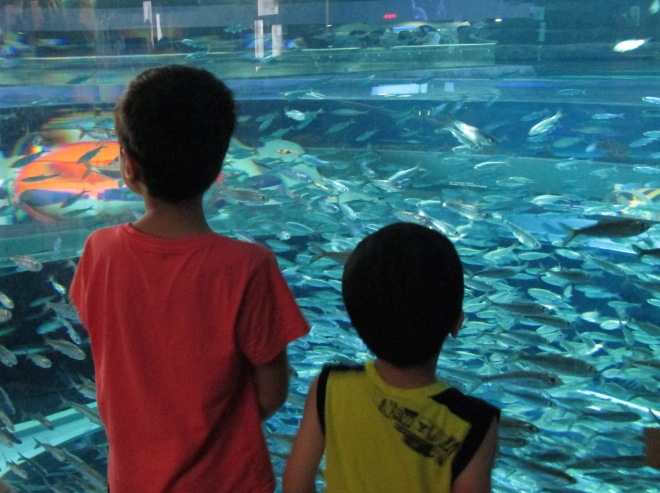
Appreciating my boys at the Aquarium back home in Toronto. Photo: Debbie Buehler

I have been back for more than a month and things are pretty much business as usual. But in the Arctic I practiced living in the moment, I practiced seeing my surroundings, and I practiced appreciation. I’ve brought that appreciation home with me.

While walking I saw bumblebee and I stopped and I watched it. I did not wander to thoughts of pollinators being in trouble. I just noticed the bee – and I smiled – with pure appreciation.

______________________________________________________________

* The views expressed in this, or any other, article written about my experience, are mine alone. I am not an employee of the Canadian Wildlife Service, though I thank them for inviting me on this incredible journey as a volunteer.

** For those who know the “Wooly bear” to be the caterpillar of the Isabella Tiger moth, this is a different Wooly bear

*** Revised from the 14-year estimate in E. C. Pielou’s book.

My Summer Vacation: A Trip to the Arctic amid Truth, Reconciliation and Coalitions for Climate Action

I went to the Arctic for my summer vacation.

To be specific, I volunteered* with the Canadian Wildlife Service (CWS) and joined a team of CWS scientists in Nunavut and the Northwest Territories to study shorebirds as part of the Arctic Program for Regional and International Shorebird Monitoring (Arctic PRISM). I was a volunteer, but I am also a trained shorebird ecologist turned university administrator, so for me the trip was part adventure, part scientific data collection, and part blissful 3-week escape from email. Oh, and I really loved the flying in a helicopter part. I was in the air for 20 or the 21 days I was away!

“My ride” in the tundra while volunteering in the Canadian Arctic

“My ride” in the tundra while volunteering in the Canadian Arctic. Photo: Debbie Buehler

But fun and adventure aside, it was an auspicious time for a trip to the Arctic.

Only days before I left, the True and Reconciliation Commission released its summary report. I am not a social scientist; I have only average knowledge about the plight of aboriginal peoples in Canada, yet the opportunity to visit the Northern communities of Iqaluit, Rankin Inlet, Baker Lake and Yellowknife, so soon after the report was released, left a lasting impression.

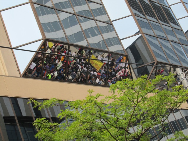
Then, upon my return, my children and I attended the March for Jobs, Justice and Climate Action. It was inspiring; and it brought together a coalition of diverse groups working towards common goals – First Nations, labour unions, students, activists, cyclists, and people like me with young kids who want to make a difference.

Jobs, Justice and Climate Action marchers reflected in Toronto’s gleaming glass.

Jobs, Justice and Climate Action marchers reflected in Toronto’s gleaming glass. Photo: Debbie Buehler

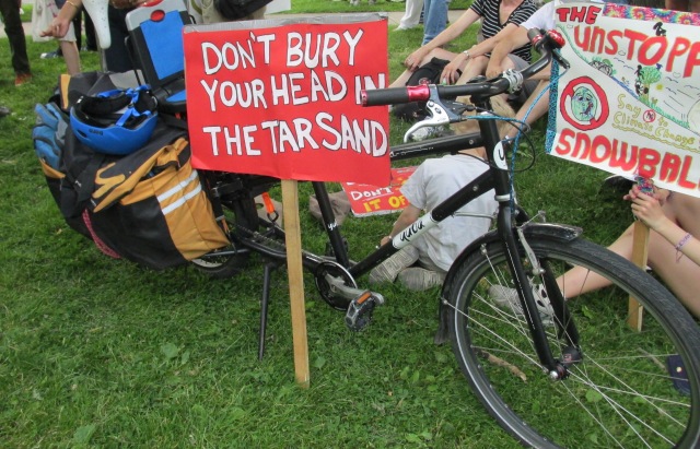
My family joined a small group of people working together to commit 15 min acts of climate action each month. Started by a professor Dan Dolderman and his kids (check out his incredible TEDX talk), the group’s metaphor is an Unstoppable Snowball, something that starts small, but gains momentum as it grows.

“My ride” (the family sedan) for the march in Toronto.

“My ride” (the family sedan) for the march in Toronto. Photo: Debbie Buehler

So, did I see evidence of climate change on my trip?

I was last in the Arctic in June 2002. On that visit, I arrived to a frozen Nunavik (Arctic Quebec). There was still at least a meter of snow on the ground, so much snow that the plane couldn’t land and we had to snowmobile to our camp. The birds had barely arrived and were hunkered down in the snow. This year, we arrived about a week later by the calendar, and on the western rather than the eastern shore of Hudson Bay. There was very little snow left and the birds were already starting to nest. Was this climate change? It would be pretty unscientific to say so. For one thing I was in a different part of the Arctic, for another, I had arrived later in the year. I would have needed to visit the same site and to look at it in the same way over time.

This is exactly what the PRISM project is doing. Scientists are systematically surveying random sites within a series of set regions across Alaska and Canada and returning to those sites at set intervals to track the health of shorebird populations. This summer alone, we collected data on 57 plots in the Kivalliq region of Arctic Canada, while a second team performed intensive surveys on a plot in Polar Bear Pass. For those who are interested there is already a monograph on the past 10 years of work.

Putting the scientist in me aside, it was hard to visit the Arctic without seeing things that, at least anecdotally, reminded me of climate change. In Iqaluit smelly gas bubbles leaked up through the thawing tundra. (This is not necessarily new, but it reminded me of much larger methane bubbles and even craters in Siberia). In Yellowknife, I was greeted by a red and hazy sky, evidence of wildfires fuelled by heat and drought in Saskatchewan and across western Canada.

For the most part though, I was lucky to see an Arctic still outwardly unmarred by climate change. Indeed, for three weeks I saw a land of immense beauty – both in its landscapes and in its people.

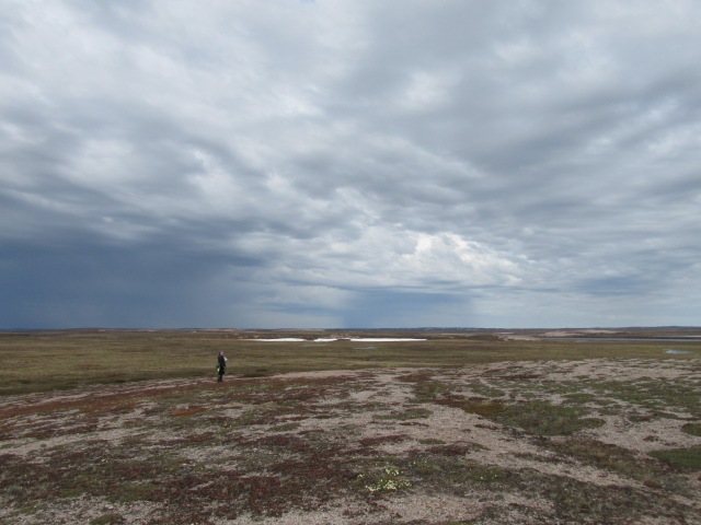
A land that humbled me with its vastness.

Scientist dwarfed by the tundra

Scientist dwarfed by the tundra. Photo: Debbie Buehler

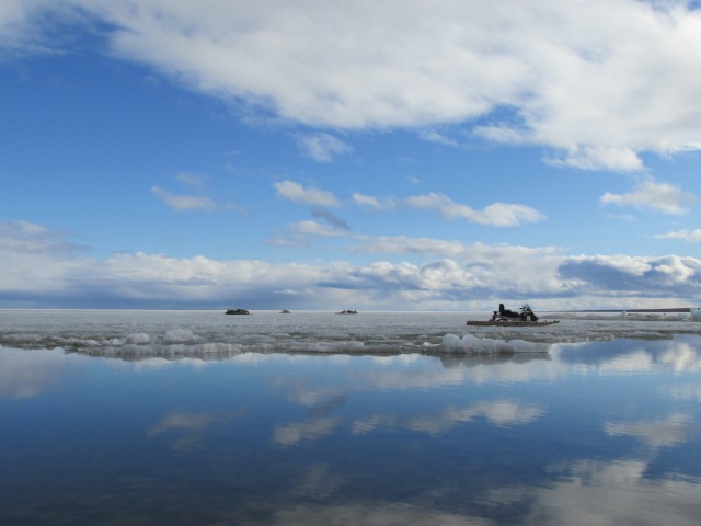
A land of snowmobiles and living skies.

Snowmobiles on the ice in Baker Lake.

Snowmobiles on the ice in Baker Lake. Photo: Debbie Buehler

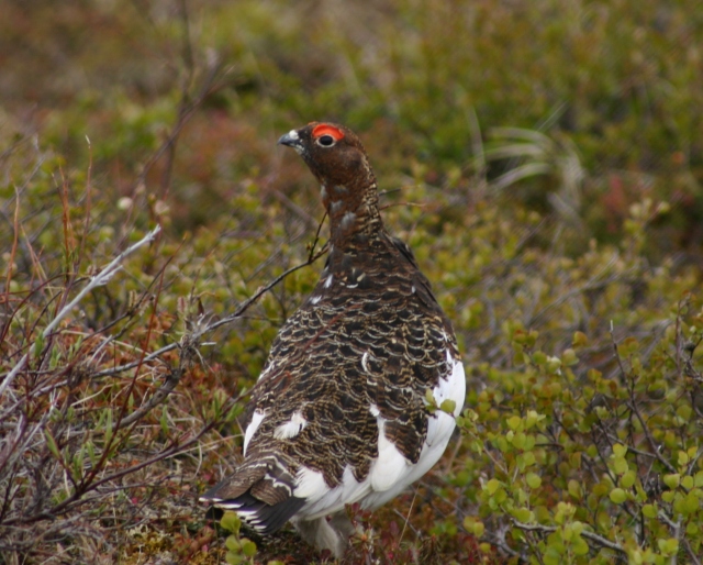
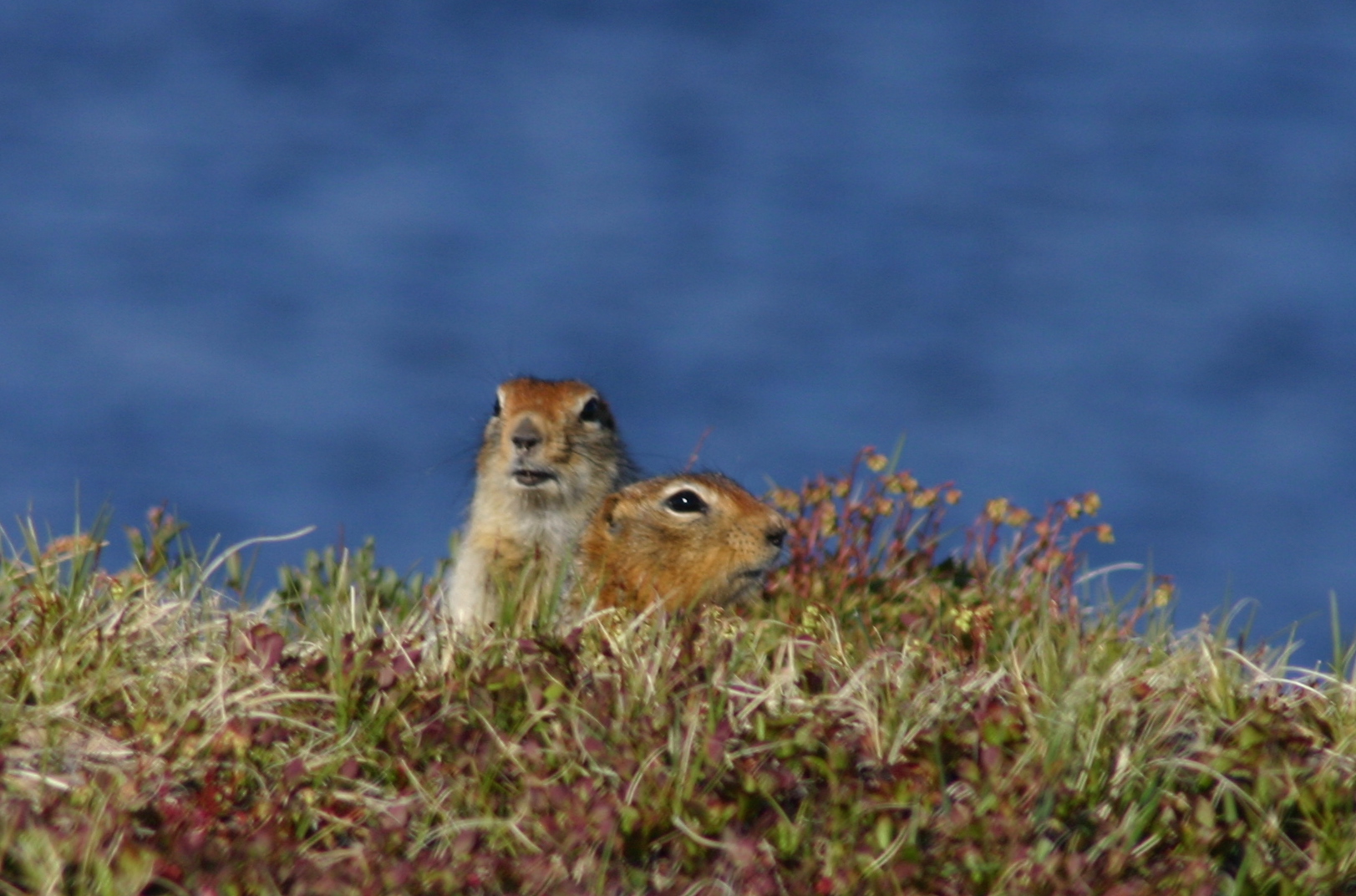
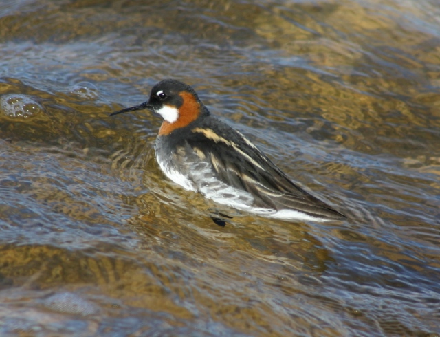
A land of abundant wildlife.

Willow Ptarmigan

Willow Ptarmigan. Photo: Debbie Buehler

Arctic Ground Squirrels (Sik-Siks). Photo: Debbie Buehler

Arctic Ground Squirrels (Sik-Siks). Photo: Debbie Buehler

Red-necked Phalarope

Red-necked Phalarope. Photo: Debbie Buehler

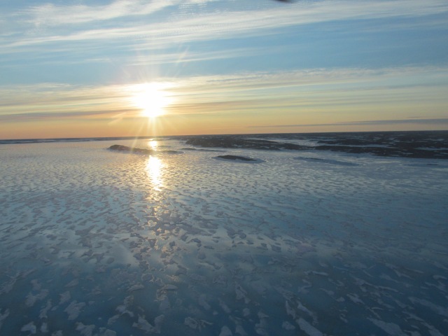
An immense, wild and (often) frozen place that I would hate to lose to climate change.

Sun at 10 pm over Hudson Bay near Rankin Inlet

Sun at 10 pm over Hudson Bay near Rankin Inlet. Photo: Debbie Buehler

I plan to write more about this 2015 trip to the Arctic and to share more of the hundreds of pictures I took. If any of you would like a guest post/article around the shorebird work, the Arctic tundra, or the communities I visited, let me know and I will be happy to oblige J.

* The views expressed in this, or any other, article written about my experience, are mine alone. I am not an employee of the Canadian Wildlife Service, though I thank them for inviting me on this incredible journey.

Toronto’s Winter Waterfowl

I’ve been wanting to write a post on winter ducks in Toronto for over a year. The opportunity finally presented itself early this month when I volunteered at Tommy Thompson Park’s Winter Waterfowl Event. It was a wonderful winter day filled with ducks, swans, people and even a mink!

Originally posted on the Tommy Thompson Park Bird Research Station Blog!

http://www.ttpbrs.ca/2015/03/guest-post-torontos-winter-waterfowl-by.html

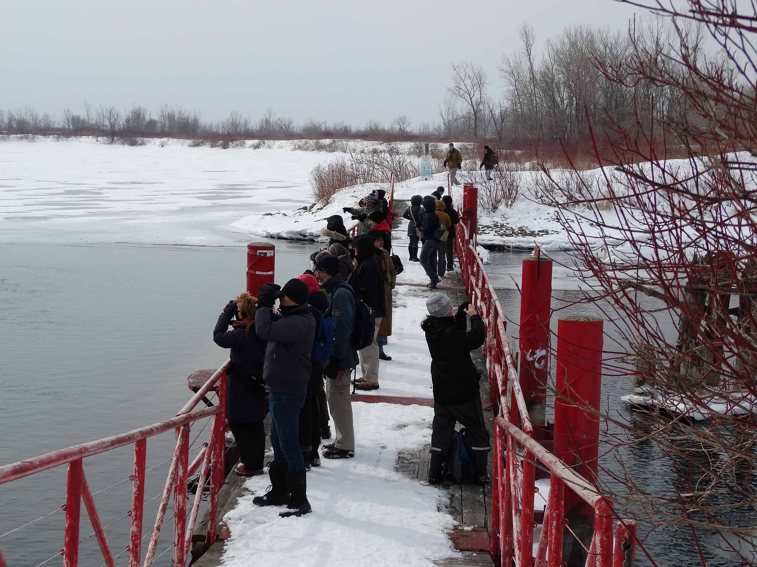
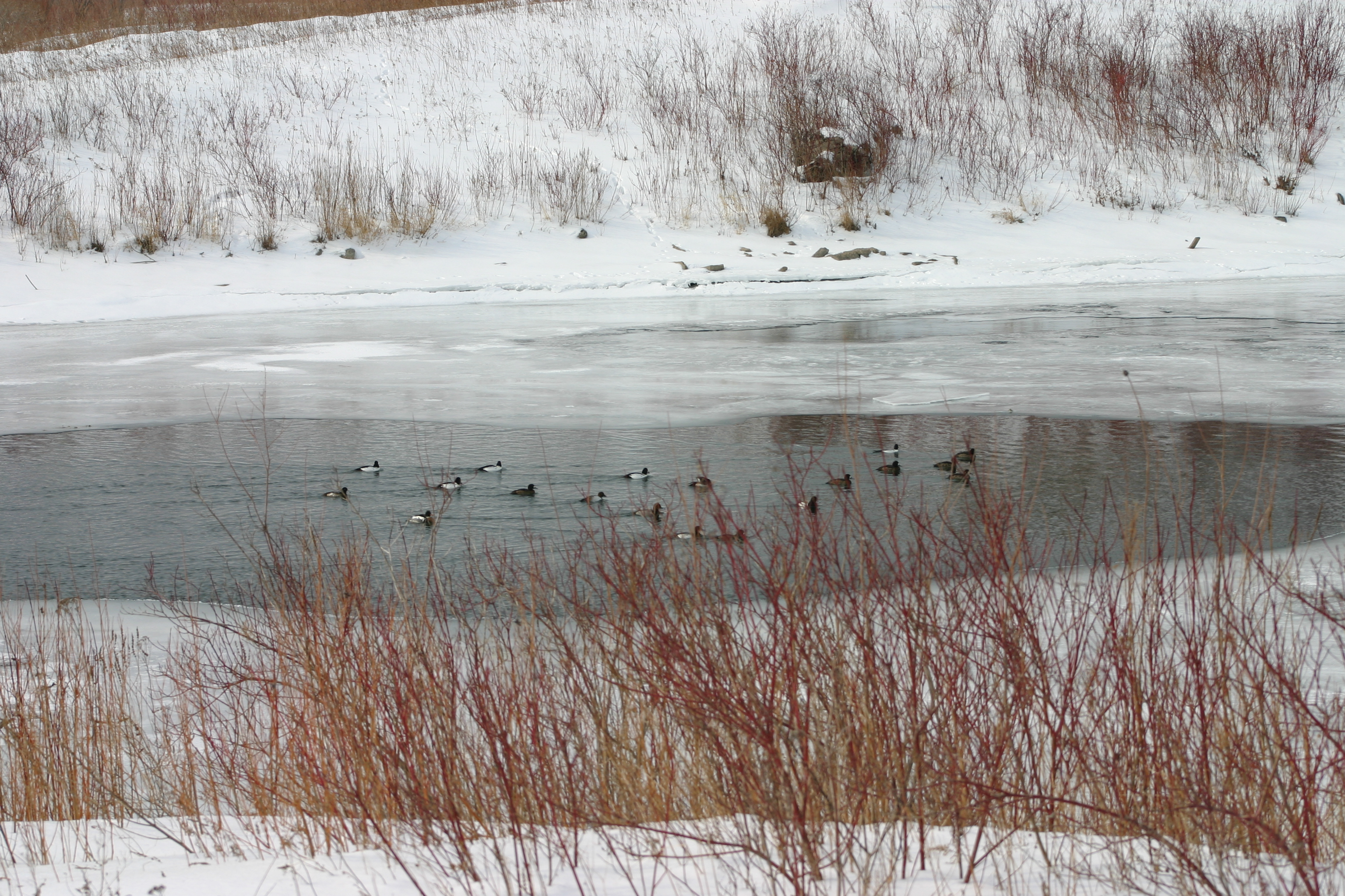
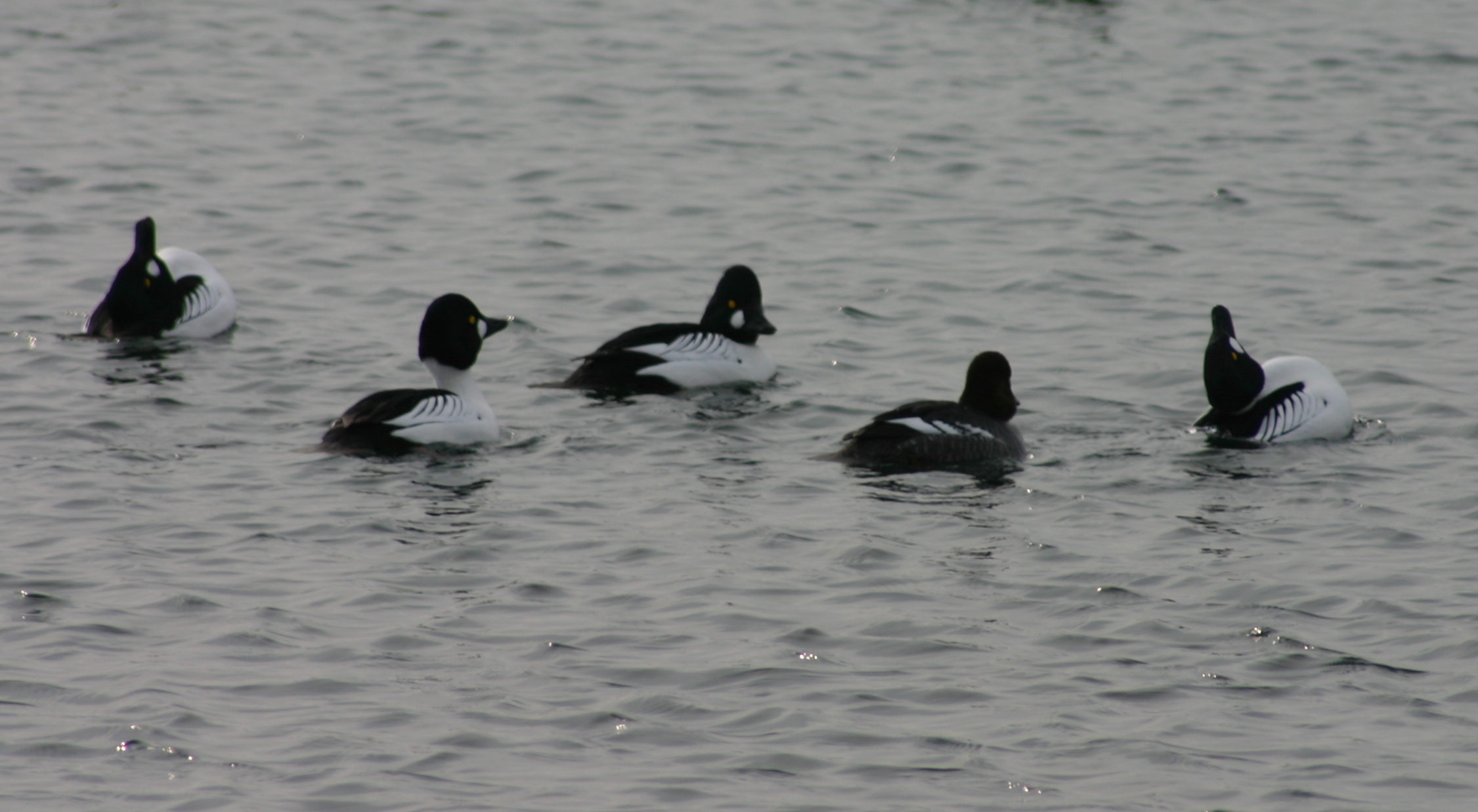
The pedestrian bridge spanning the junction between Embayment C and Cell 3 in Tommy Thompson Park swayed slightly in the brisk winter breeze.  On the bridge, people chattered with excitement about how to tell a Greater Scaup from a Common Goldeneye (or for the hard core birders, from a Lesser Scaup) and speculated about whether the swans with their head’s tucked under their wings were Trumpeter or Mute.

Winter Waterfowl Event Participants

Enjoying Winter Waterfowl at the pedestrian bridge viewing station. Photo: Don Johnston

Then someone called out, “Mink!”

The mink’s would be prey (a merganser) narrowly escaped, to the collective “Oh!” of myself, and about 20 others, who had piled onto the bridge as part of the Toronto Region and Conservation Authority’s Winter Waterfowl Event on March 7th, 2015.

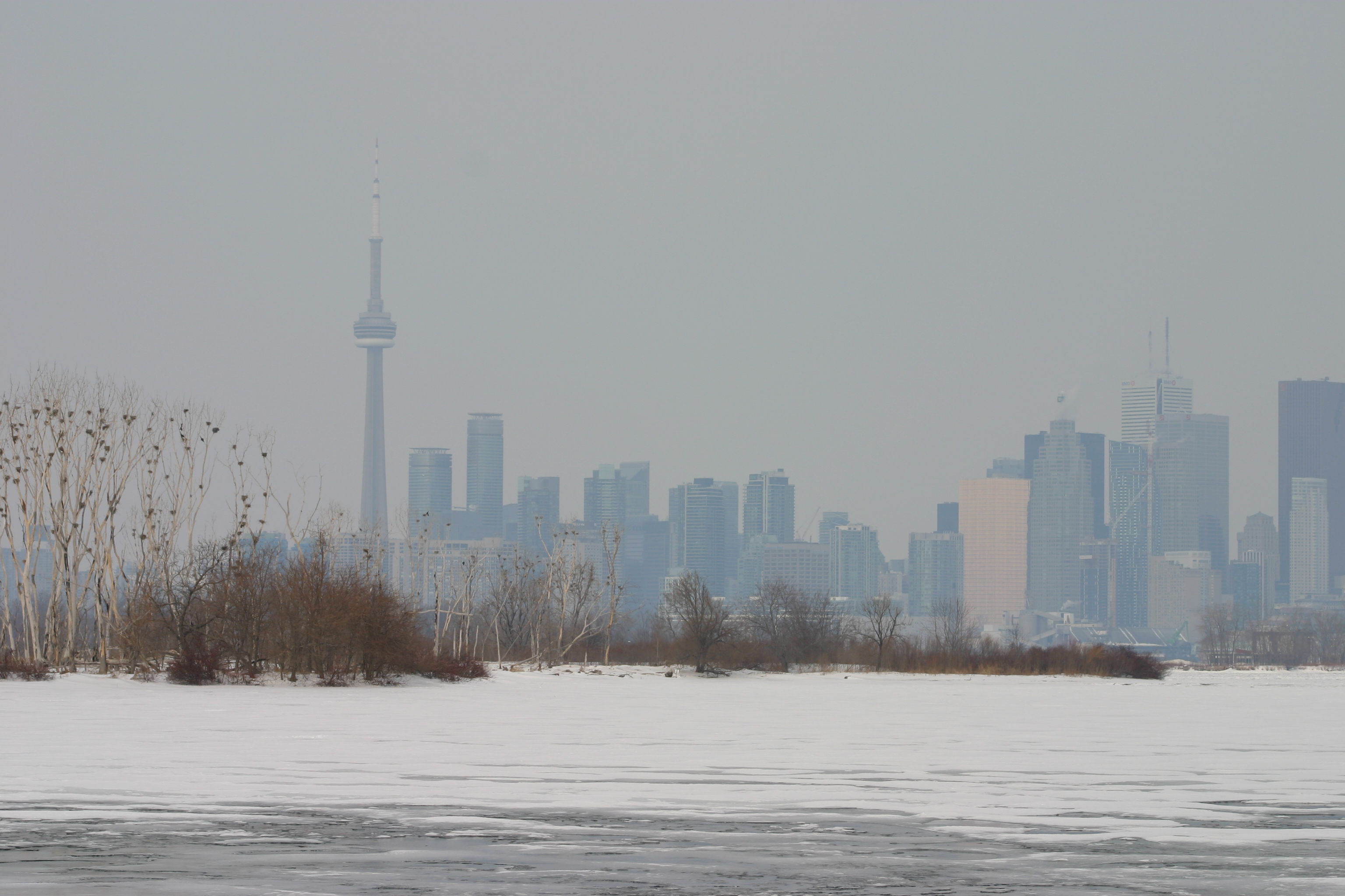
We were further delighted when the mink scampered across the open ice of Embayment C with the Toronto skyline as a backdrop.

20150307SkylineBehindEmbaymentC

Toronto skyline from Tommy Thompson Park – now picture it with a mink running across the ice. Photo: Debbie Buehler.

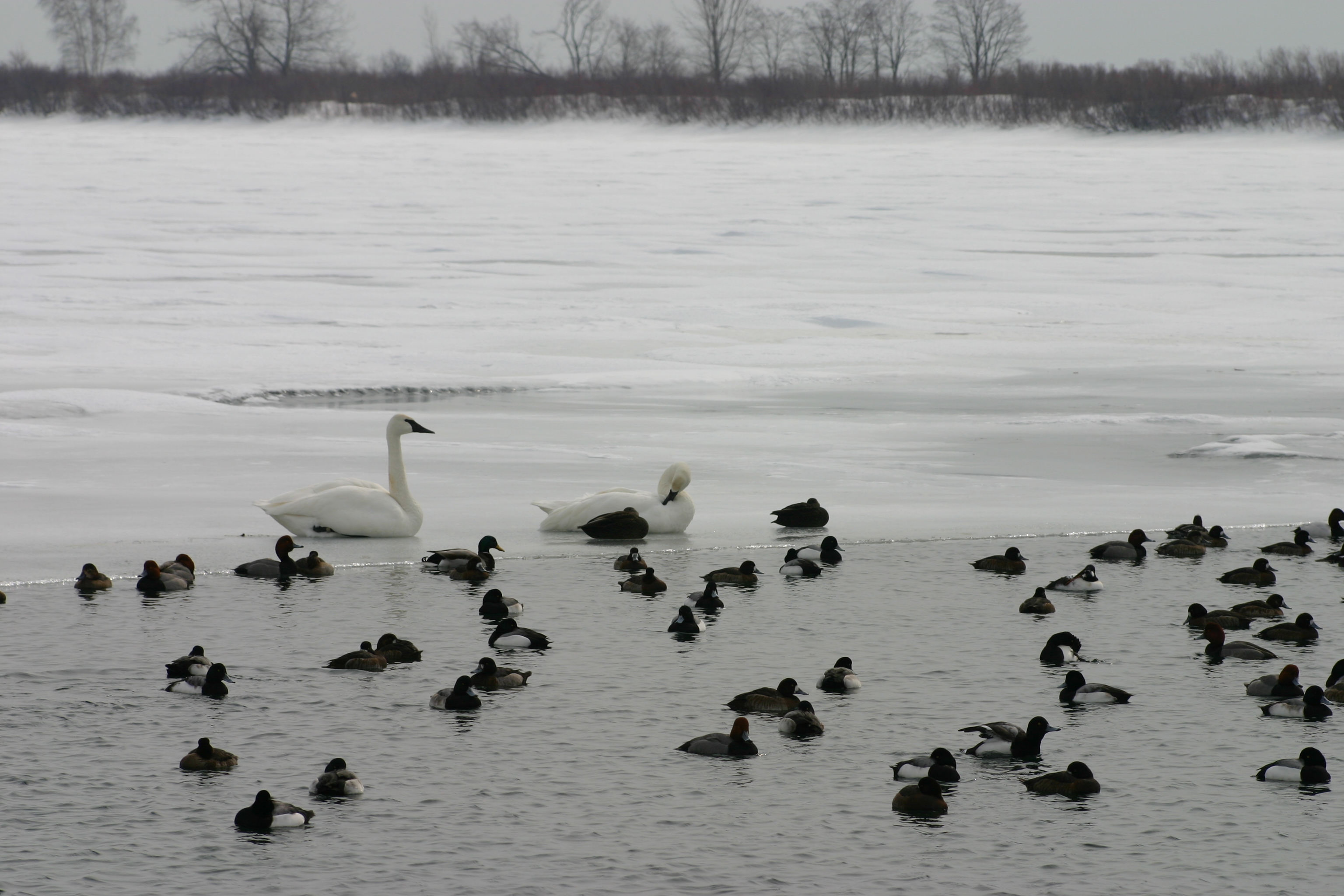
The pedestrian bridge provided an ideal viewing platform, not only for mink, but also for a variety of ducks and swans. I had volunteered to staff the bridge with long time TTP volunteer naturalist Don Johnston. As part of the event, the TRCA had interpretive stations and walks at various places within the park, but I thought the bridge would be the best place to see the waterfowl. I was not disappointed! We had Greater and Lesser Scaup, Common Goldeneye, Common and Red-breasted Mergansers, Mallards, American Black Ducks, a White-winged Scoter, and a Canvasback with it’s longer neck and wedge shaped head in direct contrast to the similarly colored Redheads. The ducks were gathered in the small stretches of open water on either side of the bridge, taking advantage of easily accessible food, mainly zebra mussels, according to Don.

20150307DucksAndSwans3

Ducks and trumpeter swans in Embayment C. Photo: Debbie Buehler

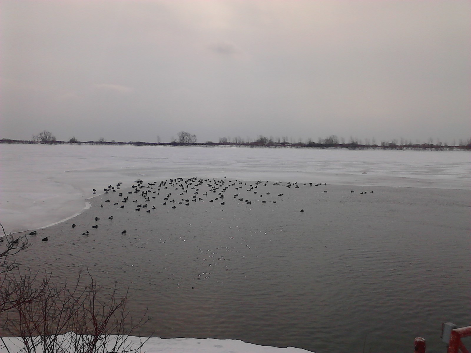
A few days earlier it was doubtful that we’d be able to see anything at all from the bridge. The deep cold of winter had frozen the water around the bridge solid. But a few warmer and sunny days, coupled with winds that caused the water to flow quickly between the two bodies of water, provided just enough ice break-up to attract the birds.

20150307DucksOnCell3

Ducks in Cell 3. Photo: Debbie Buehler

Freeze up on the Great Lakes, is a much bigger problem for ducks than it is for human duck watchers. These past two winters have been brutal. When the lakes freeze, and especially when sheltered inlets and bays freeze, it becomes much harder for ducks to reach their winter foods. Last winter proved lethal for many of Toronto’s winter ducks, and this winter has also been very hard.

20150307DucksInEmbaymentC

Ducks in Embayment C. Photo Debbie Buehler

Although some of Toronto’s winter ducks – like the Mallards and American Black Ducks – will stay to breed in the area, many will migrate north to lakes and ponds in the boreal forest. And some, like the Long-tailed ducks, will carry on all the way up to the high Arctic. Indeed, some of the ducks were already feeling amorous. A few Common Goldeneye drakes even provided a few moments of display.

20150307GoldeneyesMatingDance

Common Goldeneye with head back mating display. Photo: Debbie Buehler

Over the course of the morning I spoke to many people on the bridge, from hardy winter regulars, to people out of their first event. I even had the pleasure of meeting one of the TRCA’s restoration biologists. We chatted about the work he’d done in Embayment A – now one of my favorite places in the park.

I looked around at the snow-covered landscape and commented, “You have one of the best offices in the world!”

A smiled and nod indicated that he agreed. More proof was that he was back “at the office” on the weekend, his time off, eager to show his 4-year old son the wonders of his workplace and Tommy Thompson Park.